Stony Brook Reservation
Stony Brook Reservation is a 475-acre (192 ha) woodland park in Boston and Dedham, Massachusetts, a unit of the Metropolitan Park System of Greater Boston, part of the state park system of Massachusetts.
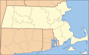
Located in the southwest of Boston, the main large contiguous section extends southwards from Washington Street in the West Roxbury neighborhood to Mother Brook in the Hyde Park neighborhood, with an additional 14.2 acres (5.7 ha) southwest along a roadway to Mother Brook in Dedham. There is also an adjacent portion around the Bellevue Hill water towers on the north side of Washington Street.
It was established in 1894 as one of the five original reservations created by the Metropolitan Park Commission.[3] Elevations in the park range from Mother Brook at 15 feet (4.6 m) to Bellevue Hill, at 338 feet (103 m) the highest point in the city of Boston.[4] Recreational facilities at the park include fishing at Turtle Pond, athletic fields, tennis courts, an ice skating rink, and a swimming pool. The park is served by the Stony Brook Reservation Parkways, a road system that was entered into the National Register of Historic Places in 2006, and features several hiking and mountain biking trails.[3]
Stony Brook Reservation contains the headwaters of Stony Brook.
History
The use of parcels of undeveloped land around Boston for a system of interconnected parks were conceived by landscape architect Charles Eliot, who had apprenticed with Frederick Law Olmsted and later assumed leadership of Olmsted's design firm in 1893. Eliot was instrumental in the founding of The Trustees of Reservations and the public Metropolitan Parks Commission in the 1890s and envisioned an expansion of the parks network to areas surrounding Boston.[5] The first five areas acquired by the Metropolitan Park Commission for this system in 1893 were the Beaver Brook, Blue Hills, Hemlock Gorge, Middlesex Fells and Stony Brook Reservations.[6]
References
Exterior links
|
|---|
|
|
|
|
|
|
|
| Wildlife Management Areas |
|---|
| Wildlife
Management Areas | |
|---|
| Wildlife
Sanctuaries |
- Billingsgate Island
- Carr Island
- E. Howe Forbush
- Egg Rock
- Grace A. Robson
- J.C. Phillips
- Knight
- Penikese Island
- Ram Island (Salisbury)
- Ram Island (Mattapoisett)
- Susan B. Minns
- Tarpaulin Cove
- Watatic Mountain
|
|---|
|
|
|
| |
|---|
|
- Black Pond Bog
- Boat Meadow
- Francis Newhall Woods
- Grassy Pond
- Greene Swamp
- Halfway Pond Island
- Hawley Bog
- Hockomock Swamp
- Hoft Farm
- Homer-Watcha Preserve
- Katama Plains
- McElwain-Olsen
- Miacomet Moors
- Reed Brook
- Drury
- Sandy Neck
- David H. Smith Preserve and Fire Trail
- Stacy Mountain
- Tatkon
|
|
|
|
|
|
|
|
|
|
|
|---|
|
| Coastal reservations | |
|---|
|
| River reservations | |
|---|
|
| Woodland reservations | |
|---|
|
| Heritage state parks | |
|---|
|
| Parkways and roads | |
|---|
|
|