Stilton
| Stilton | |
 The Bell Inn |
|
 Stilton |
|
| Population | 2,455 (211 census) |
|---|---|
| OS grid reference | TL162893 |
| District | Huntingdonshire |
| Shire county | Cambridgeshire |
| Region | East |
| Country | England |
| Sovereign state | United Kingdom |
| Post town | PETERBOROUGH |
| Postcode district | PE7 |
| Dialling code | 01733 |
| Police | Cambridgeshire |
| Fire | Cambridgeshire |
| Ambulance | East of England |
| EU Parliament | East of England |
| UK Parliament | North West Cambridgeshire |
|
|
Coordinates: 52°29′21″N 0°17′33″W / 52.48915°N 0.29238°W
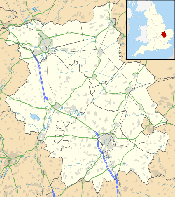
Stilton is a village and civil parish in Cambridgeshire, England,[1] approximately 12 miles (19 km) north of Huntingdon in Huntingdonshire, a non-metropolitan district of Cambridgeshire as well as a historic county of England.
History
.jpg)
There is evidence of Neolithic occupation of the parish, and a number of Roman finds have been uncovered in the village; as well as a Roman silver ring and a 2nd-century jug, archaeologists found a potential Roman settlement in the village as well as Roman cheese press.[2]
In 1085 William the Conqueror ordered that a survey should be carried out across his kingdom to discover who owned which parts and what it was worth. The survey took place in 1086 and the results were recorded in what, since the 12th century, has become known as the Domesday Book. Starting with the king himself, for each landholder within a county there is a list of their estates or manors; and, for each manor, there is a summary of the resources of the manor, the amount of annual rent that was collected by the lord of the manor both in 1066 and in 1086, together with the taxable value.[3]
Stilton was listed in the Domesday Book in the Hundred of Normancross in Huntingdonshire; the name of the settlement was written as Stichiltone and Sticilitone in the Domesday Book.[4] In 1086 there were three manors at Stilton; the annual rent paid to the lords of the manors in 1066 had been £4 and the rent was the same in 1086.[5]
The Domesday Book does not explicitly detail the population of a place but it records that there were ten households at Stilton.[5] There is no consensus about the average size of a household at that time; estimates range from 3. 5 to 5. 0 persons.[6] Using these figures then an estimate of the population of Stilton in 1086 is that it was within the range of 35 and 50 people.
The Domesday Book uses a number of units of measure for areas of land that are now unfamiliar, such as hides and ploughlands. In different parts of the country, these were terms for the area of land that a team of eight oxen could plough in a single season and are equivalent to 120 acres (49 hectares); this was the amount of land that was considered to be sufficient to support a single family. By 1086, the hide had become a unit of tax assessment rather than an actual land area; a hide was the amount of land that could be assessed as £1 for tax purposes. The survey records that there were 6. 37 ploughlands at Stilton in 1086 and that there was the capacity for a further 1. 62 ploughlands.[5] In addition to the arable land, there was 32 acres (13 hectares) of meadows and 10 acres (4 hectares) of woodland at Stilton.[5]
The tax assessment in the Domesday Book was known as geld or danegeld and was a type of land-tax based on the hide or ploughland. It was originally a way of collecting a tribute to pay off the Danes when they attacked England, and was only levied when necessary. Following the Norman Conquest, the geld was used to raise money for the King and to pay for continental wars; by 1130, the geld was being collected annually. Having determined the value of a manor's land and other assets, a tax of so many shillings and pence per pound of value would be levied on the land holder. While this was typically two shillings in the pound the amount did vary; for example, in 1084 it was as high as six shillings in the pound. For the manors at Stilton the total tax assessed was five geld.[5]
In 1086 there was no church at Stilton.
Coaching inns
The Roman Ermine Street, which later became the Great North Road, was integral to the development of the village, and in late medieval times the village was a popular posting station and coaching stop. At one time there were 14 public houses for a population of around 500.[7][8]
The main inns of the period were The Bell and The Angel, both of which are still in existence. The Bell Inn has been recorded since 1515 and was rebuilt in 1642. The Angel Inn, dating from the early 17th century, was rebuilt as an impressive red brick house in the 18th century. It ceased to be an inn and was badly burned in 1923. Fires also damaged the village as a whole in 1729, 1798 and 1895.[7]
Modern times
Stilton's reliance on its position on the Great North Road has twice led to problems when use of the road reduced; the arrival of the railway several miles to the east in the 19th century cut goods transportation along the road, and the opening of the 1.25-mile-long A1 bypass on 21 July 1958 by David Renton, Baron Renton reduced passing trade through the village to almost nil. The bypass was the first from London to Newcastle when the A1 was completely improved in the late 1950s and early 1960s.
The Bell Inn closed and fell into disrepair and the village as a whole lost many businesses. To try to revive interest, on Easter Monday 1962 Tom McDonald of The Talbot and Malcolm Moyer of The Bell organised the first Cheese Rolling race along a course near the Post Office. Now held every May Day holiday it has become a popular annual event.[8]
Listed as Stichiltone or Sticiltone at the time of the 1086 Domesday Book the name Stilton means "village at a stile or steep ascent".[9]
Government
As a civil parish, Stilton has a parish council. The parish council is elected by the residents of the parish who have registered on the electoral roll; the parish council is the lowest tier of government in England. A parish council is responsible for providing and maintaining a variety of local services including allotments and a cemetery; grass cutting and tree planting within public open spaces such as a village green or playing fields. The parish council reviews all planning applications that might affect the parish and makes recommendations to Huntingdonshire District Council, which is the local planning authority for the parish. The parish council also represents the views of the parish on issues such as local transport, policing and the environment. The parish council raises its own tax to pay for these services, known as the parish precept, which is collected as part of the Council Tax. The parish council consists of twelve councillors and a parish clerk. The parish council normally meets on the second Tuesday of the month (except in August) in the parish meeting room.[10]
Stilton was in the historic and administrative county of Huntingdonshire until 1965. From 1965, the village was part of the new administrative county of Huntingdon and Peterborough. Then in 1974, following the Local Government Act 1972, Stilton became a part of the county of Cambridgeshire.
The second tier of local government is Huntingdonshire District Council which is a non-metropolitan district of Cambridgeshire and has its offices in Huntingdon. Huntingdonshire District Council has 52 councillors representing 29 district wards.[11] Huntingdonshire District Council collects the council tax, and provides services such as building regulations, local planning, environmental health, leisure and tourism.[12] Stilton is a district ward and is represented on the district council by one councillor.[13][11] District councillors serve for four-year terms following elections to Huntingdonshire District Council.
For Stilton the highest tier of local government is Cambridgeshire County Council which has administration buildings in Cambridge. The county council provides county-wide services such as major road infrastructure, fire and rescue, education, social services, libraries and heritage services.[14] Cambridgeshire County Council consists of 69 councillors representing 60 electoral divisions.[15] Stilton is part of the electoral division of Norman Cross[13] and is represented on the county council by two councillors.[15]
At Westminster Stilton is in the parliamentary constituency of North West Cambridgeshire,[13] and elects one Member of Parliament (MP) by the first past the post system of election. Stilton is represented in the House of Commons by Shailesh Vara (Conservative). Shailesh Vara has represented the constituency since 2005. The previous member of parliament was Brian Mawhinney (Conservative) who represented the constituency between 1997 and 2005. For the European Parliament Stilton is part of the East of England constituency which elects seven MEPs using the d'Hondt method of party-list proportional representation.
Geography
Stilton lies south of the city of Peterborough, on the old Great North Road, 70 miles (110 km) from London. It was an important coaching stop in the days before motorised transport. It lies just south of Norman Cross. In 1998, the village was bypassed by the new A1(M), with access limited to the A15 intersection at Norman Cross.
Stilton is twinned with Saint-Christol-lès-Alès, a community in Gard in the south of France.
Demography
Between 1801 and 1901, the censuses recorded populations for Stilton in the range of 509 (the lowest in 1801) and 817 (the highest in 1841).[16]
From 1901, a census was taken every ten years with the exception of 1941 (due to the Second World War).
| Parish |
1911 |
1921 |
1931 |
1951 |
1961 |
1971 |
1981 |
1991 |
2001 |
2011 |
|---|---|---|---|---|---|---|---|---|---|---|
| Stilton | 491 | 455 | 494 | 672 | 633 | 911 | 1782 | 2151 | 2425 | 2455 |
All population census figures from report Historic Census figures Cambridgeshire to 2011 by Cambridgeshire Insight.[16]
In 2011, the parish covered an area of 1,633 acres (661 hectares)[16] and included Folksworth
Cheese

The village gave its name to Stilton cheese. Previously the most widely accepted explanation was that the cheese came down to be sold at the coaching inns in Stilton. Daniel Defoe in 1722 described the village as famous for its cheese.[17] Traditionally it was thought that supplies were obtained from the housekeeper at Quenby Hall,[18] Hungarton, Leicestershire, near Melton Mowbray, and were sold via her brother-in-law to travellers in Stilton's coaching inns, namely The Bell or The Angel.[19] Subsequent research has led to claims that the cheese did originate in the village in the late 17th or early 18th centuries, before any contemporary references to its production in Leicestershire.
Today Stilton cheese is made in Derbyshire, Leicestershire and Nottinghamshire. The manufacturers of Stilton cheese in these counties applied for and received Protected Geographical Status (PGS) in 1996 so that production is currently limited to these three counties and must use pasteurised milk, which can be drawn from many counties within the central belt of England. Recent evidence indicates that it is unlikely that the village would have been a centre for selling of cheese unless cheese was also made in the area. Furthermore, the original recipe for a cream cheese made in Stilton in the early 18th century has since been discovered and since more than one type of cheese was usually made, it is possible that a blue cheese was also made in the area.[20] The Parish of Stilton applied to Defra for an amendment to the Stilton PDO to be included into the Protected area but was unsuccessful. However, a new application is currently (June 2014) being prepared and this is being supported by Shailesh Vara MP, the Member of Parliament for North West Cambridgeshire.[21]
Church
There is no record of a church in Stilton before the 13th century and the earliest parts of the present church date from that period. The present parish church of St Mary consists of a chancel with vestry and organ chamber, nave, north and south aisles, west tower and south porch most of which was built in the 15th century with the nave arcades 13th century.[7]
Village life
Stilton has its own Church of England primary school. The village has two shops and four pubs: the Stilton Tunnels, The Stilton Cheese, The Bell, The Talbot and Colbrook's, a Rolls Royce and Bentley specialist garage.
References
- ↑ Ordnance Survey: Landranger map sheet 142 Peterborough (Market Deeping & Chatteris) (Map). Ordnance Survey. 2012. ISBN 9780319229248.
- ↑ "A port and Stilton". Time Team, Channel 4. 2007.
- ↑ Dr Ann Williams, Professor G.H. Martin, eds. (1992). Domesday Book: A Complete Translation. London: Penguin Books. pp. 551–561. ISBN 0-141-00523-8.
- ↑ Dr Ann Williams, Professor G.H. Martin, eds. (1992). Domesday Book: A Complete Translation. London: Penguin Books. p. 1405. ISBN 0-141-00523-8.
- 1 2 3 4 5 Professor J.J.N. Palmer, University of Hull. "Open Domesday: Place – Stilton". www. opendomesday.org. Anna Powell-Smith. Retrieved 25 February 2016.
- ↑ Goose, Nigel; Hinde, Andrew. "Estimating Local Population Sizes" (PDF). Retrieved 23 February 2016.
- 1 2 3 A History of the County of Huntingdon: Volume 3. Victoria County History. 1936. pp. 222–227.
- 1 2 "Stilton history".
- ↑ A. D. Mills (2003). A Dictionary of British Place-Names.
- ↑ "Stilton Parish Council: Councillors". www. stilton.org. Stilton Parish Council. Retrieved 8 February 2016.
- 1 2 "Huntingdonshire District Council: Councillors". www. huntingdonshire.gov.uk. Huntingdonshire District Council. Retrieved 23 February 2016.
- ↑ "Huntingdonshire District Council". www. huntingdonshire.gov.uk. Huntingdonshire District Council. Retrieved 23 February 2016.
- 1 2 3 "Ordnance Survey Election Maps". www. ordnancesurvey.co.uk. Ordnance Survey. Retrieved 23 February 2016.
- ↑ "Cambridgeshire County Council". www. cambridgeshire.gov.uk. Cambridgeshire County Council. Retrieved 23 February 2016.
- 1 2 "Cambridgeshire County Council: Councillors". www. cambridgeshire.gov.uk. Cambridgeshire County Council. Retrieved 15 February 2016.
- 1 2 3 "Historic Census figures Cambridgeshire to 2011" (xlsx – download). www. cambridgeshireinsight.org.uk. Cambridgeshire Insight. Retrieved 12 February 2016.
- ↑ A Tour through England & Wales. Everyman's Library (London/New York: Dent/Dutton, 1928), Vol. II, p. 110.
- ↑ Quenby Hall
- ↑ Stilton Village site
- ↑ BBC Radio 4 The Food Programme, "Food Myths", 20 September 2009
- ↑ "Villagers' bid to make Stilton cheese in Stilton is rejected", Daily Mirror 23 October 2013
External links
| Wikimedia Commons has media related to Stilton. |