Stephenville Crossing
| Stephenville Crossing | |
|---|---|
| Town | |
|
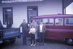
Stephenville Crossing railway station in 1965. | |
| Nickname(s): 'crossing' 'xing' or 'zing' | |
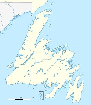 Stephenville Crossing Location of Stephenville Crossing in Newfoundland | |
| Coordinates: 48°31′N 58°25′W / 48.517°N 58.417°W | |
| Country |
|
| Province |
|
| Government | |
| Time zone | Newfoundland Time (UTC-3:30) |
| • Summer (DST) | Newfoundland Daylight (UTC-2:30) |
| Area code(s) | 709 |
| Website | Stephenville Crossing official site |
Stephenville Crossing (2001 population: 1,950) is a Canadian town in the province of Newfoundland and Labrador on the island of Newfoundland. The town is located at the easternmost limit of Bay St. George.
History
The settlement derives its name from the Newfoundland Railway, which ran through the community on its way from Port aux Basques to Corner Brook.
The Hanson Memorial Highway was constructed by the United States Army Air Forces to link the railway line at Stephenville Crossing with Harmon Field, under construction on the other side of a hill to the north in Stephenville. Later, the USAAF built its own railway line from Stephenville Crossing to Stephenville.
Since the air base was constructed, Stephenville Crossing has functioned more or less as a suburb of Stephenville.
The 1988 abandonment of the railway in Newfoundland by CN resulted in the last train running through Stephenville Crossing to St. George's (return) on June 6, 1990.
Facilities
Stephenville Crossing, in addition to the usual residential and commercial premises, such as a gas station, pharmacy, lumber yard and grocery store, it also has a search and rescue building. The Search and Rescue is active in assisting authorities in water rescues, and is also active within the community; regularly seen doing training exercises and also working with local children, teaching them vital skills.
Education
St. Michael's Elementary School is a K-8 school, located off West Street, that educates around 180 pupils. The facility includes a science lab, art room, music room, gymnasium, and a cafeteria. St. Michael's Elementary was officially opened in December 1976. The school website is www.stmichaelselementary.com
External links
- Stephenville Crossing official site
- Newfoundland Railway - Newfoundland & Labrador Heritage
- History of the railway in the village of Stephenville Crossing
- Photos of railway displays and memorabilia across the island
Coordinates: 48°31′N 58°25′W / 48.517°N 58.417°W