Stenkyrka
| Stenkyrka | |
|---|---|
|
The road from Martebo to Stenkyrka | |
 Stenkyrka | |
| Coordinates: 57°47′35.84″N 18°30′54.06″E / 57.7932889°N 18.5150167°ECoordinates: 57°47′35.84″N 18°30′54.06″E / 57.7932889°N 18.5150167°E | |
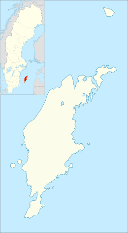
| Country | Sweden |
| Province | Gotland |
| County | Gotland County |
| Municipality | Gotland Municipality |
| Area[1] | |
| • Total | 43 km2 (17 sq mi) |
| Population (2014)[2] | |
| • Total | 505 |
| Time zone | CET (UTC+1) |
| • Summer (DST) | CEST (UTC+2) |

Stenkyrka is a settlement in the northwest part of the island of Gotland, Sweden, where the medieval Stenkyrka Church is situated.[3] Near the church is a minor settlement with a few houses. Formerly a socken,[4] on 1 January 2016, it was reconstituted into the administrative area Stenkyrka District.[5]
History
This settlement is where the Stenkyrka spearhead was found. It is incised with the oldest known runic inscription known in Sweden.[6]
In 2006, the Stenkyrka parish was expanded to include the sockens of Stenkyrka, Tingstäde, Martebo and Lummelunda.
One of the asteroids in the Asteroid belt, 10125 Stenkyrka, is named after this place.[7]
Little Bjärs Grave Field
A bit east of the church in Stenkyrka is one of the largest grave fields on Gotland, the Little Bjärs Grave Field (Lilla Bjärs gravfält). Along one of the oldest roads in this part of the island, now not more than a trail, are more than 1,000 visible graves from the Stone Age and the Bronze Age. Most of the graves are cairns and circular tumuli. Bases for picture stones have been found in the field. They have remained after the picture stones have been moved and incorporated in the walls of the Stenkyrka Church. Some of these have later been moved to Gotland Museum.[8]
The grave field is about 700 m × 500 m (2,300 ft × 1,600 ft) in a general northeast–southwest direction. It contains about 750 identifiable graves above ground, but it is difficult to ascertain the borders between the mounds. A number of the mounds have depressions in the middle, about ten have visible remains of cists made of limestone slabs, about 30 graves have grave orbs. Among the graves is also a stone ship. A large number of the graves have been damaged by modern constructions and farming. The modern road bisects the area in an angle to the old road that the field have been established around.[9]
Gallery
Stenkyrka
 Rauks at Lickershamn, Stenkyrka.
 Stenkyrka church.
 Ancient fortress at Lickershamn, Stenkyrka.
Little Bjärs Grave Field
 Two stone mounds
 One of the larger graves
References
- ↑ Carlquist, Gunnar, ed. (1947–1955). Svensk Uppslagsbok (in Swedish) (2nd ed.). Malmö: Förlagshuset Norden. p. 67.
- ↑ "Gotland i siffror 2015" [Gotland in numbers 2015]. www.gotland.se. Gotland Municipality. Retrieved 25 May 2016.
- ↑ Lagerlöf, Erland; Svahnström, Gunnar (1973). Gotlands kyrkor [Gotland's Churces] (in Swedish). Stockholm: Rabén & Sjögren. pp. 242–245. ISBN 91-29-41035-5. LIBRIS 7232718.
- ↑ The exact extent of the socken, now district, can be obtained by clicking on Kartinställningar and check the Socken box in the menu of this map from the Swedish National Heritage Board database.
- ↑ "Förordning om district" [Regulation of districts] (PDF). Ministry of Finance. 17 June 2015. Retrieved 24 May 2016.
- ↑ Jansson, Sven B. F. (1962). The runes of Sweden. Stockholm: Norstedt. pp. 3–4. Retrieved 11 June 2014.
- ↑ "JPL Small-Body Database Browser". NASA. Retrieved 2008-04-25.
- ↑ Brynolf, Lars (2007). Gotland. Turist & cykelguide, 99-1933445-6. Trångsund: Läsförlaget i samarbete med Svenska cykelsällskapet. ISBN 9789179025625.
- ↑ "RAÄ-nummer Stenkyrka 26:1". www.raa.se. Swedish National Heritage Board. Retrieved 21 June 2015.
Further reading
- Henriksson Åke, Engström Eric, ed. (2006). Stenkyrka förr och nu: om livet i Stenkyrka socken på Gotland. Stenkyrka: Stenkyrka hembygdsförening. ISBN 91-976345-0-6. LIBRIS 10202199.
- Stenkyrka kyrka. Tingstäde: Stenkyrka församlings kyrkoråd. 1990. LIBRIS 10019571.
- Ottosson, Ingrid; Weber, Eva (2004). Vale gård i Stenkyrka socken på Norra Gotland. Visby: Book-on-demand. ISBN 91-631-5046-8. LIBRIS 10306654.
- Hall, Ola (1993). Lickershamn, Stenkyrka socken: hamn redan på 700-talet, påvisad genom fosfatkartering. Stockholm: Stockholms Universitet. LIBRIS 10427724.
- Kjellén, Ulf (1990). Likairs hamn – en vikingatida stormanshamn i Stenkyrka sn, Gotland. Stockholm: Inst. för arkeologi, Stockholms univ. LIBRIS 889108.
- Åhman, Suzanne (1989). Stenåldersbosättningen i Lickershamnsområdet – en områdesstudie. Stockholm: Inst. för arkeologi, Stockholms univ. LIBRIS 814913.
External links
| Wikimedia Commons has media related to Stenkyrka, Gotland. |
| Wikimedia Commons has media related to Little Bjärs Grave Field. |
