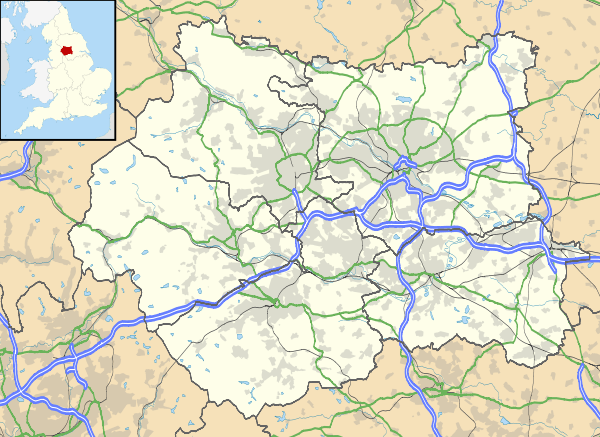
Steeton with Eastburn
| Steeton with Eastburn | |
 St Stephen's parish church |
|
 Steeton with Eastburn |
|
| Population | 4,375 (2011) |
|---|---|
| OS grid reference | SE034444 |
| Civil parish | Steeton with Eastburn |
| Metropolitan borough | City of Bradford |
| Metropolitan county | West Yorkshire |
| Region | Yorkshire and the Humber |
| Country | England |
| Sovereign state | United Kingdom |
| Post town | KEIGHLEY |
| Postcode district | BD20 |
| Dialling code | 01535 |
| Police | West Yorkshire |
| Fire | West Yorkshire |
| Ambulance | Yorkshire |
| EU Parliament | Yorkshire and the Humber |
| UK Parliament | Keighley |
Coordinates: 53°53′46″N 1°56′53″W / 53.896°N 1.948°W
Steeton with Eastburn is a civil parish within the City of Bradford Metropolitan District, West Yorkshire, England.[1] Historically part of the West Riding of Yorkshire, it has, according to the 2001 census, a population of 4,277,[2] increasing to 4,375 at the 2011 Census.[3] The parish includes the villages of Steeton and Eastburn.
It has a small parish school and public transport links to local towns and cities. It also has a local newsagents, a transport cafe and a children's park. On the outskirts of Steeton is Steeton and Silsden Station. Cricketer's Walk takes you to the cricket and football pitch.
Located in the parish is Airedale General Hospital, which lies between Steeton and Eastburn.[4]
History
The Domesday Book lists Steeton and Eastburn as belonging to Gamal Barn including 5¼ carucates of ploughland (630 acres/262ha).[5] The Norman conquest of England made it part of the lands of Gilbert Tison, but by 1118 Tison had suffered a demotion and his lands returned to the king. They were then given to Lord Percy.[6]
Government
The parish is part of the Craven ward of the Metropolitan borough of the City of Bradford, part of the Metropolitan county of West Yorkshire.[7]
References
- ↑ Parish Council
- ↑ "Census 2001 : Parish Headcounts : Bradford". Office for National Statistics. Retrieved 2009-09-18.
- ↑ "Civil Parish population 2011". Neighbourhood Statistics. Office for National Statistics. Retrieved 22 February 2016.
- ↑ Google Maps – location
- ↑ Dr. Anne Williams and Prof. G H Martin, ed. (1992). Domesday Book a Complete Translation. Penguin Books. ISBN 978-0-14-143994-5.
- ↑ Paul Dalton. Conquest, Anarchy and Lordship: Yorkshire, 1066-1154
- ↑ "Craven". 2010. Retrieved 28 January 2014.
External links
| Wikimedia Commons has media related to Steeton with Eastburn. |