Stara Sil
| Stara Sil Стара Сіль | |||
|---|---|---|---|
| village | |||
| |||
 Stara Sil | |||
| Coordinates: UA 49°29′22″N 22°57′56″E / 49.48944°N 22.96556°ECoordinates: UA 49°29′22″N 22°57′56″E / 49.48944°N 22.96556°E | |||
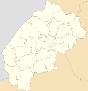
| Country |
| ||
| Province |
| ||
| District |
| ||
| Established | 1421 | ||
| Area | |||
| • Total | 1,93 km2 (75 sq mi) | ||
| Elevation/(average value of) | 346 m (1,135 ft) | ||
| Population | |||
| • Total | 1,154 | ||
| • Density | 632.640/km2 (1,638.53/sq mi) | ||
| Time zone | EET (UTC+2) | ||
| • Summer (DST) | EEST (UTC+3) | ||
| Postal code | 82066 | ||
| Area code | +380 3238 | ||
| Website | смт Стара Сіль (Ukrainian) | ||

Stara Sil (the former name – Stara Ropa), (Ukrainian: Стара́ Сіль, Стара́ Ро́па, German: Salzbrock) is an urban-type settlement in Staryi Sambir Raion, Lviv Oblast, of Western Ukraine. Population: 1,154 (2013 est.)[1].
Geography
The settlement is located in the Ukrainian Carpathians hills in the western part of the Lviv region. This is on the path Staryi Sambir – Khyriv at a distance of 7 kilometres (4.3 mi) from the district center Staryi Sambir and 96 kilometres (60 mi) from the regional center of Lviv.
History and attractions
The first historical mention is traditionally considered the year 1254. However, according to some sources, the settlement was founded as a watchdog in the 9 -10 century.[2] Since ancient times in the territory settlement were the extraction of salt, hence the name of the settlement.
The Magdeburg Law has received the Stara Sil in 1421.
An architectural monuments of Staryi Sambir Raion is in the village Stara Sil:[3]
- Church of the Resurrection of Christ (XVII century, wooden). (1427 /1).
- The bell tower of the church of the Resurrection of Christ (XVII century, wooden). (1427 /2).
- Church of St. Michael (stone) (1613 - 1660, 1922-1928) (1428 /1).
- The bell tower of the church of St. Michael (mix.) XVII century. (1428 /2).
- Church of Saint Paraskevi (wooden) XVI-XVII centuries. (1429 /1).
- The bell tower of the church of St. Paraskevi XVII century. (1429 /2).
Gallery
-
._%D0%A1%D1%82%D0%B0%D1%80%D0%B0_%D0%A1%D1%96%D0%BB%D1%8C..JPG)
St. Archangel Michael catholic church.
-
._%D0%A1%D1%82%D0%B0%D1%80%D0%B0_%D0%A1%D1%96%D0%BB%D1%8C..JPG)
Church and bell tower of the St. Archangel Michael catholic church.
References
- ↑ "Чисельність наявного населення України (Actual population of Ukraine)" (in Ukrainian). State Statistics Service of Ukraine. Retrieved 21 January 2015.
- ↑ Мандри Україною. Стара Сіль. (Ukrainian)
- ↑ Пам'ятки архітектури Старосамбірського району (Ukrainian)
External links
- смт. Стара Сіль, Львівська область, Старосамбірський район, Облікова картка (Ukrainian)
- Стара Сіль, церква Воскресіння Господнього XVII ст., церква Св. Параскеви XVII ст. (Ukrainian)
- Via Est Vita. Стара Сіль. Частина 1 Костел Архістратига Михаїла (Ukrainian)
- weather.in.ua Stara Sil'
Literature
- Історія міст і сіл УРСР : Львівська область, Населені пункти, центри селищних і сільських Рад, Старосамбірського району, Стара Сіль. – К. : ГРУРЕ, 1968 р. Page 785 (Ukrainian)