Stanford, Indiana
| Stanford | |
|---|---|
| Unincorporated community | |
|
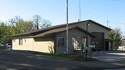
Van Buren Township Hall | |
 Stanford  Stanford | |
| Coordinates: 39°05′23″N 86°40′00″W / 39.08972°N 86.66667°WCoordinates: 39°05′23″N 86°40′00″W / 39.08972°N 86.66667°W | |
| Country | United States |
| State | Indiana |
| County | Monroe |
| Township | Van Buren |
| Elevation[1] | 761 ft (232 m) |
| ZIP code | 47463 |
| FIPS code | 18-72584[2] |
| GNIS feature ID | 444059 |
Stanford is an unincorporated community in Van Buren Township, Monroe County, Indiana.
History
Stanford was platted in 1838.[3] The first store was started in Stanford in 1839.[4] A post has been in operation at Stanford since 1839.[5]
Geography
Stanford is located at 39°05′23″N 86°40′00″W / 39.08972°N 86.66667°W.
Municipalities and communities of Monroe County, Indiana, United States | ||
|---|---|---|
| City | ||
| Towns | ||
| Townships | ||
| CDPs | ||
| Other unincorporated communities |
| |
References
- ↑ "US Board on Geographic Names". United States Geological Survey. 2007-10-25. Retrieved 2008-01-31.
- ↑ "American FactFinder". United States Census Bureau. Retrieved 2008-01-31.
- ↑ History of Lawrence and Monroe Counties, Indiana: Their People, Industries, and Institutions. B.F. Bowen. 1914. p. 436.
- ↑ Blanchard, Charles (1884). Counties of Morgan, Monroe and Brown, Indiana: Historical and Biographical. F.A. Battey & Company. p. 510.
- ↑ "Monroe County". Jim Forte Postal History. Retrieved 5 September 2015.
This article is issued from Wikipedia - version of the 11/4/2016. The text is available under the Creative Commons Attribution/Share Alike but additional terms may apply for the media files.