Stamford, Texas
| Stamford, Texas | |
|---|---|
| City | |
| City of Stamford | |
|
Downtown Stamford | |
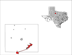 | |
 Stamford, Texas Location in Texas | |
| Coordinates: 32°56′57″N 99°47′24″W / 32.94917°N 99.79000°WCoordinates: 32°56′57″N 99°47′24″W / 32.94917°N 99.79000°W | |
| Country |
|
| State |
|
| Counties | Jones, Haskell |
| Incorporated (city) | 2 January 1900 |
| Named for | Stamford, Connecticut |
| Government | |
| • Type | Mayor-Council |
| • Mayor | Johnny Anders |
| Area | |
| • Total | 12.8 sq mi (33.3 km2) |
| • Land | 6.0 sq mi (15.4 km2) |
| • Water | 6.9 sq mi (17.8 km2) |
| Elevation | 1,614 ft (492 m) |
| Population (2010) | |
| • Total | 3,124 |
| • Density | 520.7/sq mi (202.9/km2) |
| Demonym(s) | Stamfordite |
| Time zone | Central (CST) (UTC-6) |
| • Summer (DST) | CDT (UTC-5) |
| ZIP code | 79553 |
| Area code(s) | 325 |
| FIPS code | 48-69980[1] |
| GNIS feature ID | 1347793[2] |
| Website |
www |

Stamford is a city located on the border of Jones and Haskell counties in west central Texas. The population was 3,124 according to the 2010 census. Henry McHarg, president of the Texas Central Railroad, named the site in 1900 for his hometown of Stamford, Connecticut.[3] The city is home to the Texas Cowboy Reunion.
Stamford is located on US Highway 277 and State Highway 6. Most of the city is in Jones County, one of 46 dry counties in Texas. The portion of the city within Jones County is part of the Abilene, Texas Metropolitan Statistical Area.
History
While the town was named by Henry King McHarg for Stamford, Connecticut, the townsite was donated by the family of Swante Magnus Swenson. Mr. Swenson was the first Swedish immigrant to Texas. He became one of the largest landowners in Texas, and by 1860 his holdings in West Texas approached 500,000 acres (202,343 ha). These ranches, which spread across twelve Texas counties, became known as SMS Ranches. Later reorganized as the Swenson Land and Cattle Company, it is headquartered in Stamford to this day.[4] Mr. Swenson had two sons, Eric Pierson and Swen Albin, who became known as the Swenson brothers. They ran SMS Ranches, and even developed a Morab horse breeding program near the city.
Swante M. Swenson is largely responsible for initiating and supporting Swedish immigration to Texas starting in 1847. Mr. Swenson would assist Swedish immigrants with the cost of their passage from Sweden to Texas in exchange for their labor. In 1899, the Swenson brothers persuaded Henry McHarg, president of the Texas Central Railroad, to extend the railroad through their land. The brothers then founded Stamford in 1900 and provided the townsite of 640 acres (259 ha). The town and surrounding area was then partially settled by immigrants from Sweden. Many of the cotton farmers who moved to the area bought tracts of land from the Swenson brothers.[4][5][6] Stamford's main street is named Swenson.
Stamford College was founded as Stamford Collegiate Institute in September 1907 by the Northwest Texas Methodist Conference. Drought and World War I caused declining enrollments, and the college was closed in 1918 after a fire. The President of Stamford College went on to found McMurry University in Abilene.[7]
In 1930, the Swenson's were largely responsible for the founding of the annual Texas Cowboy Reunion.[4]
The city's general aviation airport, Arledge Field, began operation in April 1941 as an Army Air Corps training center during World War II.
For the city's first half century, order was kept by police chief George G. Flournoy. A small, crippled, cigar-chewing man, Flournoy began each day's work with target shooting at a stump outside city hall.[3]
Geography

Stamford is located in west central Texas, and is part of the American Southwest. The city is also part of the physical region in West Texas known as the Rolling Plains.[8]
Stamford is 41 miles (66 km) north of Abilene, 132 miles (212 km) west of Fort Worth, 137 miles (220 km) east southeast of Lubbock, and 160 miles (257 km) due west of DFW Airport.[9]
According to the United States Census Bureau, the city has a total area of 12.9 square miles (33.4 km2), of which 6.0 square miles (15.5 km2) are land and 6.9 square miles (17.9 km2) (53.62%) are water.
Lake Stamford
Lake Stamford, owned by the city, is located approximately 10 miles (16 km) northeast of the city proper. The lake was created in 1953 by the impoundment of Paint Creek in Haskell County. Lake Stamford serves as the municipal water source for Stamford as well as several neighboring communities and rural water suppliers. The lake also provides recreational fishing and boating.
Climate
| Stamford | ||||||||||||||||||||||||||||||||||||||||||||||||||||||||||||
|---|---|---|---|---|---|---|---|---|---|---|---|---|---|---|---|---|---|---|---|---|---|---|---|---|---|---|---|---|---|---|---|---|---|---|---|---|---|---|---|---|---|---|---|---|---|---|---|---|---|---|---|---|---|---|---|---|---|---|---|---|
| Climate chart (explanation) | ||||||||||||||||||||||||||||||||||||||||||||||||||||||||||||
| ||||||||||||||||||||||||||||||||||||||||||||||||||||||||||||
| ||||||||||||||||||||||||||||||||||||||||||||||||||||||||||||
Stamford has a semi-arid climate, according to the Köppen climate classification. Stamford's record high temperature was 118 °F (48 °C) on June 28, 1994, and the record low temperature was −7 °F (−22 °C) on February 2, 1985. Average annual rainfall is 24.7 in (630 mm). Record snowfall of 8 in (200 mm) occurred on two separate dates: November 25, 2007, and April 6, 1996.[10] In September 1900, months after Stamford was formed, the 1900 Galveston hurricane caused flooding in the city and reportedly killed 10 people.[11] Because of its position at the southern edge of Tornado alley, Stamford is susceptible to supercell thunderstorms, which produce large hail and can produce tornadoes.
| Climate data for Stamford, Texas | |||||||||||||
|---|---|---|---|---|---|---|---|---|---|---|---|---|---|
| Month | Jan | Feb | Mar | Apr | May | Jun | Jul | Aug | Sep | Oct | Nov | Dec | Year |
| Record high °F (°C) | 87 (31) |
96 (36) |
97 (36) |
106 (41) |
113 (45) |
118 (48) |
113 (45) |
109 (43) |
109 (43) |
103 (39) |
92 (33) |
85 (29) |
118 (48) |
| Average high °F (°C) | 55.8 (13.2) |
59.6 (15.3) |
68.4 (20.2) |
78.1 (25.6) |
85.7 (29.8) |
92.9 (33.8) |
96.9 (36.1) |
96.4 (35.8) |
88.5 (31.4) |
77.9 (25.5) |
66.1 (18.9) |
56 (13) |
76.86 (24.88) |
| Average low °F (°C) | 29.9 (−1.2) |
33.3 (0.7) |
40.6 (4.8) |
49.4 (9.7) |
59.4 (15.2) |
67.7 (19.8) |
71.5 (21.9) |
70.7 (21.5) |
63.4 (17.4) |
52.1 (11.2) |
40.6 (4.8) |
31.3 (−0.4) |
50.83 (10.45) |
| Record low °F (°C) | −1 (−18) |
−7 (−22) |
10 (−12) |
24 (−4) |
34 (1) |
50 (10) |
50 (10) |
52 (11) |
38 (3) |
23 (−5) |
10 (−12) |
−2 (−19) |
−7 (−22) |
| Average precipitation inches (mm) | 0.9 (23) |
1.4 (36) |
1.3 (33) |
2.2 (56) |
3.6 (91) |
3.1 (79) |
1.9 (48) |
2.2 (56) |
2.9 (74) |
2.5 (64) |
1.4 (36) |
1.3 (33) |
24.7 (629) |
| Average snowfall inches (cm) | 1.0 (2.5) |
0.8 (2) |
0.3 (0.8) |
0.1 (0.3) |
0 (0) |
0 (0) |
0 (0) |
0 (0) |
0 (0) |
0 (0) |
0.4 (1) |
0.7 (1.8) |
3.3 (8.4) |
| Average precipitation days (≥ 0.01 in) | 4.0 | 4.6 | 4.8 | 4.7 | 6.8 | 6.4 | 4.1 | 4.8 | 4.5 | 5.6 | 3.6 | 4.0 | 57.9 |
| Average snowy days (≥ 0.1 in) | 0.8 | 0.7 | 0.3 | 0 | 0 | 0 | 0 | 0 | 0 | 0 | 0.3 | 0.6 | 2.7 |
| Source: NOAA (extremes 1911–present)[12] Weatherbase[13] | |||||||||||||
Rainfall and drought
Demographics
| Historical population | |||
|---|---|---|---|
| Census | Pop. | %± | |
| 1910 | 3,902 | — | |
| 1920 | 3,704 | −5.1% | |
| 1930 | 4,095 | 10.6% | |
| 1940 | 4,810 | 17.5% | |
| 1950 | 5,819 | 21.0% | |
| 1960 | 5,259 | −9.6% | |
| 1970 | 4,558 | −13.3% | |
| 1980 | 4,542 | −0.4% | |
| 1990 | 3,817 | −16.0% | |
| 2000 | 3,636 | −4.7% | |
| 2010 | 3,124 | −14.1% | |
| Est. 2015 | 2,973 | [14] | −4.8% |
| U.S. Census Bureau[15] Texas Almanac[16] | |||
As of the census[1] of 2000, there were 3,636 people, 1,402 households, and 971 families residing in the city. The population density was 610.2 people per square mile (235.5/km2). There were 1,713 housing units at an average density of 287.5/sq mi (111.0/km2). The racial makeup of the city was 74.01% White, 7.92% African American, 1.38% Native American, 0.11% Asian, 14.80% from other races, and 1.79% from two or more races. Hispanic or Latino of any race were 26.93% of the population.
There were 1,402 households out of which 34.2% had children under the age of 18 living with them, 51.3% were married couples living together, 13.5% had a female householder with no husband present, and 30.7% were non-families. 28.3% of all households were made up of individuals and 17.6% had someone living alone who was 65 years of age or older. The average household size was 2.48 and the average family size was 3.03.
In the city the population was spread out with 27.6% under the age of 18, 6.2% from 18 to 24, 23.5% from 25 to 44, 21.0% from 45 to 64, and 21.6% who were 65 years of age or older. The median age was 40 years. For every 100 females there were 88.8 males. For every 100 females age 18 and over, there were 80.2 males.
The median income for a household in the city was $24,079, and the median income for a family was $28,438. Males had a median income of $22,453 versus $16,786 for females. The per capita income for the city was $14,028. About 22.0% of families and 24.7% of the population were below the poverty line, including 37.2% of those under age 18 and 21.0% of those age 65 or over.
As of the 2010 census,[1] 3,124 people resided in the city.
Education
The City of Stamford is served by the Stamford Independent School District and home to the Stamford High School Bulldogs.
Public library
Of the 32 original Carnegie libraries built in Texas, Stamford Carnegie Library is one of only four that remains a library, and one of 13 that survive.
Culture
Texas Cowboy Reunion
The first annual Texas Cowboy Reunion was held on June 28, 1930.[17] It was established as a tribute to the Texas cowboy, to preserve their traditions, and to counteract the depression-era morale.[18] Will Rogers made one of his last public appearances at the Texas Cowboy Reunion in 1935, less than two months before he died.[11][19] The reunion grew to be billed as the "World's Largest Amateur Rodeo", and is held for four days each year around July 4 at the Texas Cowboy Reunion Grounds, just west of Stamford. Annual events include the parade, rodeo, roping, chuckwagon cook-off, Western Art Show & Sale, and dances.
Elvis Presley
Elvis Presley performed at the Roundup Hall on the Texas Cowboy Reunion Grounds on Friday, April 15, 1955. Earlier that evening, Elvis performed a stage show at the Stamford High School Auditorium.[20] Just over two months later, Elvis performed at the Roundup Hall on Friday, June 17, 1955.[21]
Museum
The Stamford Cowboy Country Museum celebrates the area's ranching heritage by showcasing original paintings and prints by noted cowboy artists, farm and ranch artifacts from the early 20th century, antique furnishings, period clothing, and a chuck wagon.
Economy

The economy of Stamford is based largely on Education, Healthcare, and Agriculture.
Many thousands of acres of arable farmland surround the city, the majority of which are used to cultivate upland cotton. There is a cotton gin in Stamford, and several more within 8 miles (13 km) of the city. Other businesses include a cotton delinting plant, cotton compress, cottonseed oil mill, clothing factory, and grain elevator.[22]
Health care
Stamford Memorial Hospital is a 25-bed acute care hospital and health clinic. The hospital was originally established in 1910 as Stamford Sanitarium, and was the only hospital in the area until 1924, with the construction of Hendrick Hospital in Abilene.[23]
Media
Newspapers
Stamford has two weekly newspapers:
- The Stamford American
- The Stamford Star
Radio
- KVRP (AM) 1400 AM 'The River' (Christian Contemporary)
- KLGD 106.9 FM 'The Country Giant' (Classic Country)
Major highways
Notable people
- Charles Coody, professional golfer who beat Jack Nicklaus to win the Masters in 1971, was born in Stamford
- Former U.S. Representative Charles Stenholm, elected to 13 terms for Texas's 17th congressional district, was born in Stamford and resides in the area
- Norm Cox, American player of gridiron football
- Jeannie C. Riley, singer of 1968 Country and Pop hit "Harper Valley PTA", was born in Stamford
- Robert S. Strauss, United States Ambassador to the Soviet Union and then Russia, Special Envoy for the Middle East under Carter, United States Trade Representative, and Chairperson of the Democratic National Committee, lived in Stamford as a child
- William C. Holden, first director of the Museum of Texas Tech University, graduated from Stamford Junior College in 1914
- Bishop Joe S. Vásquez, currently the Bishop-designate for the Diocese of Austin, was born in Stamford
- Bob Harrison, former defensive lineman in the National Football League for the San Francisco 49ers, Philadelphia Eagles, and the Pittsburgh Steelers, was born and resides in Stamford
- Mike Compton, former MLB player for the 1970 Philadelphia Phillies, was born in Stamford and now works as a minor league manager and catching coordinator
- Pete Cole, American football player, born in Stamford
- Noel Brown, American tennis player, was born in Stamford
- Adan Sanchez, Apache Mexican American actor, acted on the PBS series Wishbone before his unexpected death on June 24, 1998, was born in Stamford
- Johnny Anders, mayor of Stamford, featured in a 2007 segment of Bob Phillips' Texas Country Reporter television series for his extensive metal artwork
- Tammy Gomez, poet and performance artist, published in the collection Hecho en Tejas: An Anthology of Texas Mexican Literature (Southwestern Writers Collection Series), was raised in Stamford
See also
- National Register of Historic Places listings in Jones County, Texas
- List of museums in West Texas
- Lake Stamford
References
- 1 2 3 "American FactFinder". United States Census Bureau. Retrieved 2008-01-31.
- ↑ "US Board on Geographic Names". United States Geological Survey. 2007-10-25. Retrieved 2008-01-31.
- 1 2 "STAMFORD, TX, The Handbook of Texas Online". Retrieved October 11, 2013.
- 1 2 3 "SMS RANCHES, The Handbook of Texas Online". Retrieved October 11, 2013.
- ↑ "Cattle Ranch, Stamford, TX". Retrieved October 11, 2013.
- ↑ "SWEDES, The Handbook of Texas Online". Retrieved October 11, 2013.
- ↑ "STAMFORD COLLEGE, The Handbook of Texas Online". Retrieved October 11, 2013.
- ↑ "Physical Regions of Texas, Texas Almanac". Retrieved October 11, 2013.
- ↑ "City Distance Tool - Find the distance between 2 cities". Retrieved October 11, 2013.
- ↑ "National Weather Service - NWS San Angelo". Retrieved October 11, 2013.
- 1 2 "What to See in Stamford". Retrieved October 11, 2013.
- ↑
- ↑ "Weatherbase: Historical Weather for Stamford, Texas". Weatherbase. 2013. Retrieved on October 1, 2013.
- ↑ "Annual Estimates of the Resident Population for Incorporated Places: April 1, 2010 to July 1, 2015". Retrieved July 2, 2016.
- ↑ http://factfinder.census.gov/servlet/SAFFPopulation?_event=Search&_name=stamford&_state=04000US48&_county=jones&_cityTown=stamford&_zip=&_sse=on&_lang=en&pctxt=fph|US Census
- ↑ http://www.texasalmanac.com/texas-towns/stamford
- ↑ "Texas History Headlines - 1892 - Battleship USS Texas Launched at Norfolk". Retrieved October 11, 2013.
- ↑ "TEXAS COWBOY REUNION, The Handbook of Texas Online". Retrieved October 11, 2013.
- ↑ "Rodeo: Rodeo official was inspired by Will Rogers, Amarillo Globe-News". Retrieved October 11, 2013.
- ↑ "Abilene Reporter-News " 15 April 1955 " Page 50 - Newspapers.com". Retrieved October 11, 2013.
- ↑ "Abilene Reporter-News " 17 June 1955 " Page 38 - Newspapers.com". Retrieved October 11, 2013.
- ↑ "Welcome to Stamford » Abilene Reporter-News". Retrieved October 11, 2013.
- ↑ "Stamford Memorial Hospital History". Retrieved October 11, 2013.
External links
| Wikimedia Commons has media related to Stamford, Texas. |
- Stamford from the Handbook of Texas Online
- Swenson Land & Cattle Company
- Texas Cowboy Reunion
 |
Sagerton, Rule & Old Glory | Haskell | Paint Creek | |
| Hamlin | |
Albany | ||
| ||||
| | ||||
| Roby | Corinth, Anson, & Abilene | Avoca, Lueders & Nugent |
Municipalities and communities of Haskell County, Texas, United States | ||
|---|---|---|
| Cities |  | |
| Towns | ||
| Unincorporated communities | ||
| Ghost town | ||
| Footnotes | ‡This populated place also has portions in an adjacent county or counties | |
Municipalities and communities of Jones County, Texas, United States | ||
|---|---|---|
| Cities |  | |
| Unincorporated communities | ||
| Footnotes | ‡This populated place also has portions in an adjacent county or counties | |