Stallion Springs, California
| Stallion Springs | |
|---|---|
| census-designated place | |
|
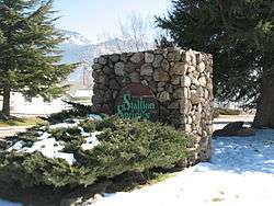
the entrance to the town | |
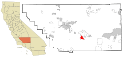 Location in Kern County and the state of California | |
 Stallion Springs Location in the United States | |
| Coordinates: 35°05′20″N 118°38′33″W / 35.08889°N 118.64250°WCoordinates: 35°05′20″N 118°38′33″W / 35.08889°N 118.64250°W | |
| Country |
|
| State |
|
| County | Kern |
| Government | |
| • Senate | Roy Ashburn (R) |
| • Assembly | Jean Fuller (R) |
| • U. S. Congress | Kevin McCarthy (R) |
| Area[1] | |
| • Total | 16.453 sq mi (42.612 km2) |
| • Land | 16.429 sq mi (42.551 km2) |
| • Water | 0.024 sq mi (0.062 km2) 0.14% |
| Elevation[2] | 3,783 ft (1,153 m) |
| Population (2010) | |
| • Total | 2,488 |
| • Density | 150/sq mi (58/km2) |
| Time zone | PST (UTC-8) |
| • Summer (DST) | PDT (UTC-7) |
| ZIP code | 93561 |
| Area code(s) | 661 |
| FIPS code | 06-73868 |
| GNIS feature ID | 1853417 |
Stallion Springs is a census-designated place (CDP) in the Tehachapi Mountains, in Kern County, California, USA. The population was 2,488 at the 2010 census, up from 1,522 at the 2000 census. Stallion Springs is located in the greater Tehachapi Area.
Geography
Stallion Springs is located at 35°5′20″N 118°38′33″W / 35.08889°N 118.64250°W.[2]
According to the United States Census Bureau, the CDP has a total area of 16.5 square miles (43 km2), of which, 16.4 square miles (42 km2) of it is land and 0.024 square miles (0.062 km2) of it (0.14%) is water.
The area is patrolled by the Stallion Springs Police Department which was established in 1972. The Stallion Springs Police Department is a California Peace Officer Standards and Training fully certified department which has full law enforcement powers throughout California. They provide the community and the surrounding schools, drug intervention classes, social media safety classes, and gang information classes. The Stallion Springs Police Department has their own Police Activities League (PAL) and Neighborhood Watch Program, and established a Community Services Unit (CSU) in 2014. The CSU assists the police department with administrative duties and some day to day patrol activities.
The most contributing crime factor in the general area is methamphetamine abuse.
Demographics
2010
The 2010 United States Census[3] reported that Stallion Springs had a population of 2,488. The population density was 151.2 people per square mile (58.4/km²). The racial makeup of Stallion Springs was 2,239 (90.0%) White, 30 (1.2%) African American, 26 (1.0%) Native American, 32 (1.3%) Asian, 7 (0.3%) Pacific Islander, 79 (3.2%) from other races, and 75 (3.0%) from two or more races. Hispanic or Latino of any race were 285 persons (11.5%).
The Census reported that 2,488 people (100% of the population) lived in households, 0 (0%) lived in non-institutionalized group quarters, and 0 (0%) were institutionalized.
There were 1,004 households, out of which 275 (27.4%) had children under the age of 18 living in them, 657 (65.4%) were opposite-sex married couples living together, 58 (5.8%) had a female householder with no husband present, 42 (4.2%) had a male householder with no wife present. There were 48 (4.8%) unmarried opposite-sex partnerships, and 8 (0.8%) same-sex married couples or partnerships. 194 households (19.3%) were made up of individuals and 87 (8.7%) had someone living alone who was 65 years of age or older. The average household size was 2.48. There were 757 families (75.4% of all households); the average family size was 2.84.
The population was spread out with 522 people (21.0%) under the age of 18, 141 people (5.7%) aged 18 to 24, 510 people (20.5%) aged 25 to 44, 801 people (32.2%) aged 45 to 64, and 514 people (20.7%) who were 65 years of age or older. The median age was 46.7 years. For every 100 females there were 95.8 males. For every 100 females age 18 and over, there were 96.4 males.
There were 1,204 housing units at an average density of 73.2 per square mile (28.3/km²), of which 862 (85.9%) were owner-occupied, and 142 (14.1%) were occupied by renters. The homeowner vacancy rate was 5.4%; the rental vacancy rate was 10.0%. 2,056 people (82.6% of the population) lived in owner-occupied housing units and 432 people (17.4%) lived in rental housing units.
2000
As of the census[4] of 2000, there were 1,522 people, 586 households, and 469 families residing in the CDP. The population density was 92.5 people per square mile (35.7/km²). There were 763 housing units at an average density of 46.4 per square mile (17.9/km²). The racial makeup of the CDP was 90.21% White, 0.92% Black or African American, 0.99% Native American, 1.12% Asian, 0.07% Pacific Islander, 2.83% from other races, and 3.88% from two or more races. 11.04% of the population were Hispanic or Latino of any race.
There were 586 households out of which 31.1% had children under the age of 18 living with them, 70.0% were married couples living together, 6.7% had a female householder with no husband present, and 19.8% were non-families. 16.4% of all households were made up of individuals and 7.8% had someone living alone who was 65 years of age or older. The average household size was 2.60 and the average family size was 2.91.
In the CDP the population was spread out with 26.3% under the age of 18, 4.3% from 18 to 24, 24.1% from 25 to 44, 23.7% from 45 to 64, and 21.6% who were 65 years of age or older. The median age was 42 years. For every 100 females there were 101.9 males. For every 100 females age 18 and over, there were 101.3 males.
The median income for a household in the CDP was $51,029, and the median income for a family was $53,958. Males had a median income of $53,162 versus $37,708 for females. The per capita income for the CDP was $18,592. About 3.4% of families and 5.3% of the population were below the poverty line, including 1.8% of those under age 18 and 9.9% of those age 65 or over.
References
- ↑ U.S. Census
- 1 2 U.S. Geological Survey Geographic Names Information System: Stallion Springs, California
- ↑ "2010 Census Interactive Population Search: CA - Stallion Springs CDP". U.S. Census Bureau. Retrieved July 12, 2014.
- ↑ "American FactFinder". United States Census Bureau. Retrieved 2008-01-31.
