Saint Peter Port
| Saint Peter Port Saint-Pierre-Port | |
|---|---|
| Parish | |
|
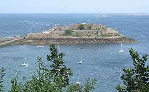
View of St Peter Port from the South | |
.GIF) Location of Saint Peter Port in Guernsey | |
| Coordinates: 49°27′20″N 2°32′12″W / 49.4555°N 2.5368°WCoordinates: 49°27′20″N 2°32′12″W / 49.4555°N 2.5368°W | |
| Crown Dependency | Guernsey, Channel Islands |
| Government | |
| • Electoral district | Divided into St Peter Port North and St Peter Port South |
| Area | |
| • Total | 6.5 km2 (2.5 sq mi) |
| Elevation | 0 m (0 ft) |
| Population (2014) | |
| • Total | 18,207 |
| • Density | 2,800/km2 (7,300/sq mi) |
| Time zone | GMT |
| • Summer (DST) | UTC+01 (UTC) |
| Postal code | GY1-GY9 |
| Website |
www |

Saint Peter Port is the capital of Guernsey as well as the main port. The population in 2001 was 16,488. In Guernésiais and in French, historically the official language of Guernsey, the name of the town and its surrounding parish is St Pierre Port. The "port" distinguishes this parish from Saint Pierre Du Bois.
As well as being a parish, St. Peter Port is a small town consisting mostly of steep narrow streets and steps on the overlooking slopes. It is known that a trading post/town has existed here since before Roman times, the pre-Christian name of which has not survived into the modern era.
The postal code for addresses in this parish starts with GY1.
People from St. Peter Port, were nicknamed "les Villais" (the townspeople) or "cllichards" in Guernésiais.
Geography
St. Peter Port is located on the east coast of Guernsey. It borders St. Sampson in the north, The Vale in the north-west, St. Andrew in the west and St. Martin in the south.
On the seaward side it faces Herm to the east, across the Little Russel, and Sark and Brecqhou even further east across the Big Russel between them and Herm. The Bréhon Tower sits in the Little Russel between St. Peter Port and Herm.
Relief The land in the north and by the harbour is low lying but in the south, the land gets much higher (but not as high as St Martin's or the Forest). This means that there are quite a few cliffs on the coast between Havelet and Fermain.
Subdivisions
Saint Peter Port is subdivided into four cantons:[1]
- Canton 1 or North Canton
- Canton 2 or Canton of the North-West
- Canton 3 or Canton of the South-West
- Canton 4 or Canton of the South
In addition, the islands of Herm and Jethou belong to the parish,[2] but are not part of any canton. They belong to Electoral district Saint Peter Port South.[3]
Sport & leisure
St. Peter Port has an English Isthmian League club, Guernsey F.C. who play at Footes Lane. The Guernsey Rugby Football Club also play at Footes Lane and compete in National League 3 London & SE.
Parks and Gardens
Candie Gardens, an award-winning restored Victorian Garden features a statue of Victor Hugo. Cambridge Park is a recreational park that includes a skate park. In 2014 the parish was a Gold & Category Winner in the RHS Britain in Bloom competition,[4] followed in 2016 with another Gold medal.[5]
Features
|
The features of the town include:
|
The parish of Saint Peter Port hosts:
 The Town Church 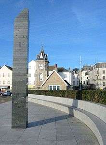 Liberation Monument |
Main roads
The following main roads (listed from north-south) provide important links between St Peter Port and the other parishes:
- Les Banques (leads up the coast to St Sampson's and the north of the island)
- Rohais Road (leads to the parish of Castel)
- Mount Row (leads to St Andrew's and the west of the island)
- Ruette Brayes (leads to St Martin's and the south of the island)
- Fort Road (leads to St Martin's)
The following coastal roads (listed from north to south) are also very important as they provide access to the shops, carparks and the harbour:
- St George's Esplanade
- North Esplanade
- South Esplanade
- Mount Durand
Politics
Saint Peter Port comprises two administrative division, St Peter Port South and St Peter Port North.
In the Guernsey general election, 2016 in:
- St Peter Port South there was a 2,068 or 63% turnout to elect five Deputies
- St Peter Port North there was a 2,639 or 65% turnout to elect six Deputies.
Famous people
- Margaret Ann Neve - The oldest woman in the world until her death in 1903
- Sir Isaac Brock – Major General, "Hero of Upper Canada", War of 1812
- Matthew Le Tissier, footballer
- Alison Merrien MBE, World indoors bowls champion
- George Métivier, poet
- Heather Watson, tennis player, Team GB athlete and Wimbledon Champion
- Victor Hugo, French writer, In exile in St-Peter Port from 1855 to 1870.
- Cameron Chalmers, athlete
Numismatic History
Guernsey bank notes feature a number of parish buildings:
|
|
See also
References
| Wikimedia Commons has media related to Saint Peter Port. |
- ↑ "St. Peter Port Parish, Canton Boundaries". Stppcons.com. 2007-11-14. Retrieved 2012-10-04.
- ↑ "Bailiwick of Guernsey". Crwflags.com. Retrieved 2012-10-04.
- ↑ "Guernsey Election of States Deputies, 2008". Islandlife.org. 2008-04-23. Retrieved 2012-10-04.
- ↑ "RHS Britain in Bloom 2014 UK Finals Judges' Reports". Britain in Bloom.
- ↑ "RHS Britain in Bloom 2016 UK Finals Full Results". RHS Britain in Bloom.
- ↑ "Places to visit". National Trust of Guernsey.
- ↑ "Victoria Tower". Guernsey Museums.
- 1 2 3 "Townie No 1" (PDF).
- ↑ "Guilles Alles Library".
- ↑ "Candie Museum". Guernsey Museums.
- ↑ "Candie Gardens". Guernsey Museums.
- ↑ "Bailiwick of Guernsey War Memorial". Great War CI.
- ↑ "St Peter Port Parish War Shrine, Guernsey". Great War CI.
- ↑ "St. Stephen's Parish Memorial, Guernsey". Great War CI.
- ↑ "South African War Memorial". Guernsey Museums.
- 1 2 3 4 Dillon, Paddy. Channel Island Walks. Cicerone Press Limited, 1999. ISBN 9781852842888.
- ↑ "PROTECTED BUILDINGS". Environment - Guernsey government.
- ↑ Careyroots http://www.careyroots.com/castle.html
- ↑ "Contact Us." Blue Islands. Retrieved on 18 September 2009.
- ↑ "Harbour Carvival". Guernsey Round Table.
- ↑ "Town Carnival". Town Centre Partnership.
External links
| Wikisource has the text of the 1911 Encyclopædia Britannica article St Peter Port. |
Guernsey articles | |||||||
|---|---|---|---|---|---|---|---|
| History |  | ||||||
| Subdivisions |
| ||||||
| Politics | |||||||
| Economy |
| ||||||
| Culture |
| ||||||
| |||||||