St. Moritz (Rhaetian Railway station)
St Moritz | |||
|---|---|---|---|
 St. Moritz station building | |||
| Location |
Via Grevas 7500 St. Moritz Maloja, Graubünden Switzerland | ||
| Coordinates | 46°29′52″N 9°50′48″E / 46.49778°N 9.84667°ECoordinates: 46°29′52″N 9°50′48″E / 46.49778°N 9.84667°E | ||
| Elevation | 1,775 m | ||
| Owned by | Rhaetian Railway | ||
| Operated by | Rhaetian Railway | ||
| Line(s) |
Albula Railway Bernina Railway | ||
| Distance |
102.93 km from Thusis 0 km from St. Moritz | ||
| Platforms | 5 | ||
| Connections | Postauto and local buses | ||
| History | |||
| Opened | 10 July 1904 | ||
| |||
| Location | |||
 St Moritz Location within Switzerland | |||

St. Moritz is a railway station in St. Moritz, Switzerland. It is the southern terminus of the Albula Railway line from Chur. Hourly services operate on this section of the line. There is also an hourly service on the Bernina Railway line from St. Moritz to Tirano, Italy. There are currently five platforms in use at this station.
The station serves as a terminus for local bus and Postbus services. St Moritz is a terminus not just for the Albula Railway but also for the Bernina Railway. Because these two companies operate with different types and levels of power supply, St Moritz is also a "Power supply switch" station (Systemwechselbahnhof).
St. Moritz is located at a height of 1,775 metres above sea level and is the highest urban railway station in Switzerland.
History
The station came into operation in 1904. At this time St Moritz had already had its own electric tram service since 1896 and there were plans to build a branch line to link the tram service to the new station. For financial reasons the short linking branch line was never built, however.
Rhaetian Railway services
- RE1/R11 - 1tph
- R5 - 1tph
| Preceding station | Rhatische Bahn | Following station | ||
|---|---|---|---|---|
| Terminus | RE1 RE940 | toward Chur |
||
| R5 R950 | toward Tirano |
|||
| R11 R940 Limited service | toward Chur |
Gallery
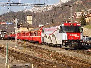 Train leaving St. Moritz.
 Glacier Express at platform 1 of St. Moritz.
 Postbus at St. Moritz station.
 St. Moritz station from above.