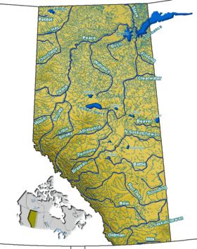
St. Mary River (Alberta–Montana)
| Saint Mary River | |
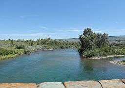 St. Mary River downstream from Saint Mary Lake | |
| Countries | United States, Canada |
|---|---|
| States | Montana, Alberta |
| Source | near Gunsight Lake |
| - location | Glacier National Park, Lewis Range, Glacier County, Montana, United States |
| - elevation | 7,560 ft (2,304 m) [1] |
| - coordinates | 48°37′13″N 113°44′37″W / 48.62028°N 113.74361°W [2] |
| Mouth | Oldman River |
| - location | near Cottonwood Park, Alberta, Canada |
| - elevation | 2,739 ft (835 m) [2] |
| - coordinates | 49°37′38″N 112°53′13″W / 49.62722°N 112.88694°WCoordinates: 49°37′38″N 112°53′13″W / 49.62722°N 112.88694°W [2] |
The Saint Mary River is a cross-border tributary of the Oldman River, itself a tributary of the South Saskatchewan River. The Saint Mary together with the Belly River and Waterton River drains a small portion of Montana, in the United States, to the Hudson Bay watershed in Canada.
The river rises as a stream on Gunsight Mountain in Glacier National Park and flows into Gunsight Lake, then flows into Saint Mary Lake, exits the park and flows on into Lower St. Mary Lake in the Blackfeet Indian Reservation. From the reservation, the St. Mary River flows into Alberta and into the St. Mary Reservoir. It flows into the Oldman River which eventually reaches the Saskatchewan River.
It passes near the town of Cardston, Alberta, and the city of Lethbridge, Alberta.
Irrigation
The St. Mary River also provides water for irrigation in Southern Alberta. The St. Mary River Irrigation District (SMRID) is Canada’s largest irrigation district delivering water through 2,060 kilometres (1,280 mi) of canals and pipelines to approximately 1,505 square kilometres (372,000 acres) of land south of the Oldman and South Saskatchewan Rivers between Lethbridge and Medicine Hat.
The irrigation project was started in 1898, and on September 4, 1900, the first water was brought to Lethbridge by the project. In December 1945 the Canadian Pacific Railway transferred control of the projects to the government of Alberta, creating the St. Mary and Milk River Development (SMRD). A dam was created in 1946 on the St. Mary River, to service the irrigation system, and water finally reached Medicine Hat in 1954 upon the completion of the St. Mary Main Canal.[3]
See also
Notes
- ↑ Derived from Google Earth search using GNIS source coordinates.
- 1 2 3 "Saint Mary River". Geographic Names Information System. United States Geological Survey. April 4, 1980. Retrieved April 18, 2013.
- ↑ "St. Mary River Irrigation District".