St. Lawrence, Newfoundland and Labrador
| St. Lawrence | |
|---|---|
| Town | |
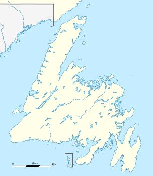 St. Lawrence Location of St. Lawrence in Newfoundland | |
| Coordinates: 46°55′28″N 55°23′34″W / 46.92444°N 55.39278°WCoordinates: 46°55′28″N 55°23′34″W / 46.92444°N 55.39278°W | |
| Country |
|
| Province |
|
| Government | |
| • Mayor | Paul Pike |
| • MHA | Carol Anne Haley |
| • MP | Judy Foote |
| Elevation | −23 m (1-80 ft) |
| Population (2016) | |
| • Total | 1,244 |
| Time zone | Newfoundland Time (UTC-3:30) |
| • Summer (DST) | Newfoundland Daylight (UTC-2:30) |
| Area code(s) | 709 |
St. Lawrence is a Canadian town located on the Burin Peninsula of Newfoundland and Labrador. As of 2011, the population of St. Lawrence was 1,244. Popular family names in the town include Slaney, Pike, Lake, Drake and Edwards.
History
The area was known to French and BASQUE fishermen in the 1600s and there was French habitation of the area in the 1640s. Settlement of St Lawrence itself, however, began in the late 1700s. Fishing was the main economic activity of the settlers for over 100 years. A tidal wave devastated the area in 1929; 27 people lost their lives, and many along the coast lost their houses, boats, stages and supplies. This added greatly to the hardship already inflicted by the Great Depression and the collapse of the saltfish trade.
Fluorspar deposits had been noted as early as 1843 but it was not until 1933 that mining began. The Fluorspar mine in St. Lawrence was a major employer in the community until 1978, when the mine was closed by Alcan. In 2011 Canada Fluorspar Inc. outlined preparations to open a fluorspar mine on the site of the old mine. As of 2016 the project has still not commenced.
A wind project has recently been initiated by the Government of Newfoundland and Labrador for St. Lawrence. The project has resulted in the installation of nine Vestas V90-3MW wind turbines. home of the wild brud as well
U.S.S. Pollux and U.S.S. Truxtun

On February 18, 1942, more than 200 American sailors died when the USS Truxton ran aground near Chambers Cove and the USS Pollux[1] ran aground at Lawn Point.
In 1992, a memorial entitled 'Echoes of Valour' was erected in dedication of the mining industry in St. Lawrence, the sailors who died in the USS Truxtun and USS Pollux disaster, and those who lost their lives in the World Wars.[2]
Education
St. Lawrence has a K-12 School, St. Lawrence Academy. The school was initially the high school for the town "St. Lawrence Central High School". With dwindling enrollment in the 1990s the school was renamed St. Lawrence Academy and encompassed k-6 upon the closure of Marion Elementary in 1999.
Sport
St. Lawrence has been referred to as the 'Soccer Capital of Canada '.[3] St. Lawrence Centennial Soccer Field has been listed on the Historic Places in Canada since 2005.[4]
The St. Lawrence soccer teams have been a powerhouse of soccer both on the Burin Peninsula where they have dominated. As well at the provincial level success has also been achieved culminating in the Laurentians being named the "Team of the Decade" for the 70's and 90's.
The town has nine organized soccer teams. The St. Lawrence Laurentians soccer club is the most recognized.
Climate
| Climate data for St. Lawrence | |||||||||||||
|---|---|---|---|---|---|---|---|---|---|---|---|---|---|
| Month | Jan | Feb | Mar | Apr | May | Jun | Jul | Aug | Sep | Oct | Nov | Dec | Year |
| Record high °C (°F) | 10.7 (51.3) |
11.9 (53.4) |
11 (52) |
16.4 (61.5) |
23.8 (74.8) |
26.1 (79) |
27.2 (81) |
27.2 (81) |
23.3 (73.9) |
20.6 (69.1) |
16 (61) |
12.7 (54.9) |
27.2 (81) |
| Average high °C (°F) | −0.3 (31.5) |
−0.9 (30.4) |
1.2 (34.2) |
4.7 (40.5) |
8.9 (48) |
12.4 (54.3) |
16.2 (61.2) |
17.7 (63.9) |
15.4 (59.7) |
10.9 (51.6) |
6.6 (43.9) |
2.2 (36) |
7.9 (46.2) |
| Daily mean °C (°F) | −3.7 (25.3) |
−4.4 (24.1) |
−2.1 (28.2) |
1.5 (34.7) |
5.3 (41.5) |
8.9 (48) |
12.9 (55.2) |
14.4 (57.9) |
11.7 (53.1) |
7.2 (45) |
3.4 (38.1) |
−1.1 (30) |
4.5 (40.1) |
| Average low °C (°F) | −7.3 (18.9) |
−8 (18) |
−5.5 (22.1) |
−1.8 (28.8) |
1.6 (34.9) |
5.3 (41.5) |
9.6 (49.3) |
11 (52) |
7.9 (46.2) |
3.6 (38.5) |
0.2 (32.4) |
−4.6 (23.7) |
1 (34) |
| Record low °C (°F) | −20.6 (−5.1) |
−25 (−13) |
−21.6 (−6.9) |
−11.6 (11.1) |
−8.9 (16) |
−2.2 (28) |
3.8 (38.8) |
3.2 (37.8) |
−1.7 (28.9) |
−5.8 (21.6) |
−12.2 (10) |
−19.4 (−2.9) |
−25 (−13) |
| Average precipitation mm (inches) | 131.4 (5.173) |
126.6 (4.984) |
122.3 (4.815) |
119.1 (4.689) |
114.8 (4.52) |
138.2 (5.441) |
106.6 (4.197) |
126.5 (4.98) |
143.1 (5.634) |
145.5 (5.728) |
142.1 (5.594) |
130.5 (5.138) |
1,546.7 (60.894) |
| Source: 1961-1990 Environment Canada [5] | |||||||||||||
References
- ↑ "Standing Into Danger" by Cassie Brown
- ↑ Echoes of Valour
- ↑ St. Lawrence Laurentian's Soccer
- ↑ http://www.historicplaces.ca/en/rep-reg/place-lieu.aspx?id=3554
- ↑ Environment Canada—1961–1990. Retrieved 16 October 2012.
External links
- History of the St. Lawrence Fluorspar Mines
- Government of Newfoundland and Labrador Hydro Wind Power Announcement for St. Lawrence
- St. Lawrence Laurentians
- St. Lawrence Academy
- Eastern School District