St. Anthony, Idaho
| St. Anthony, Idaho | |
|---|---|
| City | |
|
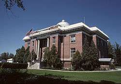
Fremont County Courthouse in St. Anthony | |
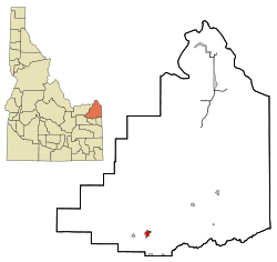 Location in Fremont County and the state of Idaho | |
 St. Anthony, Idaho Location in the United States | |
| Coordinates: 43°57′58″N 111°41′4″W / 43.96611°N 111.68444°WCoordinates: 43°57′58″N 111°41′4″W / 43.96611°N 111.68444°W | |
| Country | United States |
| State | Idaho |
| County | Fremont |
| Area[1] | |
| • Total | 1.55 sq mi (4.01 km2) |
| • Land | 1.53 sq mi (3.96 km2) |
| • Water | 0.02 sq mi (0.05 km2) |
| Elevation | 4,967 ft (1,514 m) |
| Population (2010)[2] | |
| • Total | 3,542 |
| • Estimate (2012[3]) | 3,470 |
| • Density | 2,315.0/sq mi (893.8/km2) |
| Time zone | Mountain (MST) (UTC-7) |
| • Summer (DST) | MDT (UTC-6) |
| Area code(s) | 208 |
| FIPS code | 16-71020 |
| GNIS feature ID | 0398080 |
| Website | cityofstanthony.org |
St. Anthony is a city in and the county seat of Fremont County, Idaho, United States.[4] The population was 3,542 at the 2010 census, up from 3,342 in 2000. [5] It is part of the Rexburg, Idaho Micropolitan Statistical Area.
St. Anthony was established in 1888.[6]
Geography
According to the United States Census Bureau, the city has a total area of 1.55 square miles (4.01 km2), of which, 1.53 square miles (3.96 km2) is land and 0.02 square miles (0.05 km2) is water.[1]
Demographics
| Historical population | |||
|---|---|---|---|
| Census | Pop. | %± | |
| 1900 | 411 | — | |
| 1910 | 1,238 | 201.2% | |
| 1920 | 2,957 | 138.9% | |
| 1930 | 2,778 | −6.1% | |
| 1940 | 2,719 | −2.1% | |
| 1950 | 2,695 | −0.9% | |
| 1960 | 2,700 | 0.2% | |
| 1970 | 2,877 | 6.6% | |
| 1980 | 3,212 | 11.6% | |
| 1990 | 3,010 | −6.3% | |
| 2000 | 3,342 | 11.0% | |
| 2010 | 3,542 | 6.0% | |
| Est. 2015 | 3,442 | [7] | −2.8% |
2010 census
As of the census[2] of 2010, there were 3,542 people, 1,118 households, and 857 families residing in the city. The population density was 2,315.0 inhabitants per square mile (893.8/km2). There were 1,252 housing units at an average density of 818.3 per square mile (315.9/km2). The racial makeup of the city was 85.9% White, 0.5% African American, 0.8% Native American, 0.5% Asian, 0.2% Pacific Islander, 10.6% from other races, and 1.6% from two or more races. Hispanic or Latino of any race were 20.9% of the population.
There were 1,118 households of which 45.3% had children under the age of 18 living with them, 58.8% were married couples living together, 12.1% had a female householder with no husband present, 5.8% had a male householder with no wife present, and 23.3% were non-families. 20.3% of all households were made up of individuals and 7.7% had someone living alone who was 65 years of age or older. The average household size was 2.94 and the average family size was 3.39.
The median age in the city was 29.8 years. 31.7% of residents were under the age of 18; 10.1% were between the ages of 18 and 24; 27.3% were from 25 to 44; 20.5% were from 45 to 64; and 10.4% were 65 years of age or older. The gender makeup of the city was 54.5% male and 45.5% female.
2000 census
As of the census[9] of 2000, there were 3,342 people, 1,091 households, and 819 families residing in the city. The population density was 2,565.0 people per square mile (992.6/km²). There were 1,218 housing units at an average density of 934.8 per square mile (361.7/km²). The racial makeup of the city was 89.05% White, 0.21% African American, 0.69% Native American, 0.66% Asian, 0.06% Pacific Islander, 7.09% from other races, and 2.24% from two or more races. Hispanic or Latino of any race were 15.38% of the population.
There were 1,091 households out of which 40.1% had children under the age of 18 living with them, 59.9% were married couples living together, 11.5% had a female householder with no husband present, and 24.9% were non-families. 22.1% of all households were made up of individuals and 10.1% had someone living alone who was 65 years of age or older. The average household size was 2.94 and the average family size was 3.47.
In the city the population was spread out with 33.2% under the age of 18, 10.1% from 18 to 24, 26.8% from 25 to 44, 18.5% from 45 to 64, and 11.4% who were 65 years of age or older. The median age was 30 years. For every 100 females there were 107.6 males. For every 100 females age 18 and over, there were 109.8 males.
The median income for a household in the city was $31,023, and the median income for a family was $37,995. Males had a median income of $26,625 versus $22,734 for females. The per capita income for the city was $12,898. About 10.3% of families and 15.6% of the population were below the poverty line, including 20.8% of those under age 18 and 14.2% of those age 65 or over.
Government and infrastructure
The Idaho Department of Correction operates the St. Anthony Work Camp in St. Anthony. [10][11]
The United States Postal Service operates the Saint Anthony Post Office in Saint Anthony.[12]
Climate
St. Anthony experiences a continental climate (Köppen Dfb) with long, cold, snowy winters and hot summers.
| Climate data for St. Anthony (1971–2000) | |||||||||||||
|---|---|---|---|---|---|---|---|---|---|---|---|---|---|
| Month | Jan | Feb | Mar | Apr | May | Jun | Jul | Aug | Sep | Oct | Nov | Dec | Year |
| Average high °F (°C) | 28.8 (−1.8) |
34.0 (1.1) |
43.6 (6.4) |
55.7 (13.2) |
65.6 (18.7) |
74.4 (23.6) |
82.8 (28.2) |
82.7 (28.2) |
73.0 (22.8) |
60.1 (15.6) |
41.7 (5.4) |
30.3 (−0.9) |
56.1 (13.4) |
| Average low °F (°C) | 6.9 (−13.9) |
9.2 (−12.7) |
17.5 (−8.1) |
25.4 (−3.7) |
34.3 (1.3) |
41.2 (5.1) |
45.8 (7.7) |
43.3 (6.3) |
35.1 (1.7) |
26.4 (−3.1) |
16.9 (−8.4) |
7.6 (−13.6) |
25.8 (−3.4) |
| Average precipitation inches (mm) | 1.26 (32) |
0.90 (22.9) |
1.10 (27.9) |
1.13 (28.7) |
2.02 (51.3) |
1.52 (38.6) |
0.97 (24.6) |
0.75 (19) |
0.92 (23.4) |
1.00 (25.4) |
1.32 (33.5) |
1.30 (33) |
14.19 (360.3) |
| Source: NOAA (normals, 1971–2000) [13] | |||||||||||||
Notable people
- Erik Estrada, who famously played a cop on the TV show "CHIPS," is a full-fledged police officer in St. Anthony, Idaho, as of July 01, 2016.
- Bill Aken, (aka Zane Ashton) Musician's Hall of Fame Guitarist (Inducted in 2007) and founding member of the renowned studio group "The Wrecking Crew" who were the musicians on hundreds of rock and roll hit records in the 1960s through the 1980s.
- Brad Harris, television and movie actor
- Sherman P. Lloyd, Utah State Senator and Member of the United States House of Representatives from Utah
- J.C. "Doc" Sorensen, veterinarian, rancher, rodeo producer and stock contractor, National Rodeo Hall of Fame inductee
References
- 1 2 "US Gazetteer files 2010". United States Census Bureau. Retrieved 2012-12-18.
- 1 2 "American FactFinder". United States Census Bureau. Retrieved 2012-12-18.
- ↑ "Population Estimates". United States Census Bureau. Retrieved 2013-06-03.
- ↑ "Find a County". National Association of Counties. Retrieved 2011-06-07.
- ↑ Spokesman-Review - 2010 census - St. Anthony, Idaho - accessed 2011-12-26
- ↑ Andrew Jenson, Encyclopedia History of The Church of Jesus Christ of Latter-day Saints, p. 724
- ↑ "Annual Estimates of the Resident Population for Incorporated Places: April 1, 2010 to July 1, 2015". Retrieved July 2, 2016.
- ↑ "Census of Population and Housing". Census.gov. Retrieved June 4, 2015.
- ↑ "American FactFinder". United States Census Bureau. Retrieved 2008-01-31.
- ↑ "Locations." Idaho Department of Correction. Retrieved on June 4, 2011. "St. Anthony Work Camp (SAWC) 125 N. 8th West St. Anthony ID 83445 "
- ↑ "St. Anthony city, Idaho." U.S. Census Bureau. Retrieved on June 3, 2011.
- ↑ "Post Office™ Location - SAINT ANTHONY." United States Postal Service. Retrieved on June 3, 2011.
- ↑ "Climatography of the United States NO.81" (PDF). National Oceanic and Atmospheric Administration. Retrieved January 13, 2011.
External links
- Official website - City of St. Anthony
- Fremont County Joint School District 215
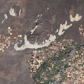
- St. Anthony Sand Dunes
Municipalities and communities of Fremont County, Idaho, United States | ||
|---|---|---|
| Cities | ||
| Unincorporated communities | ||