Srednja Vas pri Dragi
| Srednja Vas pri Dragi | |
|---|---|
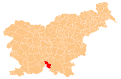
 Srednja Vas pri Dragi Location in Slovenia | |
| Coordinates: 45°36′56.33″N 14°39′45.46″E / 45.6156472°N 14.6626278°ECoordinates: 45°36′56.33″N 14°39′45.46″E / 45.6156472°N 14.6626278°E | |
| Country |
|
| Traditional region | Lower Carniola |
| Statistical region | Southeast Slovenia |
| Municipality | Loški Potok |
| Area | |
| • Total | 10.48 km2 (4.05 sq mi) |
| Elevation | 786.5 m (2,580.4 ft) |
| Population (2002) | |
| • Total | 48 |
| [1] | |
Srednja Vas pri Dragi (pronounced [ˈsɾeːdnja ˈʋaːs pɾi ˈdɾaːɡi]; Slovene: Srednja vas pri Dragi, German: Mittergrass[2] or Mittergraß[3]) is a village southeast of Draga in the Municipality of Loški Potok in southern Slovenia. The area is part of the traditional region of Lower Carniola and is now included in the Southeast Slovenia Statistical Region.[4] The settlement includes the hamlet of Šafarje (German: Schaffern[3]).[5]
Name
The name of the settlement was changed from Srednja vas to Srednja vas pri Dragi in 1953.[6]
References
- ↑ Statistical Office of the Republic of Slovenia
- ↑ Ferenc, Mitja. 2007. Nekdanji nemški jezikovni otok na kočevskem. Kočevje: Pokrajinski muzej, p. 4.
- 1 2 Leksikon občin kraljestev in dežel zastopanih v državnem zboru, vol. 6: Kranjsko. 1906. Vienna: C. Kr. Dvorna in Državna Tiskarna, pp. 42–43.
- ↑ Loški Potok municipal site
- ↑ Savnik, Roman, ed. 1971. Krajevni leksikon Slovenije, vol. 2. Ljubljana: Državna založba Slovenije, p. 243.
- ↑ Spremembe naselij 1948–95. 1996. Database. Ljubljana: Geografski inštitut ZRC SAZU, DZS.
External links
- Srednja Vas pri Dragi on Geopedia
- Pre–World War II list of oeconyms and family names in Srednja Vas pri Dragi
| Settlements | Administrative centre: Hrib–Loški Potok
|  | ||||||
|---|---|---|---|---|---|---|---|---|
This article is issued from Wikipedia - version of the 1/5/2016. The text is available under the Creative Commons Attribution/Share Alike but additional terms may apply for the media files.