Springville, New York
| Springville, New York | |
|---|---|
| Village | |
|
The former Springville depot for the Buffalo, Rochester and Pittsburgh Railroad in June 2016. | |
| Nickname(s): "Cold Springs", "Fiddlers Green" | |
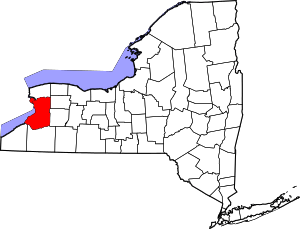
 Location in Erie County and the state of New York | |
| Coordinates: 42°30′34″N 78°40′11″W / 42.50944°N 78.66972°WCoordinates: 42°30′34″N 78°40′11″W / 42.50944°N 78.66972°W | |
| Country | United States |
| State | New York |
| County | Erie |
| Town | Concord |
| Area | |
| • Total | 3.7 sq mi (9.5 km2) |
| • Land | 3.7 sq mi (9.5 km2) |
| • Water | 0.010 sq mi (0.026 km2) |
| Elevation | 1,329 ft (405 m) |
| Population (2010) | |
| • Total | 4,596 |
| • Density | 1,300/sq mi (480/km2) |
| Time zone | Eastern (EST) (UTC-5) |
| • Summer (DST) | EDT (UTC-4) |
| ZIP code | 14141 |
| Area code(s) | 716 |
| FIPS code | 36-70442 |
| GNIS feature ID | 0966106 |
| Website |
www |

Springville is a village in the southeast part of the town of Concord in Erie County, New York, in the United States. Springville is the principal community in the town and a major business location in south Erie County. The population was 4,596 at the 2010 census.[1] It is part of the Buffalo–Niagara Falls Metropolitan Statistical Area. Springville was originally named "Fiddler's Green" before it was renamed "Springville".
History
In 1808, Samuel Cochran became the first permanent settler in the town. The Springville Academy, opening in 1830, became the first high school in Erie County. It was given its current name, Springville Griffith Institute, in 1867 to honor Archibald Griffith, a donor. The village of Springville was incorporated in 1834 from part of the town of Concord. The Dygert Farm on Elk Street was the site of the 1866 and 1867 Erie County Fair.
Springville is home to five National Register of Historic Places-listed (NRHP) buildings (Citizens National Bank; Buffalo, Rochester and Pittsburgh Railroad Station; Baptist Church of Springville; United States Post Office; Scoby Power Plant and Dam) and the NRHP-listed East Main-Mechanic Streets Historic District and East Hill Historic District.[2][3]
Geography
According to the United States Census Bureau, the village has a total area of 3.7 square miles (9.6 km2), of which 3.7 square miles (9.6 km2) is land and 0.27% is water.
Cattaraugus Creek and Cattaraugus County are south of the village.
New York State Route 39 (NY 39), a major east–west truck road, becomes Main Street upon entering Springville. U.S. Route 219, the Southern Expressway, passes just west of the village. NY 240 (Vaughn Street), a major north–south truck road, marks the east border of the village.
Demographics
| Historical population | |||
|---|---|---|---|
| Census | Pop. | %± | |
| 1870 | 1,006 | — | |
| 1880 | 1,227 | 22.0% | |
| 1890 | 1,883 | 53.5% | |
| 1900 | 1,992 | 5.8% | |
| 1910 | 2,246 | 12.8% | |
| 1920 | 2,331 | 3.8% | |
| 1930 | 2,540 | 9.0% | |
| 1940 | 2,849 | 12.2% | |
| 1950 | 3,322 | 16.6% | |
| 1960 | 3,852 | 16.0% | |
| 1970 | 4,350 | 12.9% | |
| 1980 | 4,285 | −1.5% | |
| 1990 | 4,310 | 0.6% | |
| 2000 | 4,252 | −1.3% | |
| 2010 | 4,296 | 1.0% | |
| Est. 2015 | 4,339 | [4] | 1.0% |
As of the census[1] of 2000, there were 4,252 people, 1,705 households, and 1,091 families residing in the village. The population density was 1,164.4 people per square mile (449.8/km2). There were 1,798 housing units at an average density of 492.4 per square mile (190.2/km2). The racial makeup of the village was 98.28% White, 0.49% African American, 0.21% Native American, 0.40% Asian, 0.02% Pacific Islander, 0.19% from other races, and 0.40% from two or more races. Hispanic or Latino of any race were 0.61% of the population.
There were 1,705 households out of which 31.4% had children under the age of 18 living with them, 49.3% were married couples living together, 10.3% had a female householder with no husband present, and 36.0% were non-families. 31.5% of all households were made up of individuals and 16.3% had someone living alone who was 65 years of age or older. The average household size was 2.40 and the average family size was 3.01.
The population was spread out in the village with 25.1% under the age of 18, 7.1% from 18 to 24, 26.9% from 25 to 44, 21.8% from 45 to 64, and 19.1% who were 65 years of age or older. The median age was 40 years. For every 100 females there were 85.8 males. For every 100 females age 18 and over, there were 82.1 males.
The median income for a household in the village was $38,221, and the median income for a family was $49,422. Males had a median income of $39,452 versus $24,621 for females. The per capita income for the village was $19,302. About 5.4% of families and 7.4% of the population were below the poverty line, including 11.0% of those under age 18 and 3.5% of those age 65 or over.
Notable people
- C. DeForest Cummings, former Syracuse Orange football coach
- Emmons Dunbar, agriculturalist, college football coach
- Erwin F. Dygert, noted importer of Belgian horses, and harness racing
- Elon Howard Eaton, ornithologist, attended school in Springville
- Ken Knowlton, computer graphics pioneer
- Asher P. Nichols, state senator
- Jessica Orsini, transgender alderwoman for Centralia, Missouri
- Tom Reynolds, Republican politician
- George Schuster, driver in the 1908 New York to Paris Auto Race
- Allen D. Scott, former New York state senator
- Bill Simon, songwriter (with Jack Yellen), jazz critic, saxophonist
- Joey Snyder III, pro golfer
- Bill Warner, college football coach, brother of Pop Warner
- Glenn "Pop" Warner, coach, prompter, helped shape football into the form it is played today
- Christine Weidinger, opera singer
- Jack Yellen, songwriter (including "Ain't She Sweet" and the Franklin D. Roosevelt campaign tune "Happy Days Are Here Again")
Notable businesses and attractions
- Bertrand Chaffee Hospital - Opened in 1946, this 24-bed acute care hospital also has primary care, cardiology, emergency, surgical and outpatient services.
- Gentner Commission Market - A weekly auction and market that includes farm fresh produce, flea market items, animal barns and more. It is held every Wednesday since 1939.
- Joylan Theatre - A one-screen movie theater showing first-run films. The theater at this location was built in 1947.
- Springville Area Chamber of Commerce The chamber coordinates events and activities to promote business and commerce in the greater Springville area.
- Springville Center for the Arts - A community multi-arts center that produces theater shows, gallery exhibits, workshops and more. The original establishment closed in 2007. Their new establishment is the former Baptist Church of Springville building on the corner of the four way stop of North Buffalo Street and Franklin Street.
Schools
References
- 1 2 "American FactFinder". United States Census Bureau. Retrieved 2008-01-31.
- ↑ National Park Service (2010-07-09). "National Register Information System". National Register of Historic Places. National Park Service.
- ↑ "National Register of Historic Places Listings". Weekly List of Actions Taken on Properties: 8/03/15 through 8/07/15. National Park Service. 2015-08-14.
- ↑ "Annual Estimates of the Resident Population for Incorporated Places: April 1, 2010 to July 1, 2015". Retrieved July 2, 2016.
- ↑ "Census of Population and Housing". Census.gov. Retrieved June 4, 2015.
External links
- Village of Springville official website
- Concord Industrial Development Agency
- Springville Chamber of Commerce
- History of Springville
- Springville Center for the Arts