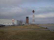
Springfield–Beckley Municipal Airport
Coordinates: 39°50′25″N 083°50′25″W / 39.84028°N 83.84028°W
| Springfield–Beckley Municipal Airport | |||||||||||||||
|---|---|---|---|---|---|---|---|---|---|---|---|---|---|---|---|
 | |||||||||||||||
| IATA: SGH – ICAO: KSGH – FAA LID: SGH | |||||||||||||||
| Summary | |||||||||||||||
| Airport type | Public | ||||||||||||||
| Owner | City of Springfield | ||||||||||||||
| Serves | Springfield, Ohio | ||||||||||||||
| Location | Green Township, Clark County, near Springfield, Ohio | ||||||||||||||
| Elevation AMSL | 1,051 ft / 320 m | ||||||||||||||
| Website | www.airparkohio.com/... | ||||||||||||||
| Map | |||||||||||||||
 SGH  SGH Location of airport in Ohio/United States | |||||||||||||||
| Runways | |||||||||||||||
| |||||||||||||||
| Statistics (2005) | |||||||||||||||
| |||||||||||||||
Springfield–Beckley Municipal Airport (IATA: SGH, ICAO: KSGH, FAA LID: SGH) is a joint use civil-military airport located five miles (8 km) south of the central business district of Springfield, a city in Clark County, Ohio, United States. It is owned by the city of Springfield.[1]
Three units of the Ohio Air National Guard, including the 178th Fighter Wing are based at the co-located Springfield Air National Guard Base.
Facilities and Aircraft
Springfield–Beckley Municipal Airport covers an area of 1,516 acres (614 ha) which contains two runways:[1]
- Runway 6/24: 9,009 x 150 ft (2,746 x 46 m), Surface: Asphalt/Concrete
- Runway 15/33: 5,499 x 100 ft (1,676 x 30 m), Surface: Asphalt
For the 12-month period ending November 29, 2005, the airport had 62,000 aircraft operations, an average of 169 per day: 75% general aviation, 21% military and 4% air taxi. There are 81 aircraft based at this airport: 59% single-engine, 14% multi-engine, 1% jet, 1% ultralight and 25% military.[1]
- Named after the Beckley family, a member of which knew the Wright Brothers, and witnessed and photographed their first flights.
References
External links
- Springfield–Beckley Municipal Airport
- Springfield Air National Guard Base (official site)
- Springfield Air National Guard Base (GlobalSecurity.org)
- FAA Airport Diagram (PDF), effective December 8, 2016
- Resources for this airport:
- FAA airport information for SGH
- AirNav airport information for KSGH
- ASN accident history for SGH
- FlightAware airport information and live flight tracker
- NOAA/NWS latest weather observations
- SkyVector aeronautical chart, Terminal Procedures