Spaulding Square, Los Angeles
| Spaulding Square | |
|---|---|
| Neighborhood of Los Angeles | |
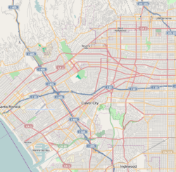 Spaulding Square Location within Western Los Angeles | |
| Coordinates: 34°05′46″N 118°21′26″W / 34.096128°N 118.357245°W | |
| Country | United States |
| State | California |
| County | Los Angeles |
| City | Los Angeles |
| Time zone | PST (UTC-8) |
| • Summer (DST) | PDT (UTC-7) |
| Zip code | 90046 |
Spaulding Square is a small community in the Hollywood neighborhood of Los Angeles, California.
Geography
Spaulding Square's community borders are roughly Fairfax Ave on the west, Stanley Avenue on the east, Sunset Blvd on the north, and Fountain Avenue on the south.
The area is residential, being composed of very well-kept upper middle class historic homes from the 1920s in tree lined small avenues.
Spaulding Square is in the Zip code of 90046.
History
Sharing much of the history of Hollywood, Spaulding Square was developed in the 1920s. The Square was named after California architect, Albert Starr Spaulding, who developed the eight block area between 1916 and 1926. Most of the early residents were silent film stars and directors.[1] One early resident was Rudolph J. Berquist,[2] a renowned cinematographer known for early works like Camille (1921 film) and One Night in Rome. He built his personal residence at 1400 N Ogden Drive in 1919 [3] and the house is now part of the HPOZ, remaining in perfect condition to this day.
In 1993, Spaulding Square was designated a Historic Preservation Overlay Zone (HPOZ) by the city of Los Angeles, with the object to preserve the historic architecture found in the community.
References
- ↑ Wedner, Diane (February 3, 2008), "It's urban life plus suburban life, squared", Los Angeles Times
- ↑ "Rudolph J. Berquist". IMBd Bio. IMBd.com, Inc. Retrieved 2015-01-14.
- ↑ Ades, Brian (2014-08-21). "1400 N Ogden Drive in Spaulding Square". Legacies of LA. Legacies of LA. Retrieved 2015-01-14.
the accomplished cinematographer Rudolph J. Berquist, who built the house as his personal residence in 1919.
External links
| Topics |  | |
|---|---|---|
| Government | ||
| Districts and neighborhoods |  | |
|---|---|---|
| Points of interest | ||
| Neighboring cities and communities | ||
Coordinates: 34°05′46″N 118°21′26″W / 34.096128°N 118.357245°W