Soyapango
| Soyapango | |
|---|---|
| Municipality | |
 | |
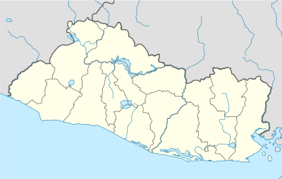 Soyapango Location in El Salvador | |
| Coordinates: 13°44′N 89°09′W / 13.733°N 89.150°W | |
| Country |
|
| Department | San Salvador Department |
| Government | |
| • Mayor | Jaime Lindo (Nationalist Republican Alliance[1] |
| Area | |
| • Total | 11.47 sq mi (29.72 km2) |
| Population | |
| • Total | 285,559 [2] |
| 2007 Census | |
| Website | soyapango.gob.sv/ |
Soyapango is a municipality in the San Salvador department of El Salvador. Soyapango is a commercial center. The municipality is the third most populated area in the country, with 290,412 inhabitants. Soyapango is a satellite city of San Salvador and it is the main thoroughfare between San Salvador and the eastern part of the country, and nearly 70,000 vehicles travel through it every day. The nickname for this satellite city is Soya. The city is infamously and notoriously known for being the most dangerous city of the Central America region, and also for being a breeding ground for the Mara gangs when they first arrive after being deported to El Salvador from South Central Los Angeles, reason why these two locations evoke a similar resemblance to each other.
Economy
Empresas ADOC has its headquarters in Soyapango.[3] There economic activity there mostly is forestry.
Geography
It is limited by the following municipalities: the north by Delgado and Tonacatepeque; to the east by Ilopango, on the south by St. Thomas and San Marcos, and the west by San Salvador and Delgado. It is located between the geographic coordinates 13° 44'42 "LN (northern end) and 13° 39'58" LN (southern end), 89° 06'57 "LWG (eastern end) and 89° 10'16" LWG (far west) .
Soils
Soils predominate in the municipality of type: 1) and Regosols Andosols, which are areas that form rolling and rolling country areas, 2) Regosols, and Andosols Latosols reddish clay, which are land areas that form of hills and mountains of the belt volcanic foothills or lower slopes of the volcanoes or volcanic massifs. In this area dominated by rock types of pyroclastic material.
Hydrography
Water the town river Las Cañas, Acelhuate, Tapachula, Chantecuán, El Sauce, and Chagiiite Sumpa and Arenal streams, and other unnamed Aposento. The main rivers are the reeds and the Acelhuate. The river Las Cañas was born in the town of Ilopango, and enters Soyapango to 2.4 miles east of the city, describing a path from south to north. Its course and divided the territory and Tonacatepeque Ilopango. Its rivers tributaries Chantecuán, El Sauce, Zapotitán, bananas and Sumpa, and streams and Arenal The Pavas Seco. It has a length within the municipality of 5.5 kilometers. Acelhuate River rises in the municipality of San Salvador. Enter Soyapango to 2.3 miles west of the city, describing a course from south to north. Its course divides this territory and those of Delgado and San Salvador. Its tributaries to the river gorge Tapachula and El Arenal. Describes a trip within the municipality of 3.5 kilometers.
Terrain
This town has a topography with features ranging from rolling to rugged mountains in the south, being less pronounced in the rest. The highlight of this town has two terrain accidents: Cerro El Mirador and Mount San Jacinto. Mount San Jacinto is the principal. Located 3.1 miles southwest of the city of Soyapango, and its summit serves as a marker for the demarcation of municipal boundaries of San Marcos, San Salvador and Soyapango. It has an elevation of 1151.93 meters over sea level.
Climate
The amount of annual rainfall varies between 1.700 and 1.850 mm.
Sports
The local professional football club is named C.D. Marte Soyapango and it currently plays in the Salvadoran Second Division.
References
External links
- Municipality of Soyapango (Spanish)
Coordinates: 13°44′N 89°09′W / 13.733°N 89.150°W
Capital: San Salvador | ||
| Municipalities |  | |