Southmead
| Southmead | |
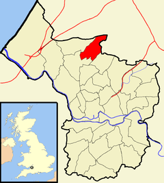 Boundaries of the city council ward |
|
| Population | 11,956 (2011.Ward)[1] |
|---|---|
| OS grid reference | ST582785 |
| Unitary authority | Bristol |
| Ceremonial county | Bristol |
| Region | South West |
| Country | England |
| Sovereign state | United Kingdom |
| Post town | BRISTOL |
| Postcode district | BS10 |
| Dialling code | 0117 |
| Police | Avon and Somerset |
| Fire | Avon |
| Ambulance | South Western |
| EU Parliament | South West England |
| UK Parliament | Bristol North West |
Coordinates: 51°30′14″N 2°36′10″W / 51.5039°N 2.6028°W
Southmead is a northern suburb and council ward of Bristol, in the southwest of England. The town of Filton (in South Gloucestershire), and the Bristol suburbs of Monks Park, Horfield, Henleaze and Westbury on Trym lie on its boundaries.
The River Trym rises in Southmead and flows southwest through Badock's Wood, a Local Nature Reserve. There is a round barrow near the northern end of the wood.[2]
History
Southmead was a manor of the parish of Westbury on Trym. The manor house, mentioned in a document of 1319, was near the south end of what is now Southmead Road.[3] Most of the estate of 313 acres (1.27 km2) was sold in the late 19th century. By 1888 Southmead was a small hamlet on Southmead Road.[4] Southmead Hospital, formerly the Barton Regis Workhouse, was opened there in 1924.
Large-scale development of the area started in 1931, when the Bristol Corporation built 1,500 houses to the north of Southmead Road, partly to house families cleared from the slums of central Bristol, and partly to address the housing shortage at the time. A further 1,100 houses were built after World War II. Since then, reference has often been made to the "pre-war estate" of Southmead and the "post-war estate".
Following the 1980 St. Pauls riot, Southmead experienced two nights of rioting.[5][6]
Southmead today
The centre of Southmead is along Greystoke Avenue, a wide road with grassy areas some distance to the north of the original hamlet on Southmead Road. The area to the south, around the old manor house, is now in Westbury on Trym ward, and the parts of Southmead to the southeast of Southmead Road, including the hospital, are in Horfield ward.[7] Embleton Primary School is located in the area.

Social issues
Efforts have been made to improve the area's social problems and implement environmental improvements, many of which have been successful. However heroin and other drugs are still an issue.[8][9][10] Many of the youth are socially deprived and not as likely to go to university as others in the country which is reflective of the national socio-economic imbalances within the UK's education system.[11]A visitor to the area commented that "the police are doing bugger all about this, all this aggro that's going on" and generally complained about the lack of bus service provision in the Crow Lane area. [12] As of 2009/10, average lifespan is 76 years, three years below the city average of 79.[13]
Panorama report
On 19 October 2009, a BBC Panorama report, investigating the extent of racism in modern Britain, featured two undercover journalists who posed as Muslims on the Southmead estate. The journalists were subject to 50 incidents of racist abuse from local residents in two months.[14] The couple were verbally and physically attacked during their time in the area of Southmead where they were residing, being told to go back to Iraq. The word "Jew" was also used as an insult against the man and a brick was thrown.[15] The day after the programme was broadcast, a 22-year-old man and an 11-year-old boy were arrested on suspicion of racially aggravated assault.[16]
References
| Wikimedia Commons has media related to Southmead (Bristol ward). |
- ↑ "Southmead" (PDF). 2011 Census Ward Information Sheet. Retrieved 26 February 2015.
- ↑ "History". Fobw.co.uk. Retrieved 4 March 2013.
- ↑ The Henleaze Book, p.14
- ↑ "It's where community spirit thrives". Bristol Post. 13 July 2012. Retrieved 28 November 2015.
- ↑ Serpico, John. "The Southmead Riots". Bristol Radical History Group. Retrieved 27 October 2011.
- ↑ Ball, Roger. "'The Bristol Riot and its Other': St. Paul's and Southmead in April 1980". University of West of England. Retrieved 27 October 2011.
- ↑ "Southmead Polling Districts (map)" (PDF). Bristol City Council. 2010. Retrieved 7 September 2011.
- ↑ "The Southmead Project: understanding drug misuse". University of Bristol. Retrieved 28 November 2015.
- ↑ Serpico, John. "The Southmead Riots". Bristol Radical History Group. Retrieved 28 November 2015.
- ↑ Hamlton, Alexander (19 July 2008). "Bristol Evening Post – Southmead drug factory swoop". This is Bristol. Retrieved 4 March 2013.
- ↑ Shepherd, Jessica (3 February 2009). "Universities don't like common people, do they?". The Guardian. London. Retrieved 23 May 2010.
- ↑ "999 Call - Very sore feet". YouTube. 2008-07-11. Retrieved 2014-02-04.
- ↑ "Crime: Total Offences" (PDF). Neighbourhood Partnership Statistical Profile 2011. Bristol City Council. Retrieved 27 October 2011.
- ↑ "BBC – Panorama – Reduced to a four-letter word". BBC News. 19 October 2009. Retrieved 4 March 2013.
- ↑ "BBC One – Panorama, Undercover – Hate on the Doorstep". Bbc.co.uk. 25 October 2009. Retrieved 4 March 2013.
- ↑ "Two held after TV racism expose". BBC News. 20 October 2009. Retrieved 23 May 2010.