Southern Rocky Mountains
| Southern Rocky Mountains | |
|---|---|
 | |
| Highest point | |
| Peak | Mount Elbert |
| Elevation | 14,440 ft (4,400 m) |
| Coordinates | 39°07′04″N 106°26′43″W / 39.11778°N 106.44528°WCoordinates: 39°07′04″N 106°26′43″W / 39.11778°N 106.44528°W |
| Geography | |
| Country | United States |
| States | Colorado, New Mexico, Utah and Wyoming |
| Parent range | Rocky Mountains |

The Southern Rocky Mountains are a major subregion of the Rocky Mountains of North America located in the southeastern portion of the U.S. state of Wyoming, the central and western portions of Colorado, the northern portion of New Mexico, and extreme eastern portions of Utah. The Southern Rocky Mountains are also commonly known as the Southern Rockies, and since the highest peaks are located in the State of Colorado, they are sometimes known as the Colorado Rockies, although many important ranges and peaks rise in the other three states. The Southern Rockies include the highest mountain ranges of the Rocky Mountains and include all 30 of the highest major peaks of the Rockies.
The Southern Rocky Mountains are generally divided from the Western Rocky Mountains by the Green River and the Colorado River below the Green River. The Southern Rockies are divided from the Central Rocky Mountains by South Pass in Wyoming and the drainage running east from the pass down the Sweetwater River and the North Platte River; and the drainage running southwest from the pass down Pacific Creek and Sandy Creek to the Green River. This divide between the Southern Rockies and the Central Rockies provided the lowest elevation traverse of the Rocky Mountain region for the historic Oregon Trail, the Mormon Trail, and the California Trail. The southern end of the Rocky Mountains are considered to be the Jemez Mountains and the Southern Sangre De Cristo mountains of New Mexico. Mountains south of here in N.M. are classified as the Arizona/New Mexico Mountains using the EPA Level III Ecoregions System.
This article defines a significant summit as a summit with at least 100 meters (328.1 feet) of topographic prominence, and a major summit as a summit with at least 500 meters (1640.4 feet) of topographic prominence. An ultra-prominent summit is a summit with at least 1500 meters (4921.3 feet) of topographic prominence.
All elevations in this article include an elevation adjustment from the National Geodetic Vertical Datum of 1929 (NGVD 29) to the North American Vertical Datum of 1988 (NAVD 88). For further information, please see this United States National Geodetic Survey note.
Mountain ranges
The following table lists the mountain ranges and subranges of the Southern Rocky Mountains with their highest summit.
| Mountain range | Highest summit | |||||||||
|---|---|---|---|---|---|---|---|---|---|---|
| primary | secondary | tertiary | states | Summit name | Elevation | Prominence | Isolation | |||
| rowspan=7 align=center | Sawatch Range[1][2] | rowspan=4 align=center | Central Sawatch Range | align=center | Elbert Massif[3] | Mount Elbert[4][5][6][7] | 14,440 ft 4401 m | 9,093 ft 2772 m | 671 mi 1,079 km | |
| align=center | Massive Massif[8] | Mount Massive[9][10][11][12] | 14,428 ft 4398 m | 1,961 ft 598 m | 5.06 mi 8.15 km | |||||
| align=center | Collegiate Peaks[13] | Mount Harvard[14][15][16][17] | 14,421 ft 4396 m | 2,327 ft 709 m | 14.92 mi 24.0 km | |||||
| align=center | Williams Mountains[18] | Bill Williams Peak[19][20][21] | 13,389 ft 4081 m | 1,682 ft 513 m | 3.73 mi 6.00 km | |||||
| rowspan=2 align=center | Southern Sawatch Range[22] | Mount Antero[23][24][25][26] | 14,276 ft 4351 m | 2,503 ft 763 m | 17.75 mi 28.6 km | |||||
| align=center | Far Southern Sawatch Range[27] | Mount Ouray[28][29][30][31] | 13,961 ft 4255 m | 2,659 ft 810 m | 13.58 mi 21.9 km | |||||
| colspan=2 align=center | Northern Sawatch Range[32] | Mount of the Holy Cross[33][34][35][36][37] | 14,011 ft 4271 m | 2,111 ft 643 m | 18.52 mi 29.8 km | |||||
| rowspan=10 align=center | Sangre de Cristo Mountains[38] | colspan=2 align=center | Sierra Blanca Massif[39] | Blanca Peak[40][41][42] | 14,357 ft 4376 m | 5,326 ft 1623 m | 103.4 mi 166.4 km | |||
| rowspan=2 align=center | Northern Sangre de Cristo Range[43] | align=center | Crestones[44] | Crestone Peak[45][46][47] | 14,300 ft 4359 m | 4,554 ft 1388 m | 27.4 mi 44.1 km | |||
| Rito Alto Peak[48][49] | 13,800 ft 4206 m | 1,134 ft 346 m | 7.28 mi 11.71 km | |||||||
| rowspan=2 align=center | Culebra Range[50] | Culebra Peak[51][52][53] | 14,053 ft 4283 m | 4,827 ft 1471 m | 35.5 mi 57.1 km | |||||
| align=center | Spanish Peaks[54] | West Spanish Peak[55][56][57] | 13,631 ft 4155 m | 3,686 ft 1123 m | 20.4 mi 32.9 km | |||||
| colspan=2 align=center | Taos Mountains[58] | Wheeler Peak[59][60][61][62] | 13,167 ft 4013 m | 3,409 ft 1039 m | 37.4 mi 60.1 km | |||||
| colspan=2 align=center | Santa Fe Mountains[63] | Truchas Peak[64][65][66][67] | 13,108 ft 3995 m | 4,001 ft 1220 m | 42.4 mi 68.2 km | |||||
| colspan=2 align=center | Cimarron Range[68] | Baldy Mountain[69][70][71][72] | 12,445 ft 3793 m | 2,701 ft 823 m | 11.33 mi 18.24 km | |||||
| colspan=2 align=center | Wet Mountains[73] | Greenhorn Mountain[74][75][76][77] | 12,352 ft 3765 m | 3,777 ft 1151 m | 25.6 mi 41.2 km | |||||
| colspan=2 align=center | Southern Sangre de Cristo Range[78] | Cerro Vista[79][80][81][82] | 11,937 ft 3638 m | 2,519 ft 768 m | 14.19 mi 22.8 km | |||||
| rowspan=12 align=center | San Juan Mountains[83] | colspan=2 align=center | North Central San Juan Mountains[84] | Uncompahgre Peak[85][86][87][88] | 14,321 ft 4365 m | 4,277 ft 1304 m | 85.1 mi 136.9 km | |||
| colspan=2 align=center | San Miguel Mountains[89] | Mount Wilson[90][91][92] | 14,252 ft 4344 m | 4,024 ft 1227 m | 33.1 mi 53.2 km | |||||
| colspan=2 align=center | Sneffels Range[93] | Mount Sneffels[94][95][96][97] | 14,158 ft 4315 m | 3,050 ft 930 m | 15.73 mi 25.3 km | |||||
| rowspan=3 align=center | Needle Mountains[98] | Mount Eolus[99][100][101] | 14,089 ft 4294 m | 2,183 ft 665 m | 15.63 mi 25.2 km | |||||
| align=center | Grenadier Range[102] | Vestal Peak[103][104][105] | 13,870 ft 4228 m | 1,124 ft 343 m | 4.29 mi 6.91 km | |||||
| align=center | West Needle Mountains[106] | Twilight Peak[107][108][109] | 13,163 ft 4012 m | 2,338 ft 713 m | 4.88 mi 7.86 km | |||||
| rowspan=2 align=center | La Garita Mountains[110] | San Luis Peak[111][112][113][114] | 14,022 ft 4274 m | 3,113 ft 949 m | 27.0 mi 43.4 km | |||||
| align=center | Cochetopa Hills | Long Branch Baldy[115] | 3652 m 11,982 ft | 449 m 1,474 ft | 22.4 km 13.89 mi | |||||
| colspan=2 align=center | East Central San Juan Mountains[116] | Half Peak[117][118] | 13,848 ft 4221 m | 1,501 ft 458 m | 3.89 mi 6.26 km | |||||
| colspan=2 align=center | Southern San Juan Mountains[119] | Summit Peak[120][121][122][123] | 13,308 ft 4056 m | 2,760 ft 841 m | 39.9 mi 64.2 km | |||||
| colspan=2 align=center | La Plata Mountains[124] | Hesperus Mountain[125][126][127] | 13,237 ft 4035 m | 2,852 ft 869 m | 24.8 mi 39.9 km | |||||
| colspan=2 align=center | Tusas Mountains[128] | Grouse Mesa[129][130][131] | 11,410 ft 3478 m | 1,385 ft 422 m | 18.91 mi 30.4 km | |||||
| rowspan=2 align=center | Mosquito Range[132] | Mount Lincoln[133][134][135][136] | 14,293 ft 4357 m | 3,862 ft 1177 m | 22.6 mi 36.3 km | |||||
| colspan=2 align=center | Tenmile Range[137] | Quandary Peak[138][139][140][141] | 14,271 ft 4350 m | 1,125 ft 343 m | 3.16 mi 5.09 km | |||||
| rowspan=12 align=center | Front Range[142] | rowspan=2 align=center | Central Front Range[143] | Grays Peak[144][145][146][147] | 14,278 ft 4352 m | 2,770 ft 844 m | 25.0 mi 40.3 km | |||
| align=center | Mount Evans Massif | Mount Evans[148][149][150][151] | 14,265 ft 4348 m | 2,769 ft 844 m | 9.79 mi 15.76 km | |||||
| rowspan=4 align=center | Northern Front Range[152] | align=center | Longs Peak Massif[153] | Longs Peak[154][155][156][157] | 14,259 ft 4346 m | 2,940 ft 896 m | 43.6 mi 70.2 km | |||
| align=center | Mummy Range[158] | Hagues Peak[159][160][161][162] | 13,573 ft 4137 m | 2,420 ft 738 m | 15.92 mi 25.6 km | |||||
| align=center | Indian Peaks[163] | North Arapaho Peak[164][165][166][167] | 13,508 ft 4117 m | 1,665 ft 507 m | 15.40 mi 24.8 km | |||||
| align=center | Never Summer Mountains[168] | Mount Richthofen[169][170][171] | 12,945 ft 3946 m | 2,680 ft 817 m | 9.66 mi 15.54 km | |||||
| rowspan=6 align=center | Southern Front Range | align=center | Pikes Peak Massif | Pikes Peak[172][173][174][175] | 14,115 ft 4302 m | 5,530 ft 1686 m | 60.8 mi 97.8 km | |||
| align=center | South Park Hills[176] | Waugh Mountain[177][178][179] | 11,716 ft 3571 m | 2,330 ft 710 m | 20.0 mi 32.2 km | |||||
| align=center | Rampart Range[180] | Devils Head[181][182][183][184] | 9,749 ft 2972 m | 1,248 ft 380 m | 7.99 mi 12.86 km | |||||
| align=center | South Williams Fork Mountains[185] | Ptarmigan Peak[186][187][188] | 12,504 ft 3811 m | 721 ft 220 m | 4.30 mi 6.92 km | |||||
| align=center | Tarryall Mountains[189] | Bison Peak[190][191][192][193] | 12,432 ft 3789 m | 2,451 ft 747 m | 18.34 mi 29.5 km | |||||
| align=center | Kenosha Mountains[194] | Knobby Crest[195][196][197] | 12,434 ft 3790 m | 1,759 ft 536 m | 8.27 mi 13.31 km | |||||
| rowspan=3 align=center | Elk Mountains[198] | Castle Peak[199][200][201][202] | 14,279 ft 4352 m | 2,365 ft 721 m | 20.9 mi 33.7 km | |||||
| colspan=2 align=center | Ruby Range | Mount Owen[203][204][205][206] | 13,070 ft 3984 m | 1,358 ft 414 m | 7.39 mi 11.90 km | |||||
| colspan=2 align=center | West Elk Mountains[207] | West Elk Peak[208][209][210][211] | 13,042 ft 3975 m | 3,095 ft 943 m | 13.78 mi 22.2 km | |||||
| colspan=3 align=center | Gore Range[212] | Mount Powell[213][214][215] | 13,586 ft 4141 m | 3,000 ft 914 m | 21.6 mi 34.8 km | |||||
| rowspan=2 align=center | Medicine Bow Mountains[216] | Clark Peak[217][218][219][220] | 12,954 ft 3948 m | 2,771 ft 845 m | 16.68 mi 26.8 km | |||||
| colspan=2 align=center | Snowy Range[221] | Medicine Bow Peak[222][223][224][225] | 12,016 ft 3662 m | 3,243 ft 988 m | 40.7 mi 65.5 km | |||||
| colspan=3 align=center | La Sal Mountains[226] | Mount Peale[227][228][229][230] | 12,726 ft 3879 m | 6,181 ft 1884 m | 73.2 mi 117.8 km | |||||
| colspan=3 align=center | Flat Tops (Colorado)[231] | Flat Top Mountain[232][233][234][235] | 12,361 ft 3768 m | 4,054 ft 1236 m | 42.8 mi 68.9 km | |||||
| colspan=3 align=center | Rabbit Ears Range[236] | Parkview Mountain[237][238][239][240] | 12,301 ft 3749 m | 2,676 ft 816 m | 10.91 mi 17.56 km | |||||
| rowspan=2 align=center | Park Range[241] | colspan=2 align=center | Central Park Range[242] | Mount Zirkel[243][244][245] | 12,185 ft 3714 m | 3,470 ft 1058 m | 38.1 mi 61.3 km | |||
| colspan=2 align=center | Elkhead Mountains[246] | Sand Mountain North[247][248] | 10,884 ft 3317 m | 2,182 ft 665 m | 11.29 mi 18.17 km | |||||
| colspan=3 align=center | White River Plateau[249] | Blair Mountain[250][251][252] | 11,465 ft 3495 m | 1,736 ft 529 m | 17.52 mi 28.2 km | |||||
| colspan=3 align=center | Grand Mesa[253] | Crater Peak[254][255][256][257] | 11,333 ft 3454 m | 2,307 ft 703 m | 17.99 mi 29.0 km | |||||
| colspan=3 align=center | Laramie Mountains[258] | South Bald Mountain[259][260][261][262] | 11,007 ft 3355 m | 1,863 ft 568 m | 13.66 mi 22.0 km | |||||
| colspan=3 align=center | Uncompahgre Plateau[263] | Horsefly Peak[264][265][266][267] | 10,353 ft 3156 m | 1,437 ft 438 m | 13.27 mi 21.4 km | |||||
| colspan=3 align=center | Ute Mountain[268] | Ute Peak[269][270][271][272] | 9,984 ft 3043 m | 4,039 ft 1231 m | 39.1 mi 62.9 km | |||||
| colspan=3 align=center | Raton Mesa[273] | Fishers Peak[274][275][276][277] | 9,633 ft 2936 m | 1,847 ft 563 m | 32.4 mi 52.2 km | |||||
Mountain peaks
Highest summits
The following sortable table lists the 57 mountain peaks of the Southern Rocky Mountains with at least 4,000 meters (13,123.4 ft) of topographic elevation and at least 500 meters (1,640.4 ft) of topographic prominence.
| Rank | Mountain Peak | State | Mountain Range | Elevation | Prominence | Isolation |
|---|---|---|---|---|---|---|
| 1 | Mount Elbert[4][5][6][7] | Sawatch Range | 14,440 ft 4401 m | 9,093 ft 2772 m | 671 mi 1,079 km | |
| 2 | Mount Massive[9][10][11][12] | Sawatch Range | 14,428 ft 4398 m | 1,961 ft 598 m | 5.06 mi 8.15 km | |
| 3 | Mount Harvard[14][15][16][17] | Collegiate Peaks | 14,421 ft 4396 m | 2,327 ft 709 m | 14.92 mi 24.0 km | |
| 4 | Blanca Peak[40][41][42] | Sierra Blanca | 14,357 ft 4376 m | 5,326 ft 1623 m | 103.4 mi 166.4 km | |
| 5 | La Plata Peak | Collegiate Peaks | 14,343 ft 4372 m | 1,841 ft 561 m | 6.28 mi 10.10 km | |
| 6 | Uncompahgre Peak[85][86][87][88] | San Juan Mountains | 14,321 ft 4365 m | 4,277 ft 1304 m | 85.1 mi 136.9 km | |
| 7 | Crestone Peak[45][46][47] | Crestones | 14,300 ft 4359 m | 4,554 ft 1388 m | 27.4 mi 44.1 km | |
| 8 | Mount Lincoln[133][134][135][136] | Mosquito Range | 14,293 ft 4357 m | 3,862 ft 1177 m | 22.6 mi 36.3 km | |
| 9 | Castle Peak[199][200][201][202] | Elk Mountains | 14,279 ft 4352 m | 2,365 ft 721 m | 20.9 mi 33.7 km | |
| 10 | Grays Peak[144][145][146][147] | Front Range | 14,278 ft 4352 m | 2,770 ft 844 m | 25.0 mi 40.3 km | |
| 11 | Mount Antero[23][24][25][26] | Sawatch Range | 14,276 ft 4351 m | 2,503 ft 763 m | 17.75 mi 28.6 km | |
| 12 | Mount Evans[148][149][150][151] | Front Range | 14,271 ft 4350 m | 2,769 ft 844 m | 9.79 mi 15.76 km | |
| 13 | Longs Peak[154][155][156][157] | Front Range | 14,259 ft 4346 m | 2,940 ft 896 m | 43.6 mi 70.2 km | |
| 14 | Mount Wilson[90][91][92] | San Miguel Mountains PB | 14,252 ft 4344 m | 4,024 ft 1227 m | 33.1 mi 53.2 km | |
| 15 | Mount Princeton NGS | Collegiate Peaks | 14,204 ft 4329 m | 2,177 ft 664 m | 5.19 mi 8.36 km | |
| 16 | Mount Yale NGS | Collegiate Peaks | 14,202 ft 4329 m | 1,876 ft 572 m | 5.55 mi 8.93 km | |
| 17 | Maroon Peak NGS | Elk Mountains | 14,163 ft 4317 m | 2,336 ft 712 m | 8.06 mi 12.97 km | |
| 18 | Mount Sneffels[94][95][96][97] | Sneffels Range PB | 14,158 ft 4315 m | 3,050 ft 930 m | 15.73 mi 25.3 km | |
| 19 | Capitol Peak | Elk Mountains | 14,137 ft 4309 m | 1,730 ft 527 m | 7.44 mi 11.98 km | |
| 20 | Pikes Peak[172][173][174][175] | Pikes Peak Massif | 14,115 ft 4302 m | 5,530 ft 1686 m | 60.8 mi 97.8 km | |
| 21 | Mount Eolus[99][100][101] | Needle Mountains | 14,089 ft 4294 m | 2,183 ft 665 m | 15.63 mi 25.2 km | |
| 22 | Handies Peak NGS | San Juan Mountains | 14,058 ft 4285 m | 1,888 ft 575 m | 11.18 mi 18.00 km | |
| 23 | Culebra Peak[51][52][53] | Culebra Range | 14,053 ft 4283 m | 4,827 ft 1471 m | 35.5 mi 57.1 km | |
| 24 | San Luis Peak[111][112][113][114] | La Garita Mountains PB | 14,022 ft 4274 m | 3,113 ft 949 m | 27.0 mi 43.4 km | |
| 25 | Mount of the Holy Cross[33][34][35][36][37] | Sawatch Range | 14,011 ft 4271 m | 2,111 ft 643 m | 18.52 mi 29.8 km | |
| 26 | Grizzly Peak NGS | Collegiate Peaks | 13,995 ft 4266 m | 1,908 ft 582 m | 6.77 mi 10.89 km | |
| 27 | Mount Ouray[28][29][30][31] | Sawatch Range | 13,961 ft 4255 m | 2,659 ft 810 m | 13.58 mi 21.9 km | |
| 28 | Vermilion Peak PB | San Juan Mountains | 13,900 ft 4237 m | 2,105 ft 642 m | 9.07 mi 14.60 km | |
| 29 | Mount Silverheels NGS PB | Front Range | 13,829 ft 4215 m | 2,283 ft 696 m | 5.48 mi 8.82 km | |
| 30 | Rio Grande Pyramid NGS PB | San Juan Mountains | 13,827 ft 4214 m | 1,861 ft 567 m | 10.76 mi 17.31 km | |
| 31 | Bald Mountain PB | Front Range | 13,690 ft 4173 m | 2,099 ft 640 m | 7.51 mi 12.09 km | |
| 32 | Mount Oso | San Juan Mountains | 13,690 ft 4173 m | 1,664 ft 507 m | 5.47 mi 8.81 km | |
| 33 | Mount Jackson PB | Sawatch Range | 13,676 ft 4169 m | 1,810 ft 552 m | 3.21 mi 5.16 km | |
| 34 | Bard Peak PB | Front Range | 13,647 ft 4159 m | 1,701 ft 518 m | 5.43 mi 8.74 km | |
| 35 | Peak 10 PB | Tenmile Range | 13,640 ft 4157 m | 1,759 ft 536 m | 0.87 mi 1.40 km | |
| 36 | West Spanish Peak[55][56][57] | Spanish Peaks | 13,631 ft 4155 m | 3,686 ft 1123 m | 20.4 mi 32.9 km | |
| 37 | Mount Powell[213][214][215] | Gore Range | 13,586 ft 4141 m | 3,000 ft 914 m | 21.6 mi 34.8 km | |
| 38 | Hagues Peak[159][160][161][162] | Mummy Range | 13,573 ft 4137 m | 2,420 ft 738 m | 15.92 mi 25.6 km | |
| 39 | Tower Mountain PB | San Juan Mountains | 13,558 ft 4132 m | 1,652 ft 504 m | 5.36 mi 8.62 km | |
| 40 | Treasure Mountain PB | Elk Mountains | 13,535 ft 4125 m | 2,821 ft 860 m | 6.92 mi 11.13 km | |
| 41 | North Arapaho Peak[164][165][166][167] | Indian Peaks PB | 13,508 ft 4117 m | 1,665 ft 507 m | 15.40 mi 24.8 km | |
| 42 | Parry Peak | Front Range | 13,397 ft 4083 m | 1,731 ft 528 m | 9.46 mi 15.22 km | |
| 43 | Bill Williams Peak[19][20][21] | Williams Mountains PB | 13,389 ft 4081 m | 1,682 ft 513 m | 3.73 mi 6.00 km | |
| 44 | Sultan Mountain PB | San Juan Mountains | 13,373 ft 4076 m | 1,868 ft 569 m | 4.59 mi 7.39 km | |
| 45 | West Buffalo Peak PB | Mosquito Range | 13,332 ft 4064 m | 1,986 ft 605 m | 10.18 mi 16.38 km | |
| 46 | Mount Herard PB | Sangre de Cristo Range | 13,325 ft 4062 m | 2,040 ft 622 m | 4.64 mi 7.47 km | |
| 47 | Summit Peak[120][121][122][123] | San Juan Mountains | 13,308 ft 4056 m | 2,760 ft 841 m | 39.9 mi 64.2 km | |
| 48 | Dolores Peak PB | San Miguel Mountains PB | 13,296 ft 4053 m | 1,950 ft 594 m | 4.98 mi 8.02 km | |
| 49 | Antora Peak PB | Sawatch Range | 13,275 ft 4046 m | 2,409 ft 734 m | 6.75 mi 10.86 km | |
| 50 | Henry Mountain PB | Sawatch Range | 13,261 ft 4042 m | 1,674 ft 510 m | 11.53 mi 18.55 km | |
| 51 | Lavender Peak PB | La Plata Mountains | 13,245 ft 4037 m | 2,860 ft 872 m | 24.8 mi 39.9 km | |
| 52 | Jacque Peak PB | Gore Range | 13,211 ft 4027 m | 2,065 ft 629 m | 4.52 mi 7.28 km | |
| 53 | Bennett Peak PB | San Juan Mountains | 13,209 ft 4026 m | 1,743 ft 531 m | 17.10 mi 27.5 km | |
| 54 | Conejos Peak NGS PB | San Juan Mountains | 13,179 ft 4017 m | 1,912 ft 583 m | 8.15 mi 13.12 km | |
| 55 | Wheeler Peak[59][60][61][62] | Taos Mountains | 13,167 ft 4013 m | 3,409 ft 1039 m | 37.4 mi 60.1 km | |
| 56 | Twilight Peak[107][108][109] | West Needle Mountains PB | 13,163 ft 4012 m | 2,338 ft 713 m | 4.88 mi 7.86 km | |
| 57 | South River Peak PB | San Juan Mountains | 13,154 ft 4009 m | 2,448 ft 746 m | 22.0 mi 35.3 km |
Most prominent summits
The following sortable table lists the three ultra prominent summits of the Southern Rocky Mountains (with at least 1,500 meters (4,921.3 ft) of topographic prominence.)
| Rank | Mountain Peak | State | Mountain Range | Elevation | Prominence | Isolation |
|---|---|---|---|---|---|---|
| 1 | Mount Elbert[4][5][6][7] | Sawatch Range | 14,440 ft 4401 m | 9,093 ft 2772 m | 671 mi 1,079 km | |
| 2 | Pikes Peak[172][173][174][175] | Pikes Peak Massif | 14,115 ft 4302 m | 5,530 ft 1686 m | 60.8 mi 97.8 km | |
| 3 | Blanca Peak[40][41][42] | Sierra Blanca Massif | 14,357 ft 4376 m | 5,326 ft 1623 m | 103.4 mi 166.4 km |

Most isolated summits
The following sortable table lists the 15 most topographically isolated peaks of the Southern Rocky Mountains with a topographic isolation of at least 50 kilometers (31.07 mi) and a topographic prominence of at least 500 meters (1,640.4 ft).
| Rank | Mountain Peak | State | Mountain Range | Elevation | Prominence | Isolation |
|---|---|---|---|---|---|---|
| 1 | Mount Elbert[4][5][6][7] | Sawatch Range | 14,440 ft 4401 m | 9,093 ft 2772 m | 671 mi 1,079 km | |
| 2 | Blanca Peak[40][41][42] | Sierra Blanca Massif | 14,357 ft 4376 m | 5,326 ft 1623 m | 103.4 mi 166.4 km | |
| 3 | Uncompahgre Peak[85][86][87][88] | San Juan Mountains | 14,321 ft 4365 m | 4,277 ft 1304 m | 85.1 mi 136.9 km | |
| 4 | Mount Peale[227][228][229][230] | La Sal Mountains | 12,726 ft 3879 m | 6,181 ft 1884 m | 73.2 mi 117.8 km | |
| 5 | Pikes Peak[172][173][174][175] | Pikes Peak Massif | 14,115 ft 4302 m | 5,530 ft 1686 m | 60.8 mi 97.8 km | |
| 6 | Longs Peak[154][155][156][157] | Front Range | 14,259 ft 4346 m | 2,940 ft 896 m | 43.6 mi 70.2 km | |
| 7 | Flat Top Mountain[232][233][234][235] | Flat Tops PB | 12,361 ft 3768 m | 4,054 ft 1236 m | 42.8 mi 68.9 km | |
| 8 | Truchas Peak[64][65][66][67] | Santa Fe Mountains PB | 13,108 ft 3995 m | 4,001 ft 1220 m | 42.4 mi 68.2 km | |
| 9 | Mount Zirkel[243][244][245] | Park Range | 12,185 ft 3714 m | 3,470 ft 1058 m | 38.1 mi 61.3 km | |
| 10 | Medicine Bow Peak[222][223][224][225] | Snowy Range PB | 12,016 ft 3662 m | 3,243 ft 988 m | 40.7 mi 65.5 km | |
| 11 | Summit Peak[120][121][122][123] | San Juan Mountains | 13,308 ft 4056 m | 2,760 ft 841 m | 39.9 mi 64.2 km | |
| 12 | Wheeler Peak[59][60][61][62] | Taos Mountains | 13,167 ft 4013 m | 3,409 ft 1039 m | 37.4 mi 60.1 km | |
| 13 | Culebra Peak[51][52][53] | Culebra Range | 14,053 ft 4283 m | 4,827 ft 1471 m | 35.5 mi 57.1 km | |
| 14 | Mount Wilson[90][91][92] | San Miguel Mountains PB | 14,252 ft 4344 m | 4,024 ft 1227 m | 33.1 mi 53.2 km | |
| 15 | Fishers Peak[274][275][276][277] | Raton Mesa PB | 9,633 ft 2936 m | 1,847 ft 563 m | 32.4 mi 52.2 km |
Easternmost summits
The following sortable table lists progressively the easternmost Rocky Mountain summits of their respective elevation.
| Rank | Mountain Peak | State | Mountain Range | Elevation | Prominence | Isolation | Location |
|---|---|---|---|---|---|---|---|
| 1 | Fishers Peak[274][275][276][277] | Raton Mesa | 9,633 ft 2936 m | 1,847 ft 563 m | 32.4 mi 52.2 km |
37.0982°N 104.4628°W | |
| 2 | East Spanish Peak[278][279][280][281] | Spanish Peaks | 12,688 ft 3867 m | 2,383 ft 726 m | 4.21 mi 6.78 km |
37.3934°N 104.9201°W | |
| 3 | West Spanish Peak[282][56][57] | 13,631 ft 4155 m | 3,686 ft 1123 m | 20.4 mi 32.9 km |
37.3756°N 104.9934°W | ||
| 4 | Pikes Peak[283][173][174][175] | Front Range | 14,115 ft 4302 m | 5,530 ft 1686 m | 60.8 mi 97.8 km |
38.8405°N 105.0442°W | |
| 5 | Blanca Peak[40][41][42] | Sangre de Cristo Mountains | 14,357 ft 4376 m | 5,326 ft 1623 m | 103.4 mi 166.4 km |
37.5775°N 105.4856°W | |
| 6 | Mount Harvard[14][15][16][17] | Sawatch Range | 14,421 ft 4396 m | 2,327 ft 709 m | 14.92 mi 24.0 km |
38.9244°N 106.3207°W | |
| 7 | Mount Elbert[4][5][6][7] | 14,440 ft 4401 m | 9,093 ft 2772 m | 671 mi 1,079 km |
39.1178°N 106.4454°W |
Mountain passes

The following sortable table lists the paved mountain passes and highway summits of the Southern Rocky Mountains.
| Rank | Mountain Pass | State | Elevation | Route |
|---|---|---|---|---|
| 1 | Mount Evans Scenic Byway[284][285] | 14,160 feet 4316 m |
||
| 2 | Pikes Peak Highway[286] | 14,115 feet 4302 m |
||
| 3 | Trail Ridge Road[285][287] | 12,183 feet 3713 m |
||
| 4 | Independence Pass[285][288] | 12,095 feet 3687 m |
||
| 5 | Loveland Pass[288] | 11,992 feet 3655 m |
||
| 6 | Hoosier Pass[288] | 11,541 feet 3518 m |
||
| 7 | Slumgullion Pass | 11,361 feet 3463 m |
||
| 8 | Fremont Pass[288] | 11,318 feet 3450 m |
||
| 9 | Berthoud Pass[288] | 11,315 feet 3449 m |
||
| 10 | Monarch Pass[288] | 11,312 feet 3448 m |
||
| 11 | Eisenhower Tunnel[289] | 11,158 feet 3401 m |
||
| 12 | Warrior Mountain Summit[290] | 11,140 feet 3395 m |
||
| 13 | Juniper Pass | 11,040 feet 3365 m |
||
| 14 | Red Mountain Pass | 11,018 feet 3358 m |
||
| 15 | Molas Divide | 10,910 feet 3325 m |
||
| 16 | Spring Creek Pass[288] | 10,901 feet 3323 m |
||
| 17 | Wolf Creek Pass[288] | 10,850 feet 3307 m |
||
| 18 | Snowy Range Pass[285] | 10,847 feet 3306 m |
||
| 19 | Grand Mesa Summit | 10,839 feet 3304 m |
||
| 20 | Milner Pass[287][288] | 10,758 feet 3279 m |
||
| 21 | Vail Pass | 10,666 feet 3251 m |
||
| 22 | Coal Bank Pass | 10,640 feet 3243 m |
||
| 23 | Tennessee Pass[288] | 10,424 feet 3177 m |
||
| 24 | Cameron Pass | 10,276 feet 3132 m |
||
| 25 | La Manga Pass | 10,230 feet 3118 m |
||
| 26 | Lizard Head Pass | 10,222 feet 3116 m |
||
| 27 | North Pass[288] | 10,149 feet 3093 m |
||
| 28 | Cumbres Pass | 10,022 feet 3055 m |
||
| 29 | Kenosha Pass | 10,001 feet 3048 m |
||
| 30 | Red Hill Pass | 9,993 feet 3046 m |
||
| 31 | Cucharas Pass | 9,941 feet 3030 m |
||
| 32 | Battle Pass[285][288] | 9,915 feet 3022 m |
||
| 33 | Bobcat Pass | 9,833 feet 2997 m |
||
| 34 | Willow Creek Pass[288] | 9,621 feet 2932 m |
||
| 35 | Gore Pass | 9,527 feet 2904 m |
||
| 36 | Wilkerson Pass | 9,507 feet 2898 m |
||
| 37 | Currant Creek Pass | 9,482 feet 2890 m |
||
| 38 | Rabbit Ears Pass[288] | 9,426 feet 2873 m |
||
| 39 | North La Veta Pass | 9,413 feet 2869 m |
||
| 40 | Trout Creek Pass | 9,346 feet 2849 m |
||
| 41 | Battle Mountain Summit | 9,267 feet 2825 m |
||
| 42 | Ute Pass | 9,165 feet 2793 m |
||
| 43 | Wind River Pass | 9,148 feet 2788 m |
||
| 44 | Black Mesa Summit | 9,121 feet 2780 m |
||
| 45 | Palo Flechado Pass | 9,109 feet 2776 m |
||
| 46 | Hardscrabble Pass | 9,085 feet 2769 m |
||
| 47 | Poncha Pass | 9,010 feet 2746 m |
||
| 48 | Dallas Divide | 8,970 feet 2734 m |
||
| 49 | Muddy Pass[288] | 8,772 feet 2674 m |
||
| 50 | McClure Pass | 8,755 feet 2669 m |
||
| 51 | Blue Mesa Summit | 8,704 feet 2653 m |
||
| 52 | Wondervu Hill | 8,660 feet 2640 m |
||
| 53 | Happy Jack Summit[291] | 8,640 feet 2633 m |
||
| 54 | U.S. Hill | 8,562 feet 2610 m |
||
| 55 | Douglas Pass | 8,268 feet 2520 m |
||
| 56 | Cerro Summit | 7,950 feet 2423 m |
||
| 57 | Raton Pass[292] | 7,834 feet 2388 m |
||
| 58 | Yellowjacket Pass | 7,783 feet 2372 m |
||
| 59 | Glorieta Pass | 7,557 feet 2303 m |
||
| 60 | South Pass[293] | 7,550 feet 2301 m |
||
| 61 | Monument Hill | 7,343 feet 2238 m |
||
| 62 | Morton Pass | 7,173 feet 2186 m |
||
| 63 | Unaweep Divide | 7,048 feet 2148 m |
||
| 64 | Separation Summit | 7,005 feet 2135 m |
||
| 65 | Robinson Summit[288] | 6,927 feet 2111 m |
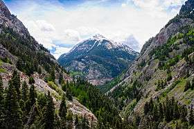
Gallery
 Mount Elbert in the Sawatch Range of Colorado is the highest peak of the Rocky Mountains.
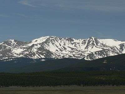 Mount Massive in the Sawatch Range is the second highest peak of the Rocky Mountains.
_-_2006-07-16.jpg) Mount Harvard is the highest of the Collegiate Peaks and the third highest peak of the Rocky Mountains.
Mount Harvard is the highest of the Collegiate Peaks and the third highest peak of the Rocky Mountains.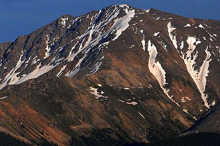 La Plata Peak in the Collegiate Peaks is the fifth highest peak of the Rocky Mountains.
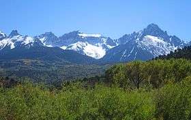
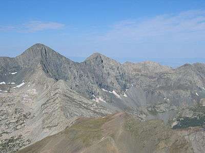 Blanca Peak is the highest peak of the Sangre de Cristo Mountains and the second most topographically isolated peak of the Southern Rocky Mountains.
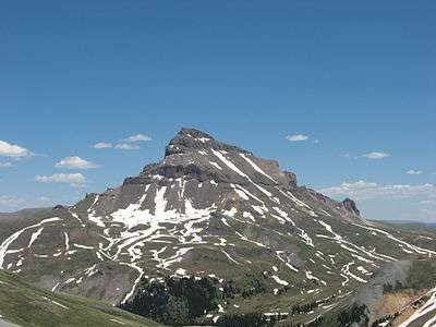 Uncompahgre Peak is the highest peak of the San Juan Mountains and the sixth highest peak of the Rocky Mountains.
 Crestone Peak is the highest peak of the Crestones and the seventh highest peak of the Rocky Mountains.
 Mount Lincoln is the highest peak of the Mosquito Range and the eighth highest peak of the Rocky Mountains.
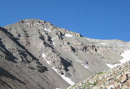 Castle Peak is the highest peak of the Elk Mountains and the ninth highest peak of the Rocky Mountains.
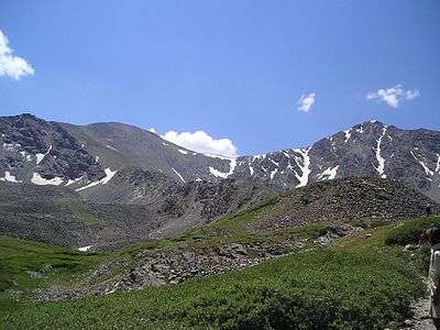 Grays Peak is the highest peak of the Front Range and the tenth highest peak of the Rocky Mountains.
 Pikes Peak is the second most topographically prominent mountain peak of the Southern Rocky Mountains.
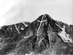 This photograph of the legendary Mount of the Holy Cross was taken by William Henry Jackson in 1874.
 Wheeler Peak in the Taos Mountains is the highest point of the State of New Mexico.
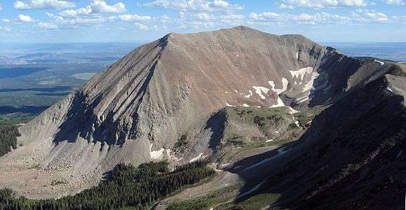 Mount Peale in the La Sal Mountains dominates east-central Utah.
 Medicine Bow Peak in the Snowy Range is the highest point of both southern and eastern Wyoming.
See also
References
- ↑ "Sawatch Range". Mountain Ranges of the World. peakbagger.com. Retrieved March 9, 2012.
- ↑ Sawatch is pronounced /səˈwætʃ/. This name comes from a Ute language word meaning "blue earth" or "water at blue earth". The Spanish language version of this name is usually spelled Saguache, while the English language version is usually spelled Sawatch
- ↑ "Elbert Massif". Mountain Ranges of the World. peakbagger.com. Retrieved March 9, 2012.
- 1 2 3 4 5 The summit of Mount Elbert is the highest point of the Rocky Mountains and the State of Colorado.
- 1 2 3 4 5 "Mount Elbert". Datasheet for NGS Station KL0637. United States National Geodetic Survey. Retrieved March 13, 2012.
- 1 2 3 4 5 The elevation of Mount Elbert includes an adjustment of +1.995 m (+6.55 ft) from NGVD 29 to NAVD 88.
- 1 2 3 4 5 "Mount Elbert". Peakbagger.com. Retrieved March 13, 2012.
- ↑ "Massive Massif". Mountain Ranges of the World. peakbagger.com. Retrieved March 9, 2012.
- 1 2 Mount Massive the second highest peak of the Rocky Mountains.
- 1 2 "Mount Massive". Datasheet for NGS Station KL0640. United States National Geodetic Survey. Retrieved March 13, 2012.
- 1 2 The elevation of Mount Massive includes an adjustment of +2.086 m (+6.84 ft) from NGVD 29 to NAVD 88.
- 1 2 "Mount Massive". Peakbagger.com. Retrieved March 13, 2012.
- ↑ "Collegiate Peaks". Mountain Ranges of the World. peakbagger.com. Retrieved March 9, 2012.
- 1 2 3 The summit of Mount Harvard is the highest point of the Collegiate Peaks.
- 1 2 3 "Mount Harvard". Datasheet for NGS Station JL0879. United States National Geodetic Survey. Retrieved March 13, 2012.
- 1 2 3 The elevation of Mount Harvard includes an adjustment of +2.084 m (+6.84 ft) from NGVD 29 to NAVD 88.
- 1 2 3 "Mount Harvard". Peakbagger.com. Retrieved March 13, 2012.
- ↑ "Williams Mountains". Mountain Ranges of the World. peakbagger.com. Retrieved March 16, 2013.
- 1 2 The summit of Bill Williams Peak is the highest point of the Williams Mountains.
- 1 2 The elevation of Bill Williams Peak includes an adjustment of +2.044 m (+6.71 ft) from NGVD 29 to NAVD 88.
- 1 2 "Bill Williams Peak". Peakbagger.com. Retrieved March 16, 2013.
- ↑ "Southern Sawatch Range". Mountain Ranges of the World. peakbagger.com. Retrieved March 9, 2012.
- 1 2 The summit of Mount Antero is the highest point of the southern Sawatch Range.
- 1 2 "Mount Antero". Datasheet for NGS Station JL0883. United States National Geodetic Survey. Retrieved March 13, 2012.
- 1 2 The elevation of Mount Antero includes an adjustment of +2.072 m (+6.80 ft) from NGVD 29 to NAVD 88.
- 1 2 "Mount Antero". Peakbagger.com. Retrieved March 13, 2012.
- ↑ "Far Southern Sawatch Range". Mountain Ranges of the World. peakbagger.com. Retrieved March 9, 2012.
- 1 2 The summit of Mount Ouray is the highest point of the far southern Sawatch Range.
- 1 2 "Mount Ouray". Datasheet for NGS Station JL0672. United States National Geodetic Survey. Retrieved March 13, 2012.
- 1 2 The elevation of Mount Ouray includes an adjustment of +1.871 m (+6.14 ft) from NGVD 29 to NAVD 88.
- 1 2 "Mount Ouray". Peakbagger.com. Retrieved March 13, 2012.
- ↑ "Northern Sawatch Range". Mountain Ranges of the World. peakbagger.com. Retrieved March 9, 2012.
- 1 2 The summit of Mount of the Holy Cross is the highest point of the northern Sawatch Range.
- 1 2 "Mount of the Holy Cross". Datasheet for NGS Station KL0649. United States National Geodetic Survey. Retrieved March 13, 2012.
- 1 2 The summit elevation of Mount of the Holy Cross includes a vertical offset of +0.6 m (+2.0 ft) from the station benchmark.
- 1 2 The elevation of Mount of the Holy Cross includes an adjustment of +1.927 m (+6.32 ft) from NGVD 29 to NAVD 88.
- 1 2 "Mount of the Holy Cross". Peakbagger.com. Retrieved March 13, 2012.
- ↑ "Sangre de Cristo Mountains". Mountain Ranges of the World. peakbagger.com. Retrieved March 9, 2012.
- ↑ "Sierra Blanca Massif". Mountain Ranges of the World. peakbagger.com. Retrieved March 9, 2012.
- 1 2 3 4 5 The summit of Blanca Peak is the highest point of the Sierra Blanca Massif and the Sangre de Cristo Range.
- 1 2 3 4 5 The elevation of Blanca Peak includes an adjustment of +1.755 m (+5.76 ft) from NGVD 29 to NAVD 88.
- 1 2 3 4 5 "Blanca Peak". Peakbagger.com. Retrieved March 13, 2012.
- ↑ "Northern Sangre de Cristo Range". Mountain Ranges of the World. peakbagger.com. Retrieved March 9, 2012.
- ↑ "Crestones". Mountain Ranges of the World. peakbagger.com. Retrieved March 9, 2012.
- 1 2 The summit of Crestone Peak is the highest point of the northern Sangre de Cristo Range.
- 1 2 The elevation of Crestone Peak includes an adjustment of +1.76 m (+5.77 ft) from NGVD 29 to NAVD 88.
- 1 2 "Crestone Peak". Peakbagger.com. Retrieved March 13, 2012.
- ↑ The elevation of Rito Alto Peak includes an adjustment of +1.808 m (+5.93 ft) from NGVD 29 to NAVD 88.
- ↑ "Rito Alto Peak". Peakbagger.com. Retrieved March 13, 2012.
- ↑ "Culebra Range". Mountain Ranges of the World. peakbagger.com. Retrieved March 9, 2012.
- 1 2 3 The summit of Culebra Peak is the highest point of the Culebra Range.
- 1 2 3 The elevation of Culebra Peak includes an adjustment of +1.74 m (+5.71 ft) from NGVD 29 to NAVD 88.
- 1 2 3 "Culebra Peak". Peakbagger.com. Retrieved March 13, 2012.
- ↑ "Spanish Peaks". Mountain Ranges of the World. peakbagger.com. Retrieved March 9, 2012.
- 1 2 The summit of West Spanish Peak is the highest point of the Spanish Peaks and the easternmost 4000 meter (13,123-foot) summit of the United States.
- 1 2 3 The elevation of West Spanish Peak includes an adjustment of +1.468 m (+4.82 ft) from NGVD 29 to NAVD 88.
- 1 2 3 "West Spanish Peak". Peakbagger.com. Retrieved March 13, 2012.
- ↑ "Taos Mountains". Mountain Ranges of the World. peakbagger.com. Retrieved March 9, 2012.
- 1 2 3 The summit of Wheeler Peak is the highest point of the Taos Mountains and the State of New Mexico.
- 1 2 3 "Wheeler Peak". Datasheet for NGS Station GM0779. United States National Geodetic Survey. Retrieved March 13, 2012.
- 1 2 3 The elevation of Wheeler Peak includes an adjustment of +1.631 m (+5.35 ft) from NGVD 29 to NAVD 88.
- 1 2 3 "Wheeler Peak". Peakbagger.com. Retrieved March 13, 2012.
- ↑ "Santa Fe Mountains". Mountain Ranges of the World. peakbagger.com. Retrieved March 9, 2012.
- 1 2 The summit of Truchas Peak is the highest point of the Santa Fe Mountains.
- 1 2 "Truchas Peak". Datasheet for NGS Station FN0666. United States National Geodetic Survey. Retrieved March 13, 2012.
- 1 2 The elevation of Truchas Peak includes an adjustment of +1.478 m (+4.85 ft) from NGVD 29 to NAVD 88.
- 1 2 "Truchas Peak". Peakbagger.com. Retrieved March 13, 2012.
- ↑ "Cimarron Range". Mountain Ranges of the World. peakbagger.com. Retrieved March 9, 2012.
- ↑ The summit of Baldy Mountain is the highest point of the Cimarron Range.
- ↑ "Baldy Mountain". Datasheet for NGS Station GM0775. United States National Geodetic Survey. Retrieved March 13, 2012.
- ↑ The elevation of Baldy Mountain includes an adjustment of +1.383 m (+4.54 ft) from NGVD 29 to NAVD 88.
- ↑ "Baldy Mountain". Peakbagger.com. Retrieved March 13, 2012.
- ↑ "Wet Mountains". Mountain Ranges of the World. peakbagger.com. Retrieved March 9, 2012.
- ↑ The summit of Greenhorn Mountain is the highest point of the Wet Mountains.
- ↑ "Greenhorn Mountain". Datasheet for NGS Station HK0512. United States National Geodetic Survey. Retrieved March 13, 2012.
- ↑ The elevation of Greenhorn Mountain includes an adjustment of +1.401 m (+4.60 ft) from NGVD 29 to NAVD 88.
- ↑ "Greenhorn Mountain". Peakbagger.com. Retrieved March 13, 2012.
- ↑ "Southern Sangre de Cristo Range". Mountain Ranges of the World. peakbagger.com. Retrieved March 9, 2012.
- ↑ The summit of Cerro Vista is the highest point of the southern Sangre de Cristo Range.
- ↑ "Cerro Vista". Datasheet for NGS Station GM0798. United States National Geodetic Survey. Retrieved March 13, 2012.
- ↑ The elevation of Cerro Vista includes an adjustment of +1.441 m (+4.73 ft) from NGVD 29 to NAVD 88.
- ↑ "Cerro Vista". Peakbagger.com. Retrieved March 13, 2012.
- ↑ "San Juan Mountains". Mountain Ranges of the World. peakbagger.com. Retrieved March 9, 2012.
- ↑ "North Central San Juan Mountains". Mountain Ranges of the World. peakbagger.com. Retrieved March 9, 2012.
- 1 2 3 The summit of Uncompahgre Peak is the highest point of the San Juan Mountains.
- 1 2 3 "Uncompahgre Peak". Datasheet for NGS Station JL0798. United States National Geodetic Survey. Retrieved March 13, 2012.
- 1 2 3 The elevation of Uncompahgre Peak includes an adjustment of +1.967 m (+6.45 ft) from NGVD 29 to NAVD 88.
- 1 2 3 "Uncompahgre Peak". Peakbagger.com. Retrieved March 13, 2012.
- ↑ "San Miguel Mountains". Mountain Ranges of the World. peakbagger.com. Retrieved March 9, 2012.
- 1 2 3 The summit of Mount Wilson is the highest point of the San Miguel Mountains.
- 1 2 3 The elevation of Mount Wilson includes an adjustment of +1.899 m (+6.23 ft) from NGVD 29 to NAVD 88.
- 1 2 3 "Mount Wilson". Peakbagger.com. Retrieved March 13, 2012.
- ↑ "Sneffels Range". Mountain Ranges of the World. peakbagger.com. Retrieved March 9, 2012.
- 1 2 The summit of Mount Sneffels is the highest point of the Sneffels Range.
- 1 2 "Mount Sneffels". Datasheet for NGS Station JL0826. United States National Geodetic Survey. Retrieved March 13, 2012.
- 1 2 The elevation of Mount Sneffels includes an adjustment of +1.879 m (+6.16 ft) from NGVD 29 to NAVD 88.
- 1 2 "Mount Sneffels". Peakbagger.com. Retrieved March 13, 2012.
- ↑ "Needle Mountains". Mountain Ranges of the World. peakbagger.com. Retrieved March 16, 2013.
- 1 2 The summit of Mount Eolus is the highest point of the Needle Mountains.
- 1 2 The elevation of Mount Eolus includes an adjustment of +1.756 m (+5.76 ft) from NGVD 29 to NAVD 88.
- 1 2 "Mount Eolus". Peakbagger.com. Retrieved March 13, 2012.
- ↑ "Grenadier Range". Mountain Ranges of the World. peakbagger.com. Retrieved March 9, 2012.
- ↑ The summit of Vestal Peak is the highest point of the Grenadier Range.
- ↑ The elevation of Vestal Peak includes an adjustment of +1.781 m (+5.84 ft) from NGVD 29 to NAVD 88.
- ↑ "Vestal Peak". Peakbagger.com. Retrieved March 13, 2012.
- ↑ "West Needle Mountains". Mountain Ranges of the World. peakbagger.com. Retrieved March 9, 2012.
- 1 2 The summit of Twilight Peak is the highest point of the West Needle Mountains.
- 1 2 The elevation of Twilight Peak includes an adjustment of +1.537 m (+5.04 ft) from NGVD 29 to NAVD 88.
- 1 2 "Twilight Peak". Peakbagger.com. Retrieved March 13, 2012.
- ↑ "La Garita Mountains". Mountain Ranges of the World. peakbagger.com. Retrieved March 9, 2012.
- 1 2 The summit of San Luis Peak is the highest point of the La Garita Mountains.
- 1 2 "San Luis Peak". Datasheet for NGS Station HL0570. United States National Geodetic Survey. Retrieved March 13, 2012.
- 1 2 The elevation of San Luis Peak includes an adjustment of +2.098 m (+6.88 ft) from NGVD 29 to NAVD 88.
- 1 2 "San Luis Peak". Peakbagger.com. Retrieved March 13, 2012.
- ↑ "Long Branch Baldy". Datasheet for NGS Station JL0682. United States National Geodetic Survey. Retrieved March 13, 2012.
- ↑ "East Central San Juan Mountains". Mountain Ranges of the World. peakbagger.com. Retrieved March 9, 2012.
- ↑ The elevation of Half Peak includes an adjustment of +1.998 m (+6.56 ft) from NGVD 29 to NAVD 88.
- ↑ "Half Peak". Peakbagger.com. Retrieved March 13, 2012.
- ↑ "Southern San Juan Mountains". Mountain Ranges of the World. peakbagger.com. Retrieved March 9, 2012.
- 1 2 3 The summit of Summit Peak is the highest point of the southern San Juan Mountains.
- 1 2 3 "Summit Peak". Datasheet for NGS Station HL0503. United States National Geodetic Survey. Retrieved March 13, 2012.
- 1 2 3 The elevation of Summit Peak includes an adjustment of +1.877 m (+6.16 ft) from NGVD 29 to NAVD 88.
- 1 2 3 "Summit Peak". Peakbagger.com. Retrieved March 13, 2012.
- ↑ "La Plata Mountains". Mountain Ranges of the World. peakbagger.com. Retrieved March 9, 2012.
- ↑ The summit of Hesperus Mountain is the highest point of the La Plata Mountains.
- ↑ The elevation of Hesperus Mountain includes an adjustment of +1.65 m (+5.41 ft) from NGVD 29 to NAVD 88.
- ↑ "Hesperus Mountain". Peakbagger.com. Retrieved March 13, 2012.
- ↑ "Tusas Mountains". Mountain Ranges of the World. peakbagger.com. Retrieved March 9, 2012.
- ↑ The summit of Grouse Mesa is the highest point of the Tusas Mountains.
- ↑ The elevation of Grouse Mesa includes an adjustment of +1.627 m (+5.34 ft) from NGVD 29 to NAVD 88.
- ↑ "Grouse Mesa". Peakbagger.com. Retrieved March 13, 2012.
- ↑ "Mosquito Range". Mountain Ranges of the World. peakbagger.com.
- 1 2 The summit of Mount Lincoln is the highest point of the Mosquito Range.
- 1 2 "Mount Lincoln". Datasheet for NGS Station KL0627. United States National Geodetic Survey. Retrieved March 13, 2012.
- 1 2 The elevation of Mount Lincoln includes an adjustment of +2.098 m (+6.88 ft) from NGVD 29 to NAVD 88.
- 1 2 "Mount Lincoln". Peakbagger.com. Retrieved March 13, 2012.
- ↑ "Tenmile Range". Mountain Ranges of the World. peakbagger.com. Retrieved March 9, 2012.
- ↑ The summit of Quandary Peak is the highest point of the Tenmile Range.
- ↑ "Quandary Peak". Datasheet for NGS Station KL0622. United States National Geodetic Survey. Retrieved March 13, 2012.
- ↑ The elevation of Quandary Peak includes an adjustment of +2.071 m (+6.79 ft) from NGVD 29 to NAVD 88.
- ↑ "Quandary Peak". Peakbagger.com. Retrieved March 13, 2012.
- ↑ "Front Range". Mountain Ranges of the World. peakbagger.com. Retrieved March 9, 2012.
- ↑ "Central Front Range". Mountain Ranges of the World. peakbagger.com. Retrieved March 9, 2012.
- 1 2 The summit of Grays Peak is the highest point of the Front Range and the Continental Divide of North America.
- 1 2 "Grays Peak". Datasheet for NGS Station KK2036. United States National Geodetic Survey. Retrieved March 13, 2012.
- 1 2 The elevation of Grays Peak includes an adjustment of +1.881 m (+6.17 ft) from NGVD 29 to NAVD 88.
- 1 2 "Grays Peak". Peakbagger.com. Retrieved March 13, 2012.
- 1 2 "Mount Evans". Datasheet for NGS Station KK2030. United States National Geodetic Survey. Retrieved March 13, 2012.
- 1 2 The summit elevation of Mount Evans includes a vertical offset of +1.8 m (+5.9 ft) from the station benchmark.
- 1 2 The elevation of Mount Evans includes an adjustment of +1.827 m (+5.99 ft) from NGVD 29 to NAVD 88.
- 1 2 "Mount Evans". Peakbagger.com. Retrieved March 13, 2012.
- ↑ "Northern Front Range". Mountain Ranges of the World. peakbagger.com. Retrieved March 9, 2012.
- ↑ "Longs Peak Massif". Mountain Ranges of the World. peakbagger.com. Retrieved March 9, 2012.
- 1 2 3 The summit of Longs Peak is the highest point of the northern Front Range.
- 1 2 3 "Longs Peak". Datasheet for NGS Station LL1346. United States National Geodetic Survey. Retrieved March 13, 2012.
- 1 2 3 The elevation of Longs Peak includes an adjustment of +1.653 m (+5.42 ft) from NGVD 29 to NAVD 88.
- 1 2 3 "Longs Peak". Peakbagger.com. Retrieved March 13, 2012.
- ↑ "Mummy Range". Mountain Ranges of the World. peakbagger.com. Retrieved March 9, 2012.
- 1 2 The summit of Hagues Peak is the highest point of the Mummy Range.
- 1 2 "Hagues Peak". Datasheet for NGS Station LL1350. United States National Geodetic Survey. Retrieved March 13, 2012.
- 1 2 The elevation of Hagues Peak includes an adjustment of +1.719 m (+5.64 ft) from NGVD 29 to NAVD 88.
- 1 2 "Hagues Peak". Peakbagger.com. Retrieved March 13, 2012.
- ↑ "Indian Peaks". Mountain Ranges of the World. peakbagger.com. Retrieved March 9, 2012.
- 1 2 The summit of North Arapaho Peak is the highest point of the Indian Peaks.
- 1 2 "North Arapaho Peak". Datasheet for NGS Station LL1357. United States National Geodetic Survey. Retrieved March 13, 2012.
- 1 2 The elevation of North Arapaho Peak includes an adjustment of +1.762 m (+5.78 ft) from NGVD 29 to NAVD 88.
- 1 2 "North Arapaho Peak". Peakbagger.com. Retrieved March 13, 2012.
- ↑ "Never Summer Mountains". Mountain Ranges of the World. peakbagger.com. Retrieved March 9, 2012.
- ↑ The summit of Mount Richthofen is the highest point of the Never Summer Mountains.
- ↑ The elevation of Mount Richthofen includes an adjustment of +1.658 m (+5.44 ft) from NGVD 29 to NAVD 88.
- ↑ "Mount Richthofen". Peakbagger.com. Retrieved March 13, 2012.
- 1 2 3 4 The summit of Pikes Peak is the highest point of the southern Front Range.
- 1 2 3 4 5 "Pikes Peak". Datasheet for NGS Station JK1242. United States National Geodetic Survey. Retrieved March 13, 2012.
- 1 2 3 4 5 The elevation of Pikes Peak includes an adjustment of +1.68 m (+5.51 ft) from NGVD 29 to NAVD 88.
- 1 2 3 4 5 "Pikes Peak". Peakbagger.com. Retrieved March 13, 2012.
- ↑ "South Park Hills". Mountain Ranges of the World. peakbagger.com. Retrieved March 9, 2012.
- ↑ The summit of Waugh Mountain is the highest point of the South Park Hills.
- ↑ The elevation of Waugh Mountain includes an adjustment of +1.702 m (+5.58 ft) from NGVD 29 to NAVD 88.
- ↑ "Waugh Mountain". Peakbagger.com. Retrieved March 13, 2012.
- ↑ "Rampart Range". Mountain Ranges of the World. peakbagger.com. Retrieved March 9, 2012.
- ↑ The summit of Devils Head is the highest point of the Rampart Range.
- ↑ "Devils Head". Datasheet for NGS Station KK1932. United States National Geodetic Survey. Retrieved March 13, 2012.
- ↑ The elevation of Devils Head includes an adjustment of +1.239 m (+4.06 ft) from NGVD 29 to NAVD 88.
- ↑ "Devils Head". Peakbagger.com. Retrieved March 13, 2012.
- ↑ "South Williams Fork Mountains". Mountain Ranges of the World. peakbagger.com. Retrieved March 9, 2012.
- ↑ The summit of Ptarmigan Peak is the highest point of the South Williams Fork Mountains.
- ↑ The elevation of Ptarmigan Peak includes an adjustment of +1.789 m (+5.87 ft) from NGVD 29 to NAVD 88.
- ↑ "Ptarmigan Peak". Peakbagger.com. Retrieved March 13, 2012.
- ↑ "Tarryall Mountains". Mountain Ranges of the World. peakbagger.com. Retrieved March 9, 2012.
- ↑ The summit of Bison Peak is the highest point of the Tarryall Mountains.
- ↑ "Bison Peak". Datasheet for NGS Station KK1966. United States National Geodetic Survey. Retrieved March 13, 2012.
- ↑ The elevation of Bison Peak includes an adjustment of +1.624 m (+5.33 ft) from NGVD 29 to NAVD 88.
- ↑ "Bison Peak". Peakbagger.com. Retrieved March 13, 2012.
- ↑ "Kenosha Mountains". Mountain Ranges of the World. peakbagger.com. Retrieved March 9, 2012.
- ↑ The summit of Knobby Crest is the highest point of the Kenosha Mountains.
- ↑ The elevation of Knobby Crest includes an adjustment of +1.595 m (+5.23 ft) from NGVD 29 to NAVD 88.
- ↑ "Knobby Crest". Peakbagger.com. Retrieved March 13, 2012.
- ↑ "Elk Mountains". Mountain Ranges of the World. peakbagger.com. Retrieved March 9, 2012.
- 1 2 The summit of Castle Peak is the highest point of the Elk Mountains.
- 1 2 "Castle Peak". Datasheet for NGS Station KL0659. United States National Geodetic Survey. Retrieved March 13, 2012.
- 1 2 The elevation of Castle Peak includes an adjustment of +2.165 m (+7.10 ft) from NGVD 29 to NAVD 88.
- 1 2 "Castle Peak". Peakbagger.com. Retrieved March 13, 2012.
- ↑ The summit of Mount Owen is the highest point of the Ruby Range.
- ↑ "Mount Owen". Datasheet for NGS Station JL0737. United States National Geodetic Survey. Retrieved March 13, 2012.
- ↑ The elevation of Mount Owen includes an adjustment of +1.99 m (+6.53 ft) from NGVD 29 to NAVD 88.
- ↑ "Mount Owen". Peakbagger.com. Retrieved March 13, 2012.
- ↑ "West Elk Mountains". Mountain Ranges of the World. peakbagger.com. Retrieved March 9, 2012.
- ↑ The summit of West Elk Peak is the highest point of the West Elk Mountains.
- ↑ "West Elk Peak". Datasheet for NGS Station JL0755. United States National Geodetic Survey. Retrieved March 13, 2012.
- ↑ The elevation of West Elk Peak includes an adjustment of +2.105 m (+6.91 ft) from NGVD 29 to NAVD 88.
- ↑ "West Elk Peak". Peakbagger.com. Retrieved March 13, 2012.
- ↑ "Gore Range". Mountain Ranges of the World. peakbagger.com. Retrieved March 9, 2012.
- 1 2 The summit of Mount Powell is the highest point of the Gore Range.
- 1 2 The elevation of Mount Powell includes an adjustment of +1.771 m (+5.81 ft) from NGVD 29 to NAVD 88.
- 1 2 "Mount Powell". Peakbagger.com. Retrieved March 13, 2012.
- ↑ "Medicine Bow Mountains". Mountain Ranges of the World. peakbagger.com. Retrieved March 9, 2012.
- ↑ The summit of Clark Peak is the highest point of the Medicine Box Mountains.
- ↑ "Clark Peak". Datasheet for NGS Station LL1388. United States National Geodetic Survey. Retrieved March 13, 2012.
- ↑ The elevation of Clark Peak includes an adjustment of +1.628 m (+5.34 ft) from NGVD 29 to NAVD 88.
- ↑ "Clark Peak". Peakbagger.com. Retrieved March 13, 2012.
- ↑ "Snowy Range". Mountain Ranges of the World. peakbagger.com. Retrieved March 9, 2012.
- 1 2 The summit of Medicine Bow Peak is the highest point of the Snowy Range.
- 1 2 "Medicine Bow Peak". Datasheet for NGS Station MP0546. United States National Geodetic Survey. Retrieved March 13, 2012.
- 1 2 The elevation of Medicine Bow Peak includes an adjustment of +1.495 m (+4.90 ft) from NGVD 29 to NAVD 88.
- 1 2 "Medicine Bow Peak". Peakbagger.com. Retrieved March 13, 2012.
- ↑ "La Sal Mountains". Mountain Ranges of the World. peakbagger.com. Retrieved March 9, 2012.
- 1 2 The summit of Mount Peale is the highest point of the La Sal Mountains.
- 1 2 "Mount Peale". Datasheet for NGS Station JM0496. United States National Geodetic Survey. Retrieved March 13, 2012.
- 1 2 The elevation of Mount Peale includes an adjustment of +1.509 m (+4.95 ft) from NGVD 29 to NAVD 88.
- 1 2 "Mount Peale". Peakbagger.com. Retrieved March 13, 2012.
- ↑ "Flat Tops (Colorado)". Mountain Ranges of the World. peakbagger.com. Retrieved March 9, 2012.
- 1 2 The summit of Flat Top Mountain is the highest point of the Flat Tops.
- 1 2 "Flat Top Mountain". Datasheet for NGS Station LM0694. United States National Geodetic Survey. Retrieved March 13, 2012.
- 1 2 The elevation of Flat Top Mountain includes an adjustment of +1.698 m (+5.57 ft) from NGVD 29 to NAVD 88.
- 1 2 "Flat Top Mountain". Peakbagger.com. Retrieved March 13, 2012.
- ↑ "Rabbit Ears Range". Mountain Ranges of the World. peakbagger.com. Retrieved March 9, 2012.
- ↑ The summit of Parkview Mountain is the highest point of the Rabbit Ears Range.
- ↑ "Parkview Mountain". Datasheet for NGS Station LM0574. United States National Geodetic Survey. Retrieved March 13, 2012.
- ↑ The elevation of Parkview Mountain includes an adjustment of +1.589 m (+5.21 ft) from NGVD 29 to NAVD 88.
- ↑ "Parkview Mountain". Peakbagger.com. Retrieved March 13, 2012.
- ↑ "Park Range". Mountain Ranges of the World. peakbagger.com. Retrieved March 9, 2012.
- ↑ "Central Park Range". Mountain Ranges of the World. peakbagger.com. Retrieved March 9, 2012.
- 1 2 The summit of Mount Zirkel is the highest point of the Park Range.
- 1 2 The elevation of Mount Zirkel includes an adjustment of +1.632 m (+5.35 ft) from NGVD 29 to NAVD 88.
- 1 2 "Mount Zirkel". Peakbagger.com. Retrieved March 13, 2012.
- ↑ "Elkhead Mountains". Mountain Ranges of the World. peakbagger.com. Retrieved March 9, 2012.
- ↑ The summit of Sand Mountain North is the highest point of the Elkhead Mountains.
- ↑ The elevation of Sand Mountain North includes an adjustment of +1.512 m (+4.96 ft) from NGVD 29 to NAVD 88.
- ↑ "White River Plateau". Mountain Ranges of the World. peakbagger.com. Retrieved March 9, 2012.
- ↑ The summit of Blair Mountain is the highest point of the White River Plateau.
- ↑ The elevation of Blair Mountain includes an adjustment of +1.565 m (+5.13 ft) from NGVD 29 to NAVD 88.
- ↑ "Blair Mountain". Peakbagger.com. Retrieved March 13, 2012.
- ↑ "Grand Mesa". Mountain Ranges of the World. peakbagger.com. Retrieved March 9, 2012.
- ↑ The summit of Crater Peak is the highest point of Grand Mesa.
- ↑ "Crater Peak". Datasheet for NGS Station KL0706. United States National Geodetic Survey. Retrieved March 13, 2012.
- ↑ The elevation of Crater Peak includes an adjustment of +1.75 m (+5.74 ft) from NGVD 29 to NAVD 88.
- ↑ "Crater Peak". Peakbagger.com. Retrieved March 13, 2012.
- ↑ "Laramie Mountains". Mountain Ranges of the World. peakbagger.com. Retrieved March 9, 2012.
- ↑ The summit of South Bald Mountain is the highest point of the Laramie Mountains.
- ↑ "South Bald Mountain". Datasheet for NGS Station LL1377. United States National Geodetic Survey. Retrieved March 13, 2012.
- ↑ The elevation of South Bald Mountain includes an adjustment of +1.425 m (+4.68 ft) from NGVD 29 to NAVD 88.
- ↑ "South Bald Mountain". Peakbagger.com. Retrieved March 13, 2012.
- ↑ "Uncompahgre Plateau". Mountain Ranges of the World. peakbagger.com. Retrieved March 9, 2012.
- ↑ The summit of Horsefly Peak is the highest point of the Uncompahgre Plateau.
- ↑ "Horsefly Peak". Datasheet for NGS Station JL0830. United States National Geodetic Survey. Retrieved March 13, 2012.
- ↑ The elevation of Horsefly Peak includes an adjustment of +1.581 m (+5.19 ft) from NGVD 29 to NAVD 88.
- ↑ "Horsefly Peak". Peakbagger.com. Retrieved March 13, 2012.
- ↑ "Ute Mountain". Mountain Ranges of the World. peakbagger.com. Retrieved March 9, 2012.
- ↑ The summit of Ute Peak is the highest point of Ute Mountain.
- ↑ "Ute Peak". Datasheet for NGS Station HM0511. United States National Geodetic Survey. Retrieved March 13, 2012.
- ↑ The elevation of Ute Peak includes an adjustment of +1.139 m (+3.74 ft) from NGVD 29 to NAVD 88.
- ↑ "Ute Peak". Peakbagger.com. Retrieved March 13, 2012.
- ↑ "Raton Mesa". Mountain Ranges of the World. peakbagger.com. Retrieved March 9, 2012.
- 1 2 3 The summit of Fishers Peak is the highest point of Raton Mesa and the High Plains.
- 1 2 3 "Fishers Peak". Datasheet for NGS Station HK0441. United States National Geodetic Survey. Retrieved March 13, 2012.
- 1 2 3 The elevation of Fishers Peak includes an adjustment of +1.145 m (+3.76 ft) from NGVD 29 to NAVD 88.
- 1 2 3 "Fishers Peak". Peakbagger.com. Retrieved March 13, 2012.
- ↑ East Spanish Peak the easternmost 3800 meter (12,467.2-foot) summit of Northern America.
- ↑ "East Spanish Peak". Datasheet for NGS Station HK0488. United States National Geodetic Survey. Retrieved April 24, 2012.
- ↑ The elevation of East Spanish Peak includes an adjustment of +1.372 m (+4.50 ft) from NGVD 29 to NAVD 88.
- ↑ "East Spanish Peak". Peakbagger.com. Retrieved April 24, 2012.
- ↑ West Spanish Peak the easternmost 4000 meter (13,123.4-foot) summit of Northern America.
- ↑ Pikes Peak is the easternmost 14,000-foot (4267.2 m) summit of Northern America. Pikes Peak was the inspiration for the lyrics of America the Beautiful".
- ↑ The state highway up Mount Evans ends about a quarter mile (400 m) from the summit. The Mount Evans Scenic Byway is the highest paved highway in North America.
- 1 2 3 4 5 This highway is closed during the winter.
- ↑ The toll road up Pikes Peak ends at the summit of the mountain. Pikes Peak is the most visited mountain summit in North America.
- 1 2 Trail Ridge Road (U.S. Highway Route 34) crosses the Continental Divide at Milner Pass but reaches its highest point several miles northeast of the pass. Trail Ridge Road is the highest paved through highway in North America.
- 1 2 3 4 5 6 7 8 9 10 11 12 13 14 15 16 This pass lies on the Continental Divide of the Americas.
- ↑ The highest elevation in the Eisenhower Tunnel is a short distance inside the West Portal. The tunnel passes under the Continental Divide a few miles west of Loveland Pass. The Eisenhower Tunnel is the highest elevation on the Interstate Highway System of the United States.
- ↑ The high point near Warrior Mountain is the highest point on Colorado State Highway 103.
- ↑ Happy Jack Summit is the highest point on I-80.
- ↑ Raton Pass was the highest point on the historic Santa Fe Trail, and now is the highest point on I-25.
- ↑ South Pass was the highest point on the historic Oregon Trail, the Mormon Trail, and the California Trail.
External links
- National Geodetic Survey (NGS)
- United States Geological Survey (USGS)
- Rocky Mountains @ peakbagger.com
- World Mountain Encyclopedia @ peakware.com
- peaklist.org
- summitpost.org

Santa Fe (capital) | |
| Topics |
|
| Society | |
| Regions | |
| Cities | |
| Counties | |
Cheyenne (capital) | |
| Topics |
|
| Society |
|
| Regions | |
| Cities | |
| Counties | |