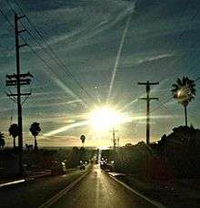
Southeast San Diego
As a geographic area, Southeast San Diego refers generally to the southeastern-most portion of the City of San Diego, and refers to those neighborhoods south of State Route 94 (Martin Luther King Jr. Freeway) and east of Downtown San Diego. There are three official community planning areas: Skyline-Paradise Hills, Encanto Neighborhoods, and Southeastern.
Largely urbanized in the areas nearer Downtown San Diego to the west[1] and characteristically hilly, with lower-density residential and semi-rural neighborhoods toward the east, it is economically and ethnically diverse.
In 1992, Councilman George Stevens campaigned against any official usage of the name "Southeast San Diego," since the designation had long been viewed as shorthand for the community as being a crime-ridden and impoverished. His campaign was successful and all official use of "Southeast San Diego" has been discontinued by the city.[2] Many residents and locals however, still refer to the area as "Southeast."
Geography
Historically, Southeast San Diego had been represented as the communities directly east of the downtown area which lies south of State Route 94 Martin Luther King Jr. Freeway, west of California State Route 125, east of Interstate 5, north of California State Route 54 and sharing its borders with surrounding cities of San Diego County National City to the south, Lemon Grove to the northeast, and Spring Valley to the east.[1]
Political boundaries
The areas southeast of downtown San Diego include portions of Council Districts 4, 8 and 9 (Encanto Neighborhoods, Skyline-Paradise Hills, and Southeastern respectively).
Neighborhoods

Skyline-Paradise Hills Planning Area[3]
- Skyline
- Paradise Hills
- South Bay Terraces
- North Bay Terraces
- Lomita
- Jamacha
Southeastern Planning Area[3]
Encanto Neighborhoods Planning Area[4]
- Oak Park
- Emerald Hills
- Chollas View
- Lincoln Park
- Alta Vista
- Valencia Park
- O'Farrell (formerly South Encanto)
- Encanto (formerly North Encanto)
- Broadway Heights
Transportation


Trains
Light rail
- San Diego Trolley: Blue Line
- Barrio Logan
- Harborside
- Pacific Fleet (NS San Diego at 32nd Street)
- San Diego Trolley: Orange Line
- Massachusetts Avenue (Lemon Grove)
- Encanto/62nd Street
- Euclid Avenue
- 47th Street
- 32nd & Commercial
- 25th & Commercial
Highways
Demographics
Southeast San Diego is widely viewed as one of the most diverse areas in the city, inhabited most visibly by Latinos, African-Americans, and Filipinos. Estimates based on the neighborhoods spanning the 92102, 92113, 92114, and 92139 ZIP codes of Southeast San Diego put the population at roughly 195,000 people over an area of 21.2 square miles (55 km2), placing the area's population density at 9,285.7/sq mi (3,565.5/km²).[5][6][7][8]
The area of Barrio Logan, for example, had been first settled by Mexicans arriving in the 1890s, followed soon after by refugees fleeing the violence of the Mexican Revolution and the poor Mexican economy between 1910 and 1920.[9] Barrio Logan is predominantly Latino and is home to Chicano Park.
Prior to "White Flight" in the 1960s and early 1970s, many neighborhoods in Southeast San Diego were subject to discriminatory restrictive covenants, a problem faced by African-Americans like former Councilman and Deputy Mayor George Stevens, who was denied the opportunity to purchase a house in the Skyline Hills from a white realtor.[2] Presently, much of the Skyline Hills, as well as other Encanto neighborhoods such as Emerald Hills, Lincoln Park, Mountain View, O'Farrell, South Encanto, and Valencia Park, have a substantial African-American population.
With the great influx of Filipino immigrants joining the United States Navy,[10] especially from the Vietnam War era on to the 1990s, many Filipinos inhabited the Southeast San Diego neighborhoods of Alta Vista, Bay Terraces, Paradise Hills, Shelltown, Skyline Hills, and Valencia Park, both for the relatively affordable housing prices and its close proximity to Naval Base San Diego.[11] During the 1980s, in the interest of urban renewal, an unused tract of land (formerly a canyon) between the Skyline and Paradise Hills neighborhoods underwent development. This tract would eventually become Bay Terraces. The notion of a new subdivision built directly triangulated in what were already considered high-crime areas repelled the great majority of home-buyers. The homes were also priced out of the range of typical residents of the area and most went unsold or, in some cases, unbuilt. Federal subsidies and economic programs were then employed to assist in completing and populating the subdivision. As a result, military personnel, Filipino immigrants with military ties, and low-income families were able to secure loans to buy the new homes in the area. The federally funded recovery project was only marginally successful, however, as several large portions of the development stood partially constructed and abandoned for nearly twenty years, the most noticeable example at the intersection of Skyline Dr. and Woodman Ave.
Additionally, enlisted military personnel (ranks E-1 to E-6) and their families occupy the Bayview Hills, a sprawling military housing complex operated by Lincoln Military Housing. This community of townhouse-style homes occupy a significant tract north of Paradise Hills adjacent to National City.[12]
Demographics from Samuel F. B. Morse High School in the Skyline neighborhood alone provides a snapshot sample of the area's diversity with the school's 3,000 students characterized by a slim plurality of the students as Filipino (35%), followed by Hispanic-Latino (34%), Black (21%), and non-Hispanic White (4.0%).[13] The latter statistic is most telling considering that as of 2000, US Census data indicates that non-Hispanic Whites alone represent 49.36% of the population of the City of San Diego.[14] Additionally, roughly 63% of the student body is eligible for Free or Reduced-Price Lunch,[15] a figure that reflects the working-class nature of the area.
Image
Southeast San Diego had long struggled with an image problem plagued by street gangs, drug dealing, assaults, and homicide throughout its communities.[16] In 1992, Councilman George Stevens campaigned against any official designation of the area as "Southeast San Diego" since the name labeled the area in an entirely negative light.[2]
The San Diego Police Department's Southeastern Division includes some of the city's peak crime areas including the neighborhoods of Encanto, Paradise Hills, Lincoln Park, Chollas View, Skyline, Shelltown, and Southcrest.[16] Many of the inhabitants in these neighborhoods are working class or lower-income, and a typical sight that is evident throughout Southeast San Diego are homes outfitted with iron bars over the ground-floor windows and doors, and in many cases, cast-iron gates and chain-link fences guarding driveways, a reflection of the perceived need for security in these high-crime urban neighborhoods.[16]
Although crime has gone down citywide, shootings are still a regular occurrence throughout Southeast San Diego, and the area routinely has a disproportionate amount of homicides in relation to the rest of the city.[17] Additionally, many crimes in the area are not reported to the police[17] which makes it difficult to give a completely accurate assessment on crime statistics in Southeast San Diego. Over the last few years, statistics from the San Diego Police Department show that about half of all homicides in the whole city had been accounted for in southeastern San Diego neighborhoods (covered by both the Central and Southeastern Districts), a substantial figure considering Southeast San Diego's relatively small geographic size and population in relation to the rest of the city.[18] For example, in 2004, of the 62 homicides in the City of San Diego, 32 of them (roughly 16.4 murders per 100,000 residents or three times the national average of 5.5 murders per 100,000 for that year)[19] had been accounted for in sixteen southeastern San Diego neighborhoods, from Barrio Logan to Lomita Village.[20] In comparison, the northern San Diego suburb of Mira Mesa, which covers a substantial geographical area sizeable to Southeast San Diego's, 21.4 square miles (55 km2) to Southeast San Diego's 21.2 square miles (55 km2),[21][22][23] had no homicides for that year.[20]
The rash of violence in Southeast San Diego had been met with community outrage over the years and prompted a series of anti-violence marches and rallies. More recently in 2005, as a response to the spike in violence in the area, hundreds of middle school students took part in an anti-violence rally from the Lincoln Park area to Gompers Park in Chollas View, echoing chants of "Peace in Southeast" as they marched.[24]
In 2010, the Southeast San Diego neighborhoods of Logan Heights and Lincoln Park were featured on The History Channel's Gangland television series.[25][26] The show documented the Logan Heights Gang in the Season 6 episode titled "The Assassins," which first aired on February 19, 2010.[27] Less than three months later, the Lincoln Park Bloods were featured on the Season 7 episode titled, "Vendetta of Blood" which first aired on May 14, 2010.[28]
Landmarks

- Chicano Park (Barrio Logan)
- Coronado Bridge (Barrio Logan)
- Elementary Institute of Science (Emerald Hills)
- Malcolm X Library and Performing Arts Center (Valencia Park)
- Terra Nova Garden at Morse High School (Skyline Hills)
- Tubman-Chavez Multicultural Center (Valencia Park)
- Walls of Excellence (Lincoln Park)
- Writerz Blok (Chollas View)
Education
The San Diego Unified School District oversees all public elementary, middle, junior and senior high schools in Southeast San Diego.[29]
Elementary schools
- Audubon Elementary
- Balboa Elementary
- Baker Elementary
- Bethune Elementary
- Boone Elementary
- Burbank Elementary
- Cesar Chavez Elementary
- Emerson/Bandini Elementary
- Encanto Elementary
- Freese Elementary
- Fulton Elementary
- Horton Elementary
- Johnson Elementary
- John F. Kennedy Elementary
- Knox Elementary
- Robert E. Lee Elementary
- Logan Elementary
- Mt. Erie Christian Academy (Private)
- Nye Elementary
- Oliver Hazard Perry Elementary
- Paradise Hills Elementary
- Penn Elementary
- Perkins Elementary
- Porter Elementary
- Rodriguez Elementary
- Valencia Park Elementary
- Webster Elementary
- Zamorano Elementary
Middle and junior high schools
- Bell Junior High School
- Keiller Leadership Academy (Middle School)
- KIPP Adelante Preparatory Academy (Middle School)
- Memorial Academy of Learning and Technology (Middle School)
- Millennial Tech Middle School
Senior high schools
The Southeast San Diego area is served primarily by three urban senior high schools.
- Abraham Lincoln High School
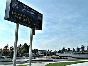
- Samuel F. B. Morse High School
- San Diego High School (in Downtown San Diego)
Through the District's Voluntary Enrollment Exchange Program (VEEP), students from the Southeast San Diego community may be bused to high schools in San Diego's more affluent northern suburban neighborhoods,[30] namely Mira Mesa High School, Mission Bay High School, Scripps Ranch High School, Serra High School, and University City High School.[31]
Atypical and other charter schools
- Gompers Preparatory Academy (grades 6-12)
- Holly Drive Leadership
- King/Chavez Preparatory Academy
- Marcy School
- Nubia Leadership Academy
- O'Farrell Community School
- San Diego School of Creative and Performing Arts
- Twain High School (Morse Campus)
People from Southeast San Diego
Artists
- Yolanda M. Lopez, artist (Logan Heights)
- Salvador Torres, artist and muralist, Chicano Park (Barrio Logan)[32]
Athletes
- Eric Allen, football, (Southcrest, O'Farrell Junior High School)[33]
- Marcus Allen, football, 1981 Heisman Trophy winner (Lincoln High School)[34]
- Tommy Bennett, football (Morse High School)
- Marcus Brady, football (Morse High School)
- Reggie Bush, football, 2005 Heisman Trophy winner (Skyline Hills)[35]
- Rashard Cook, football (Morse High School)
- Terrell Davis, football (Morse and Lincoln High School)[36]
- Tony Drake, pro wrestling[37]
- David Dunn, football (Morse High School)
- Lonnie Ford, football (Morse High School)
- Monique Henderson, track and field, 2004 and 2008 Olympic Gold Medalist, 4 × 400 m relay (Morse High School)[38][39]
- Wally Henry, football (Lincoln High School) NFL Pro Bowler Philadelphia Eagles
- Sam Horn, baseball (Morse High School)[40][41][42]
- Adam Jones, baseball (Morse High School)[43]
- Jacque Jones, baseball (San Diego High School)
- Lincoln Kennedy, football (Skyline Hills, Morse High School)
- Cliff Levingston, basketball (Morse High School)[44] (Keith MaGee), football, basketball, baseball. (Morse High School)
- Dominic McGuire, basketball (Lincoln High School)
- Mark McLemore, baseball (Morse High School)[40][41]
- Keith Mitchell, baseball (Lincoln High School) Seattle Mariners, cousin of Kevin Mitchell
- Kevin Mitchell, baseball (Mountain View), cousin of Keith Mitchell
- Archie Moore, boxing (Stockton)
- Arnie Robinson, track and field, 1972 Olympic Bronze Medalist and 1976 Olympic Gold Medalist, long jump (Morse High School)[45]
- Rashaan Salaam, football, 1994 Heisman Trophy winner[46]
- Akili Smith, football (Lincoln High School)
- Marcus Smith, football (Morse High School)
Criminals
- David Barron, Mexican Mafia figure and enforcer for the Tijuana Cartel (Logan Heights)
Musical and performance artists
- Nick Cannon, rapper, actor, comedian (Grant Hill and Lincoln Park)[47][48]
- Andra Day, singer (Valencia Park and San Diego School of Creative and Performing Arts)[49]
- Jayo Felony, rapper (Chollas View, Gompers Secondary High School)
- Lecrae, rapper (Skyline Hills)[50]
- Ananda Lewis, model, television personality (San Diego School of Creative and Performing Arts)
- Faizon Love, actor (Emerald Hills)
- Mitchy Slick, rapper (Lincoln Park, Lincoln High School)
- Members of the rock band My American Heart (Morse High School)
- Rafael Reyes, creator of the Cholo Goth genre (Grant Hill)
- Tiny Doo, rapper (Lincoln Park)
Political figures
- Shirley Horton, California Assemblywoman and former Mayor of Chula Vista (Paradise Hills, O'Farrell Junior High School)[51]
- Fabian Núñez, former Speaker of the California State Assembly (Logan Heights, San Diego High School)[52]
- Tony Young, former San Diego City Council member (Morse High School)
Distinguished military veterans
- Marine Sergeant Rafael Peralta, USMC, casualty Iraq War (Morse High School)[53]
References
- 1 2 "Southeastern San Diego Community Profile". Retrieved 2007-11-17.
- 1 2 3 "George Stevens 1932–2006 11 years a councilman, always a fighter". Retrieved 2007-11-17.
- 1 2 "City of San Diego Southeastern Map". Archived from the original on 2007-10-31. Retrieved 2007-11-17.
- ↑ http://www.sandiego.gov/planning/community/profiles/encanto/index.shtml
- ↑ "92102 Zip Code Detailed Profile". Retrieved 2007-11-22.
- ↑ "92113 Zip Code Detailed Profile". Retrieved 2007-11-22.
- ↑ "92114 Zip Code Detailed Profile". Retrieved 2007-11-22.
- ↑ "92139 Zip Code Detailed Profile". Retrieved 2007-11-22.
- ↑ "Barrio Logan". Retrieved 2007-11-17.
- ↑ "Journal of San Diego History". Retrieved 2007-11-17.
- ↑ "San Diego Reader - Their Own Paradise". Retrieved 2011-07-23.
- ↑ "Lincoln Military - San Diego - Bayview Hills". Retrieved 2007-11-18.
- ↑ "2006-07 Selected School Level Data for Morse High School". Retrieved 2007-11-17.
- ↑ "San Diego (city) QuickFacts from the US Census Bureau". Retrieved 2007-11-17.
- ↑ "greatschools.net". Retrieved 2007-11-17.
- 1 2 3 "On the street. Fighting crime in some of San Diego's toughest neighborhoods". Retrieved 2007-11-22.
- 1 2 "Taking a stand against violence, Shootings prompt call for residents to unite". Retrieved 2007-11-22.
- ↑ "Crime Statistics/Maps, Police Department". Retrieved 2007-11-22.
- ↑ "Bureau of Justice Statistics Homicide Trends in the United States". Archived from the original on 2008-04-13. Retrieved 2008-04-20.
- 1 2 "City of San Diego Actual Crimes January to December 2004" (PDF). Retrieved 2007-11-22.
- ↑ "92126 Zip Code Detailed Profile". Retrieved 2007-11-22.
- ↑ "City of San Diego Neighborhoods Map". Retrieved 2007-11-22.
- ↑ "City of San Diego Northeastern Neighborhoods Map". Archived from the original on 2007-10-31. Retrieved 2007-11-22.
- ↑ "Middle school students walk a mile for peace". Retrieved 2007-11-22.
- ↑ "Gangland episode guide". Retrieved 2011-07-21.
- ↑ "Gangland episode guide". Retrieved 2011-07-21.
- ↑ "Gangland: The Assassins". Retrieved 2011-07-21.
- ↑ "Gangland: The Assassins". Retrieved 2011-07-21.
- ↑ "San Diego Unified School District School List". Retrieved 2016-02-15.
- ↑ "VEEP Information". Retrieved 2007-11-17.
- ↑ "2007–2008 VEEP Allied Patterns" (PDF). Retrieved 2007-11-17.
- ↑ "Salvador Roberto Torres". Retrieved 2008-02-19.
- ↑ "S.D. Hall latest to enshrine Eric Allen". San Diego Union-Tribune. Retrieved 2009-02-20.
- ↑ "Special Feature on Lincoln High School's History". San Diego Union-Tribune. Retrieved 2007-11-17.
- ↑ ""Greatness suits him - Trophy hopeful Bush from humble beginnings, tries to stay that way" from the San Diego Union-Tribune". 2005-12-08. Retrieved 2007-11-17.
- ↑ Stewart, Mark. Terrell Davis: Toughing It Out. Retrieved 2007-11-17.
- ↑ "Wrestler Profile, Babi Slymm".
- ↑ "United States Olympic Committee - Henderson, Monique". United States Olympic Committee. Archived from the original on 2007-09-30. Retrieved 2007-08-23.
- ↑ "Olympic Roundup - Saturday, August 23, 2008 Monique Henderson won her second career Olympic gold.". UCLA Bruins. Retrieved 2009-02-20.
- 1 2 "The Baseball Cube". Archived from the original on 2007-09-29. Retrieved 2007-08-22.
- 1 2 "Samuel F.B. Morse High School Yearbook 1982-San Diego California". Retrieved 2007-08-22.
- ↑ "SoSH Wiki". 2006-09-21. Retrieved 2007-08-22.
- ↑ "The Official Site of The Seattle Mariners". MLB. Retrieved 2007-08-22.
- ↑ "San Diego Hall of Champions Breitbard Hall of Fame Nominees". Archived from the original on 2007-08-07. Retrieved 2007-10-02.
- ↑ Fikes, Jr., Robert. "The Black in Crimson and Black: A History and Profiles of African Americans at SDSU" (PDF). Archived from the original (PDF) on May 14, 2008. Retrieved 2007-08-23.
- ↑ Moran, Malcolm (1994-12-11). "COLLEGE FOOTBALL; 2,055 Reasons Why Salaam Is the Winner". New York Times. Retrieved 2008-02-24.
- ↑ "vh1.com - Rags to Riches Episode, Nick Cannon". Retrieved 2008-02-19.
- ↑ http://hiphopdx.com/news/id.28234/title.nick-cannon-describes-upbringing-in-blood-gang-neighborhood
- ↑ "Andra Day on Her First Grammy Nominations". Retrieved 2016-02-15.
- ↑ "Meet Lecrae, the Real God MC". Retrieved 2016-02-21.
- ↑ "Biography of Shirley Horton".
- ↑ Sweeney, James P. "Ex-assembly speaker Núñez looks at options for his future". San Diego Union-Tribune. Retrieved 2008-05-19.
- ↑ Rother, Caitlin. "Another tragedy for grieving family". Union-Tribune. Retrieved 2007-08-22.
External links
- City Council District 4 website
- Southeastern San Diego Community Profile
- Southeast San Diego - A Diamond in the Rough Community Website
Coordinates: 32°42′3″N 117°3′19″W / 32.70083°N 117.05528°W