Southam
| Southam | |
 Market Hill, Southam (click here for alternative view) |
|
 Southam |
|
| Population | 6,567 (2011 Census) |
|---|---|
| OS grid reference | SP4161 |
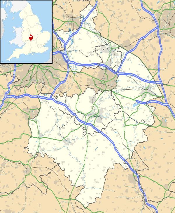
| Civil parish | Southam |
| District | Stratford-on-Avon |
| Shire county | Warwickshire |
| Region | West Midlands |
| Country | England |
| Sovereign state | United Kingdom |
| Post town | Southam |
| Postcode district | CV47 |
| Dialling code | 01926 |
| Police | Warwickshire |
| Fire | Warwickshire |
| Ambulance | West Midlands |
| EU Parliament | West Midlands |
| UK Parliament | Kenilworth and Southam |
|
|
Coordinates: 52°15′07″N 1°23′24″W / 52.252°N 1.39°W
Southam is a small market town and civil parish in the Stratford-on-Avon district of Warwickshire, England. Southam is on the River Stowe (called 'The Brook' by many locals), which flows from Napton-on-the-Hill and joins Warwickshire's River Itchen at Stoneythorpe, just outside the town. The town is about 7.5 miles (12 km) east of Leamington Spa, about 10 miles (16 km) from Rugby and Daventry, 13 miles (21 km) south of Coventry and 14 miles (23 km) north of Banbury.
The 2001 census recorded a parish population of 6,509,increasing to 6,567 at the 2011 Census.[1]
History
Southam was a Royal manor until AD 998, when Ethelred the Unready granted it to Earl Leofwine.[2] When Coventry Priory was founded in 1043, Leofwine's son Leofric, Earl of Mercia granted Southam to it.[2] The Domesday Book records the manor as "Sucham".[3] The Priory, which in the 12th century became the first Coventry Cathedral, kept Southam until the 16th century when it surrendered all its estates to the Crown in the Dissolution of the Monasteries.[3] The current Manor House is Grade II * listed and dates from the early 17th century.
The present parish church of St James was built in the 14th century.[2][4][5] In the 15th century the spire was added[4] and the chancel was rebuilt.[5] The nave's clerestory and present roof were added in the 16th century, along with the present west door.[5] St James' is a Grade I listed building.[5]
In the medieval era the town minted its own local currency because local people found regular English currency too high in value for everyday use. In the English Civil War Charles I used Southam's mint to make new coins to pay his troops. The building is early 16th century[6] and is now the Old Mint public house.[4]
Southam's Holy Well, in the picturesque Stowe river valley, is a Grade II listed building and scheduled Ancient Monument, and was first recorded in the year 998.[7] The Well was used in medieval times by local monks and for hundreds of years as the town's principal water supply. Water from a natural mineral spring feeds the semi-circular Well and pours through the mouths of carved stone gargoyles into the river. The water from the Well was said to cure eye complaints. The Holy Well and paths were renovated in 2007 using a National Lottery grant including wheelchair access and oak seats designed by artist Will Glanfield as part of his Southam Stories project, and fall within the unspoilt Stowe valley Area of Restraint as a protected landscape of special significance and value to the town.
In the 1540s John Leland visited the town and described it as "a modest market town of a single street".[3] William Shakespeare mentions Southam in Henry VI, part 3, Act V, Scene I, Lines 10–16:
WARWICK
Say, Somerville, what says my loving son?
And, by thy guess, how nigh is Clarence now?
SOMERSETAt Southam I did leave him with his forces,
And do expect him here some two hours hence.
WARWICKThen Clarence is at hand, I hear his drum.
SOMERSETIt is not his, my lord; here Southam lies:
The drum your honour hears marcheth from Warwick.
Charles I passed through Southam just before the outbreak of the Civil War and apparently was not made welcome by the townsfolk, who refused to ring the parish church bells.[3] On 23 August 1642, the day after King Charles 1st formally declared war on Parliament, a skirmish was fought outside the town between Parliamentary forces led by Lord Brooke and Royalist forces commanded by the Earl of Northampton. The Battle of Southam is claimed by locals to have been the first battle of the English Civil Wars. Later that year, Charles stayed in Southam before the Battle of Edgehill on 23 October 1642.[3] In 1645 Oliver Cromwell and 7,000 Parliamentary troops stayed in the town.[8]
In the stagecoach era Southam became an important stop on the coach road between Coventry and Oxford. Many old coaching inns remain in the town.[3] However, few buildings in Southam date from before 1741, when a large fire devastated the town.[3]
Southam was never on a railway. The Great Western Railway had absorbed the Birmingham and Oxford Junction Railway in 1848, and when the GWR line to Birmingham opened in 1852 Southam had a station 3 miles (5 km) to the south-west, named Southam Road and Harbury. British Railways (BR) closed the station to goods in 1963 and passengers in 1964. The line is now part of the London Marylebone to Birmingham Chiltern Line.
The London and North Western Railway completed its Weedon to Marton Junction Line in 1895 and opened Southam and Long Itchington station on it 2 miles (3 km) north of Southam. British Railways closed the station to passengers in 1958 and goods in 1965.
Southam was the seat of Southam Rural District from 1894 until 1974, when under the Local Government Act 1972 it was made part of Stratford-on-Avon District.
Southam was in the parliamentary constituency of Stratford-on-Avon until the boundary changes approved by Parliament in June 2007 when it became part of the new constituency of Kenilworth and Southam. The constituency was first contested in the United Kingdom general election, 2010.
RAF Southam, about 0.6 miles (1 km) east of the town, was a World War II airfield. It was opened in 1940 and closed at the end of 1944. It was a training base and a relief landing ground.
Southam's history is commemorated in Southam's Cardall Collection.
Historic population
| Year | Population |
|---|---|
| 1801 | 900 |
| 1911 | 1,804[2] |
| 1971 | 4,435 |
| 1991 | 5,304 |
| 2001 | 6,509[9] |
| 2011 | 6,499 |
Economy
The dominant rock type for the area is Blue Lias clay. Until recently there was a cement factory and associated quarry 1 mile (1.6 km) north of the town. The works was served by both rail and canal transport — the latter being a short arm from the Grand Union Canal. Cement production was relocated to Rugby in the late 1990s but quarrying at the site continues.
South of the town is an industrial estate that is a significant source of local employment. Europe's largest privately owned computer games company, Codemasters, was founded by two locals and is based nearby. A Polo Club is also located just outside Southam on the Leamington Road.
Southam has become a commuter town due to its road links and location. Taxi and minicab firms operate in the area and frequent bus services serve Southam and local villages.
Facilities
Education
Southam has three primary schools and a secondary school (Southam College) that has about 1,400 pupils from Southam and local villages. There is a leisure centre with swimming pool and gym next to the school.
Shopping
The main shopping street runs through the centre of town. Each Tuesday there is a small but popular market on the upper part of the town centre's Wood Street car park. Market Hill has a farmers' market on the second Saturday of each month. There is a range of shops in the town centre, including a Co-Op supermarket, a small independent supermarket - Acorn Stores, a post office, a newsagent, an optician, a pharmacy, a hardware store and undertaker, a carpet shop, a stationery and print shop, a dry cleaner and laundry, a bridal shop, two florists, two ladies clothes shops, other small speciality and gift shops, charity shops for Acorns Hospice and Myton Hospice, and a branch of both Lloyds and HSBC banks. In Spring 2013 a branch of the Original Factory Shop opened in Oxford Street following the closure of Budgens Supermarket. A Tesco Supermarket is located on the outskirts of town, on the Kineton Road Industrial Estate.
Other
The town's pubs include the Black Dog, the Bowling Green, the Bull, the Market Tavern, the Old Mint and the Breeze Bar. There is also a CIU-affiliated Sports and Social Club in School Street. Southam town centre also has several cafes, various takeaway food outlets, a public library and information centre, several hairdressers, a beautician, two dental surgeries, a chiropodist, a bookmaker, a saddlery and professional services including solicitors, estate agents, accountants and financial advisers. The main car park in Wood Street is free of charge, and has public lavatories.
Southam also has a Retained Fire Station. The police station is now closed to the general public; for police enquiries, people should go to a public library, as long as it's open. Otherwise they should use a telephone. The main entertainment venue in the town is Grange Hall in Coventry Street, which hosts dramatic and musical performances, meetings and dance/exercise classes. The Graham Adams Centre in St James Road houses the town's Children's Centre, the Youth Centre and a community cafe. It is also home to adult education classes and is a meeting place for many of the town's youth and community groups.
Religion
There are four churches. St James's parish church is behind Market Hill. Both Our Lady and St Wulstan's Catholic church and the Congregational chapel are on Wood Street, and the new Community Church is on Coventry Street. There is also a small but active Bahá´í group in the town. The footpath from St James church along the protected Stowe valley to the historic Holy Well and on to Stoneythorpe Hall is a popular route for local people, ornithologists and other naturalists.
Sport and Recreation
Southam Rugby Club was formed in 1962. In 1969 the club purchased pitches at Kineton Road and started playing home games. Over three years money was raised to build the club house which was constructed mainly by the players and was opened in 1972. Today the club plays in the Midland League and has three senior teams and a colts team.
Southam United F.C. is the town's football club, and Southam also has a bowling club, a cricket club and the six pitch Dallas Burston Polo Club which includes conference and events facilities.
Southam has 2028 (Southam) Squadron Air Training Corps, an RAF-sponsored (Royal Air Force) youth organisation for 13- to 20-year-olds. The squadron is based in Millar House, Wattons Lane.
Parks
Southam Recreational ground locally known simply as "The Rec" is located on Park Lane, the land adjoins to the local church yard which extends to the lower part of the high street. The park its self is split in to two main parts the bottom part is just a bare field used mainly for ball games and the upper part contain various kinds of play equipment, with a separate area for very young children. The second largest park is at Toll gate Road, simply referred to as Tollgate.
Transport
Southam is between Leamington Spa and Daventry on the A425 road and between Coventry and Banbury on the A423 road. The A426 road connects it to Rugby. Southam is about 15 miles (24 km) from Stratford-upon-Avon, birthplace of William Shakespeare. About 8 miles (13 km) from Southam is the M40 motorway, though the town is surprisingly not indicated.
The nearest railway stations are Leamington Spa, Rugby and Banbury.
Notable people
- Lieutenant General Charles Allfrey, British Army commander, veteran of World War I and World War II.
- Steve Beaton, 1996 World Professional Darts Champion.
- Arthur Cox, who managed Newcastle United and Derby County football clubs between 1980 and 1993, was born at Southam in December 1939.
- Flight Lieutenant Jon Egging, former Air Cadet at 2028 Squadron Air Training Corps, Red Arrows display team pilot during 2009 and 2011 seasons.
- Trina Gulliver, nine times women's World Professional Darts Champion, who moved to Somerset in 2008.[10]
- Henry Lilley Smith (1787/88 – 1859) founded a cottage hospital, Southam Dispensary, in 1823.[2]
- Steve Walwyn, guitarist with Dr. Feelgood, was born in Southam in 1956.
- Sergeant Seth Bond (1823-1902), soldier of the 11th Hussars, survivor of the Crimean Charge of the Light Brigade of 1854.
- Adam Woodyatt, EastEnders actor, had a home in Southam for many years.
- Richard and David Darling, aka Codemasters, award-winning videogames developer company, founded in 1986 and retains its head office of several hundred employees in Southam.
See also
- Wikisource – The Third Part of King Henry the Sixth – Act V, Scene I - contains mentions of Southam.
References
- ↑ "Town population 2011". Retrieved 23 December 2015.
- 1 2 3 4 5 Salzman 1951, pp. 219–226.
- 1 2 3 4 5 6 7 Allen 2000, p. not cited.
- 1 2 3 Pevsner & Wedgwood 1966, p. 403.
- 1 2 3 4 "Church of St James". National Heritage List for England. English Heritage. Retrieved 19 October 2012.
- ↑ "The Old Mint Public House, Coventry Road". National Heritage List for England. English Heritage. Retrieved 19 October 2012.
- ↑ Patchell, P.M.; Patchell, E.M. (Winter 1986). Jordan, Kathy, ed. "The Wells of Old Warwickshire". Living Spring Journal. University of Bath. 6. Retrieved 15 March 2012.
- ↑ Warwickshire Federation of Women's Institutes (2000). The Warwickshire Village Book. Newbury: Countryside Books. ISBN 1-85306-652-4.
- ↑ "Area selected: Stratford-on-Avon (Non-Metropolitan District)". Neighbourhood Statistics. Office for National Statistics.
- ↑ "Golden Girl hits bullseye". ThisIsSomerset.co.uk. 15 January 2010. Retrieved 8 January 2011.
Sources
- Allen, Geoff (2000). Warwickshire Towns and Villages. Ammanford: Sigma Leisure. pp. not cited. ISBN 1-85058-642-X.
- Pevsner, Nikolaus; Wedgwood, Alexandra (1966). Warwickshire. The Buildings of England. Harmondsworth: Penguin Books. p. 403.
- Salzman, L.F., ed. (1951). A History of the County of Warwick, Volume 6: Knightlow hundred. Victoria County History. pp. 219–226.

| Boroughs or districts | |
|---|---|
| Major settlements | |
| Rivers | |
| Canals | |
| Topics | |