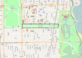
South Side, Chicago
| South Side | |
|---|---|
| District | |
|
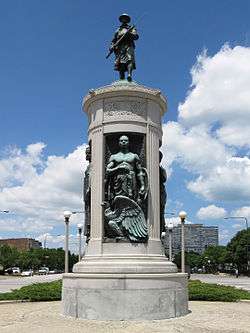
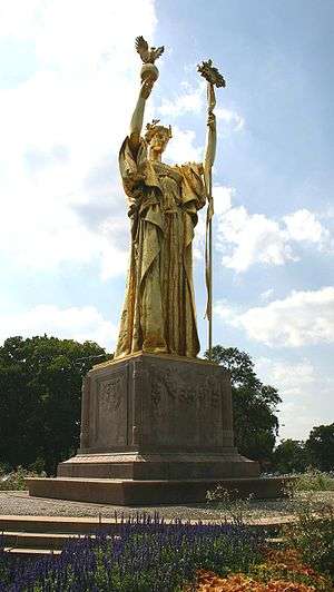
The Victory Monument, which is listed on the National Register of Historic Places, is located in the Black Metropolis-Bronzeville District near the starting point of the Bud Billiken Parade | |
| Coordinates: 41°52′02″N 87°37′18″W / 41.8671°N 87.6216°WCoordinates: 41°52′02″N 87°37′18″W / 41.8671°N 87.6216°W | |
| Country | USA |
| State | Illinois |
| County | Cook County |
| City | Chicago |
| Time zone | CST (UTC−06:00) |
| • Summer (DST) | CDT (UTC−05:00) |
The South Side is part of the city of Chicago, Illinois. It is one of the three major parts of the city, the others being the West Side and the North Side. Much of it evolved from the city's incorporation of independent townships, such as Hyde Park.[1] The city's "sides" have historically been divided by the Chicago River and its branches.[2][3]
The South Side of Chicago was originally defined as all of the city south of the main branch of the Chicago River,[4][5] but it now excludes the Loop.[3] The South Side has a varied ethnic composition. It has great disparity in income and other demographic measures.[6] Although it has a reputation for being poor or crime-infested,[7][8] the reality is more varied. The South Side ranges from affluent to middle class to working class to impoverished.[9][10] Neighborhoods such as Armour Square, Back of the Yards, Bridgeport and Pullman host more blue collar residents, while Hyde Park, the Jackson Park Highlands District, Kenwood and Beverly feature affluent, middle and upper-middle class residents.[11]
The South Side boasts a broad array of cultural and social offerings, such as professional sports teams, landmark buildings, museums, educational institutions, medical institutions and major parts of Chicago's parks system. The South Side is served by bus and 'L' train via the Chicago Transit Authority and a number of Metra lines.[12] It has several interstate and national highways.[13]
Boundaries
There is some debate as to the South Side's boundaries. The city's address numbering system uses a grid demarcating Madison Street as the East-West axis and State Street as the North-South axis. Madison is in the middle of the Loop.[14] As a result, much of the downtown "Loop" district is south of Madison Street, but the Loop is excluded from the definition of the South Side.[3][6][15]
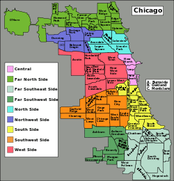
One definition has the South Side beginning at Roosevelt Road (formerly 12th Street), at the Loop's southern boundary, with the community area known as the Near South Side immediately adjacent. Another definition, taking into account that much of the Near South Side is in effect part of the commercial district extending in an unbroken line from the South Loop, locates the boundary immediately south of 18th Street, where Chinatown in the Armour Square district begins.[4]
Lake Michigan and the Indiana state line provide eastern boundaries. The southern border changed over time because of Chicago's evolving city limits; the city limits are now at 138th Street (in Riverdale and Hegewisch).[16] Using the Roosevelt Road boundary, the South Side is larger than the North and West Sides combined.
Subdivisions
The exact boundaries dividing the Southwest, South and Southeast Sides vary by source.[15] If primarily racial lines are followed, the South Side can be divided into a White and Hispanic Southwest Side, a largely Black South Side and a smaller, more racially diverse Southeast Side centered on the East Side (#52) community area and including the adjacent community areas of South Chicago (#46), South Deering (#51) and Hegewisch (#55).[17]
The differing interpretations of the boundary between the South and Southwest Sides are due to a lack of a definite natural or artificial boundary.[15] One source states that the boundary is Western Avenue or the railroad tracks adjacent to Western Avenue.[6] This border extends further south to a former railroad right of way paralleling Beverly Avenue and then Interstate 57.
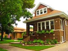
The Southwest Side of Chicago is a subsection of the South Side comprising mainly residential, predominantly white and Hispanic neighborhoods. Architecturally, the Southwest Side is distinguished by the tract of Chicago's Bungalow Belt, which runs through it.[18]
Archer Heights, a Polish enclave along Archer Avenue, which leads toward Midway Airport, is located on the Southwest Side of the city, as is Beverly-Morgan Park (#72, 75), home to a large concentration of Irish Americans.
History
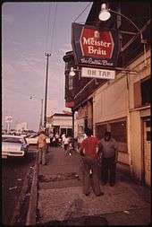
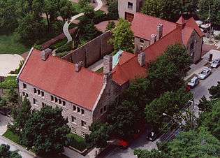
.JPG)
With its factories, steel mills and meat-packing plants, the South Side saw a sustained period of immigration which began around the 1840s and continued through World War II. Irish, Italian, Polish, Lithuanian and Yugoslav immigrants, in particular, settled in neighborhoods adjacent to industrial zones.[20]
The Illinois Constitution gave rise to townships that provided municipal services in 1850. Several settlements surrounding Chicago incorporated as townships to better serve their residents. Growth and prosperity overburdened many local government systems. In 1889, most of these townships determined that they would be better off as part of a larger city of Chicago. Lake View, Jefferson, Lake, Hyde Park Townships and the Austin portion of Cicero voted to be annexed by the city in the June 29, 1889 elections.[1][21][22]
After the Civil War freed millions of slaves, during Reconstruction black southerners migrated to Chicago and caused the black population to nearly quadruple from 4,000 to 15,000 between 1870 and 1890.[23]
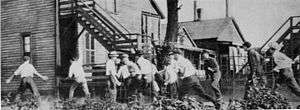
In the 20th century, the numbers expanded with the Great Migration, as blacks left the agrarian South seeking a better future in the industrial North, including the South Side. By 1910 the black population in Chicago reached 40,000, with 78% residing in the Black Belt.[23][24] Extending 30 blocks, mostly between 31st and 55th Streets,[25] along State Street, but only a few blocks wide,[23] it developed into a vibrant community dominated by black businesses, music, food and culture.[24] As more blacks moved into the South Side, descendants of earlier immigrants, such as ethnic Irish, began to move out. Later housing pressures and civic unrest caused more whites to leave the area and the city. Older residents of means moved to newer suburban housing as new migrants entered the city,[26][27] driving further demographic changes.
The South Side was racially segregated for many decades. During the 1920s and 1930s, housing cases on the South Side such as Hansberry v. Lee, 311 U.S. 32 (1940), went to the U. S. Supreme Court.[28] The case, which reset the limitations of res judicata, successfully challenged racial restrictions in the Washington Park Subdivision by reopening them for legal argument.[28] Blacks resided in Bronzeville (around 35th and State Streets) in an area called "the Black Belt". After World War II they spread across the South Side. The Black Belt, which gave a new meaning to the term ghetto, arose from discriminatory real estate practices and the threat of violence in nearby ethnic white neighborhoods.[20]
In the early 1960s,[29] during the tenure of then Mayor Richard J. Daley, the construction of the Dan Ryan Expressway created controversy. Many perceived the highway's location as an intentional physical barrier between white and black neighborhoods,[30] particularly as the Dan Ryan divided Daley's own neighborhood, the traditionally Irish Bridgeport, from Bronzeville.[31]
The economic conditions that led to migration into the South Side were not sustained. Mid-century industrial restructuring in meat packing and the steel industry cost many jobs. Blacks who became educated and achieved middle-class jobs also left after the Civil Rights Movement opened more neighborhoods to them. The South Side lost population, leaving a concentration of poor families. Many of its businesses and cultural amenities departed.
Street gangs have been prominent in some South Side neighborhoods for over a century, beginning with those of Irish immigrants, who established the first territories in a struggle against other European and black migrants. Some other neighborhoods stayed relatively safe for a big city. By the 1960s, gangs such as the Vice Lords began to improve their public image, shifting from criminal ventures to operating social programs funded by government and private grants. However, in the 1970s gangs returned to violence and the drug trade. By 2000, traditionally all-male gangs crossed gender lines to include about 20% females.[32]
Housing
By the 1930s, the city of Chicago boasted that over 25% of its residential structures were less than 10 years old, many of which were bungalows. These continued to be built in the working-class South Side into the 1960s.[33][34] Studio apartments, with Murphy beds and kitchenettes or Pullman kitchens, comprised a large part of the housing supply during and after the Great Depression, especially in the "Black Belt".[35] The South Side had a history of philanthropic subsidized housing dating back to 1919.[36]
The United States Congress passed the Housing Act of 1949 to fund public housing to improve housing for the disadvantaged. CHA produced a plan of citywide projects, which was rejected by some of the Chicago City Council's white aldermen who opposed public housing in their wards. This led to a CHA policy of construction of family housing in black residential areas, concentrated on the South and West Sides.[37]
Gentrification
Gentrification of parts of the Douglas community area has bolstered the Black Metropolis-Bronzeville District.[38] Gentrification in various parts of the South Side has displaced many black citizens.[39] The South Side offers numerous housing cooperatives. Hyde Park has several middle-income co-ops and other South Side regions have limited equity (subsidized, price-controlled) co-ops.[40] These regions experienced condominium construction and conversion in the 1970s and 1980s.[40]
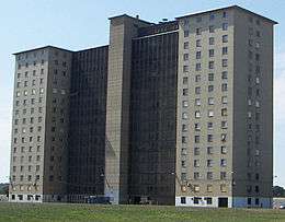
In the late 20th century the South Side had among the poorest housing conditions in the U.S., but the Chicago Housing Authority (CHA) began replacing the old high-rise public housing with mixed-income, lower-density developments, part of the city's Plan for Transformation.[41] Many of the CHA's massive public housing projects, which lined several miles of South State Street, have been demolished. Among the largest were the Robert Taylor Homes.[42]
Demographics
The South Side has a population of 752,496, of which over 93% are African American .[43] Some census tracts (4904 in Roseland, 7106 in Auburn Gresham) are 99% black.[44] The South Side covers 60% of the city's land area, with a higher ratio of single-family homes and larger sections zoned for industry than the rest of the city.
Hyde Park is home to the University of Chicago, as well as the South Side's largest Jewish population, centered on Chicago's oldest synagogue, the Chicago Landmark KAM Isaiah Israel.[45] The Southwest Side's ethnic makeup also includes the largest concentration of Górals, (Carpathian highlanders) outside of Europe; it is the location of the Polish Highlanders Alliance of North America.[46] A large Mexican-American population resides in Little Village (South Lawndale) and areas south of 99th Street.[47]
Ethnic parades
The South Side Irish Parade occurs in the Beverly neighborhood along Western Avenue each year on the Sunday before St. Patrick's Day. The parade, which was founded in 1979, was at one time said to be the largest Irish neighborhood St. Patrick's celebration in the world outside of Dublin, Ireland,[48] and was—until being scaled back in 2012—actually larger than Chicago's other St. Patrick's Day parade in the Loop. The South Side parade became such an event that it was broadcast on Chicago's CBS affiliate.[49][50] Following the 2009 parade, organizers stated the group was "not planning to stage a parade in its present form".[50] The parade was cancelled in 2010 and 2011 before being revived with more strict security and law enforcement.[51] The Bud Billiken Parade and Picnic, the second largest parade in the U.S. and the nation's largest black parade,[52] runs annually on Martin Luther King Drive between 31st and 51st Streets in the Bronzeville neighborhood, through the main portion of the South Side.
Economic development
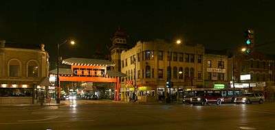
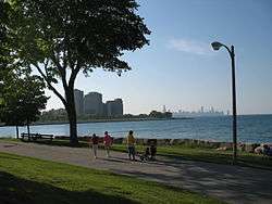
Private sector redevelopment is occurring rapidly. Neighborhood rehabilitation (and, in some cases, gentrification) can also be seen in parts of Washington Park, Woodlawn (#42) and Bronzeville, as well as in Bridgeport and McKinley Park. Historic Pullman's redevelopment is another example of a work in progress. Chinatown is located on the South Side and has seen a surge in growth. It has become an increasingly popular destination for both tourists and locals alike and is a cornerstone of the city's Chinese community. The South Side offers many outdoor amenities, such as miles of public lakefront parks and beaches, as it borders Lake Michigan on its eastern side.
Today's South Side is mostly a combination of the former Hyde Park and Lake Townships. Within these townships many had made speculative bets on future prosperity. Much of the South Side evolved from these speculative investments. Stephen A. Douglas, Paul Cornell, George Pullman and various business entities developed South Chicago real estate. The Pullman District, a former company town, Hyde Park Township, various platted communities and subdivisions were the results of such efforts.[53]
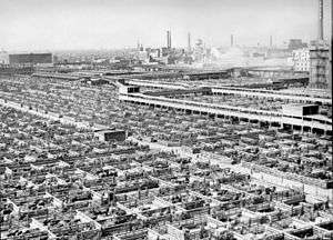
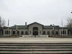
The Union Stock Yards, which were once located in the New City community area (#61), at one point employed 25,000 people and produced 82 percent of US domestic meat production.[54] They were so synonymous with the city that for over a century they were part of the lyrics of Frank Sinatra's "My Kind of Town", in the phrase: "The Union Stock Yard, Chicago is ..." The Union Stock Yard Gate marking the old entrance to stockyards was designated a Chicago Landmark on February 24, 1972,[55] and a National Historic Landmark on May 29, 1981.[56][57]
Other South Side regions have been known for great wealth, such as Prairie Avenue. 21st century redevelopment includes One Museum Park and One Museum Park West.[58]
The South Side accommodates much of the city's conference business with various convention centers. The current McCormick Place Convention Center is the largest convention center in the U.S. and the third largest in the world.[59] Previously, the South Side hosted conventions at the Chicago Coliseum and the International Amphitheatre.[6] The Ford City Mall and the surrounding shopping district includes several big-box retailers.
Political figures
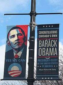
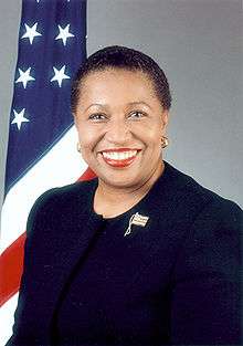
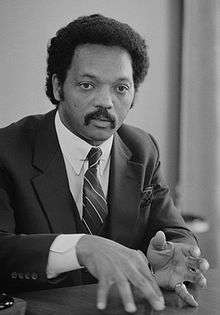
The South Side has been home to some of the most significant figures in the history of American politics. These include Richard J. Daley and his son, Richard M. Daley; the first black U.S. President, Barack Obama; the first female black U.S. Senator, Carol Moseley Braun; and the first black presidential candidate to win a primary, Jesse Jackson. Before them, Harold Washington, a Congressman and the first black Mayor of Chicago, as well as groundbreaking Congressman William L. Dawson, achieved political success from the South Side.[60]
Education
Colleges and universities
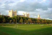
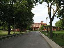
The University of Chicago is one of the world's top universities, with 22 Nobel Prize winners working at the university at the time of the award announcement, placing it 3rd among U.S. institutions (behind Harvard and Stanford.)[61] At Chicago Pile-1 at the university, the first self-sustaining nuclear chain reaction was achieved under the direction of Enrico Fermi in the 1940s.[62]
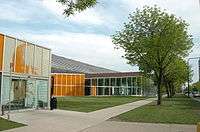
Other four-year educational institutions there are the Illinois Institute of Technology, St. Xavier University, Chicago State University, Illinois College of Optometry and Shimer College.[63] The South Side also hosts community colleges such as Olive-Harvey College, Kennedy-King College and Richard J. Daley College.[64]
Primary and secondary schools
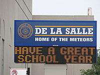
Chicago Public Schools operates the public schools on the South Side, including DuSable High School, Simeon Career Academy, John Hope College Prep High School and Phillips Academy High School.[65][66][67][68] The De La Salle Institute, located in the Douglas community area across the street from Chicago Police Department headquarters, has taught five Chicago Mayors:[69] Richard J. Daley, Michael A. Bilandic, Martin H. Kennelly, Frank J. Corr and Richard M. Daley. Three of these mayors hail from the South Side's Bridgeport community area, which also produced two other Chicago Mayors.[70]
University of Chicago Lab School, affiliated with the University of Chicago, is a private school located there.[63]
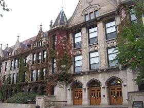
Landmarks
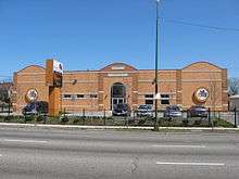
.JPG)
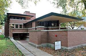
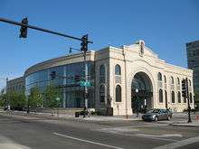
The South Side is home to many official landmarks and other notable buildings and structures.[71][72] It hosts three of the four Chicago Registered Historic Places from the original October 15, 1966 National Register of Historic Places list (Chicago Pile-1, Robie House and Lorado Taft Midway Studios).[73]
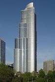
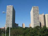
One Museum Park, which is along Roosevelt Road, is the tallest building on the South Side.[74] One Museum Park West, which is next door to One Museum Park, is another of Chicago's tallest. 1700 East 56th Street in Hyde Park is the tallest building south of 13th Street. This neighborhood hosts several other highrises.
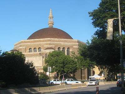
Many landmark buildings are found in the Black Metropolis-Bronzeville District,[75] including Powhatan Apartments, Robie House and John J. Glessner House.[76][77][78] The South Side has many of Chicago's premier places of worship such as Eighth Church of Christ, Scientist, First Church of Deliverance and K.A.M. Isaiah Israel Temple.[45][79][80]
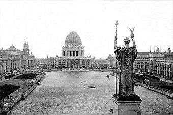
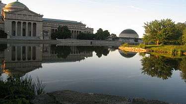
The South Side has several landmark districts including two in Barack Obama's Kenwood community area: Kenwood District, North Kenwood District and (partially) Hyde Park-Kenwood Historic District.[81][82] The South Side hosts the Museum of Science and Industry,[83] located in the Palace of Fine Arts, one of the few remaining buildings from the 1893 World's Columbian Exposition,[84] which was hosted in South Side.
The South Side is the residence of other prominent black leaders such as Jesse Jackson and Louis Farrakhan. It is also where U.S. Congressmen Jesse Jackson, Jr. and Bobby Rush (a former Black Panther leader) serve.[62]
The South Side has been a place of political controversy. Although the locations of some of these notable controversies have not become official landmarks, they remain important parts of Chicago history. The Chicago Race Riot of 1919 was the worst of the approximately 25 riots during the Red Summer of 1919 and required 6,000 National Guard troops.[85] As mentioned above, segregation has been a political theme of controversy for some time on the South Side as exhibited by Hansberry v. Lee, 311 U.S. 32 (1940).[86]
President Obama announced in 2015 that the Barack Obama Presidential Center would be built adjacent the University of Chicago campus.[87][88] Both Washington Park and Jackson Park were considered and it was announced in July 2016 that it would be built in Jackson Park.[89]
Transportation
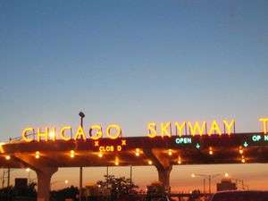
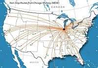
The South Side is served by mass transit as well as roads and highways. Midway International Airport is located on the South Side.[90][91] Among the highways through the South Side are I-94 (which goes by the names Dan Ryan Expressway, Bishop Ford Freeway and Kingery Expressway on the South Side), I-90 (which goes by the names Dan Ryan Expressway and Chicago Skyway on the South Side), I-57, I-55, U.S. 12, U.S. 20 and U.S. 41.[92]
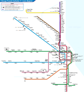
Several Chicago Transit Authority (CTA) bus and train lines and Metra train lines link the South Side to rest of the city. The South Side is served by the Red, Green and Orange lines of the CTA and the Rock Island District, Metra Electric and South Shore Metra lines and a few stops on the SouthWest Service Metra line. Standard local metropolitan bus service and CTA express service bus routes provide service to the Loop.[93]
Arts
Chicago's African American community, concentrated on the South Side, experienced an artistic movement following the Harlem Renaissance in New York City. From the 1930s until the 1950s, the movement was concentrated in and around the Hyde Park community area. Prominent writers and artists included Gwendolyn Brooks, Margaret Burroughs, Elizabeth Catlett, Eldzier Cortor, Gordon Parks and Richard Wright.[94]
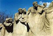
Other Chicago Black Renaissance artists included Willard Motley, William Attaway, Frank Marshall Davis and Margaret Walker. St. Clair Drake and Horace R. Cayton represented the new wave of intellectual expression in literature by depicting the culture of the urban ghetto rather than the culture of blacks in the South in the monograph Black Metropolis.[23][95] In 1961, Burroughs founded the DuSable Museum of African American History. By the late 1960s the South Side had a resurgent art movement led by Jim Nutt, Gladys Nilsson and Karl Wirsum, who became known as the Chicago Imagists.
Music in Chicago flourished, with musicians bringing blues and gospel influences up from Mississippi and stops along the way and creating a Chicago sound in blues and jazz. There was opportunity for independent companies because labels with studios in New York City or Los Angeles only kept regional distribution offices in Chicago.[96] In 1948, Blues was introduced by Aristocrat Records (later Chess Records). Muddy Waters and Chess Records quickly followed with Chuck Berry, Bo Diddley, Little Walter, Jimmy Rogers and Howlin' Wolf.[23][97]
Vee-Jay, the largest black-owned label before Motown Records, was among the post-World War II companies that formed "Record Row" on Cottage Grove between 47th and 50th Streets. In the 1960s, it was located along South Michigan Avenue.[96][97] Rhythm and blues continued to thrive after Record Row became the hub of gospelized rhythm and blues, known as soul. Chicago continues as a prominent musical city.[97]
Many other artists have left their mark on Chicago's South Side. These include Upton Sinclair and James Farrell via fiction, Archibald Motley, Jr. via painting, Henry Moore and Lorado Taft via sculpture and Thomas Dorsey and Mahalia Jackson via gospel music.[6] The South Side has numerous art museums and galleries such as the DuSable Museum of African American History,[98] National Museum of Mexican Art,[99] National Vietnam Veterans Art Museum,[100] and the David and Alfred Smart Museum of Art (known as the Smart Museum).[101] In addition, cultural centers such as the South Shore Cultural Center, South Side Community Art Center, Harold Washington Cultural Center and Hyde Park Art Center bring art and culture to the public while fostering opportunities for artists.[102] The Bronzeville Children's Museum is the only African American Children's museum in the U.S.[103]
Parks
The Chicago Park District boasts 7,300 acres (30 km2) of parkland, 552 parks, thirty-three beaches, nine museums, two world-class conservatories, sixteen historic lagoons and ten bird/wildlife gardens.[104] Many of these are on the South Side, including several large parks that are part of the legacy of Paul Cornell's service on the South Parks Commission. He was also the father of Hyde Park.
Chicago Park District parks serving the South Side include Burnham Park,[105] Jackson Park,[106] Washington Park,[107] Midway Plaisance,[108] and Harold Washington Park.[109] Away from the Hyde Park area, large parks include the 69-acre (28 ha) McKinley Park,[110] 323-acre (131 ha) Marquette Park,[111] the 198-acre (80 ha) Calumet Park,[112] and the 173-acre (70 ha) Douglas Park.[113] The parks of Chicago foster and host tremendous amounts of athletic activities.
The South Side has the only Illinois state park within the city of Chicago: William W. Powers State Recreation Area. Other opportunities for more "natural" recreation are provided by the Cook County Forest Preserve's Dan Ryan Woods and the Beaubien Woods on the far south side, along the Little Calumet River[114]
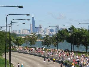
Various events cause the closure of parts of Lake Shore Drive. Although the Chicago Marathon causes many roads to be closed in its route that goes as far north as Wrigleyville and to Bronzeville on the South Side, it does not cause closures to the drive.[115] However, on the South Side, the Chicago Half Marathon necessitates closures[116] and the entire drive is closed for Bike The Drive.[117]
Beginning in 1905, the White City Amusement Park, located on 63rd Street provided a recreational area to the citizens of the area.[118][119] Until the early 1920s, a dirigible service ran from the park, which was also where Goodyear Blimps were first produced, to Grant Park. This service was discontinued after the Wingfoot Air Express Crash.[120] A fire destroyed much of the park in the late 1920s and more was torn down in the 1930s. The park filed for bankruptcy in 1933 and 1943. Despite attempts to resurrect the park in 1936 and 1939, by 1946 all the remaining equipment was auctioned off.[121]
Sports

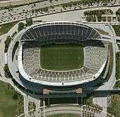
The South Side hosts two major professional athletic teams: Major League Baseball's Chicago White Sox play at U.S. Cellular Field in the Armour Square neighborhood, while the National Football League's Chicago Bears play at Soldier Field, adjacent to the Museum Campus on the Near South Side.[122][123] Seven other teams—three now defunct, two playing in other media markets, one playing in a Chicago suburb and one now playing in another part of Chicago—have called the South Side home. The defunct Chicago American Giants baseball club of the Negro National Leagues played at Schorling's Park from 1911 to 1940,[6] and then at Comiskey Park until 1952. In football, the Chicago Cardinals of the National Football League originally played at Normal Park but eventually moved to Comiskey Park in the late 1920s.[6] The Cardinals left Chicago for St. Louis in 1960 and in 1988 for Phoenix, where they became the Arizona Cardinals.[124] In hockey, the Chicago Cougars of the WHA played in the International Amphitheatre, located next to the Union Stock Yards, from 1972 until their demise in 1975.[125]
Two NBA teams also briefly played on the South Side. The Chicago Packers played at the Amphitheatre in their inaugural season of 1961–62. The following season, they changed their name to the Zephyrs and played at the Chicago Coliseum on the Near South Side. The team moved to Baltimore after that season and now plays in Washington, D.C. as the Washington Wizards.[126] Chicago's current NBA team, the Bulls, played at the Amphitheatre during their first season[127] before moving away from the South Side to Chicago Stadium and eventually to United Center.
The Chicago Fire of Major League Soccer played at Soldier Field from 1997 until the team relocated to Bridgeview, a southwest suburb adjacent to the city, in 2006[128] and the defunct Chicago Sting soccer club played at Soldier Field and Comiskey Park from 1974 to 1984.[129][130]
2016 Olympic bid
The South Side played a prominent role in Chicago's bid for the 2016 Summer Olympics. The Olympic Village was planned in the Douglas (#35) community area across Lake Shore Drive from Burnham Park.[131] In addition, the Olympic Stadium was expected to be located in the Chicago Park District's Washington Park located in the Washington Park (#40) community area.[132] Many Olympic events were planned for these community areas as well as other parts of the South Side.[133]
References in popular culture
The South Side's gritty reputation often makes its way into popular culture.
- The opening lines of Jim Croce's song "Bad, Bad Leroy Brown" state that the South Side is "the baddest part of town".[134]
- Richard Wright's novel Native Son (ISBN 978-0-06-083756-3) takes place on the South Side and focuses on the plight of African Americans in the ghetto, including the housing practices that created such slums.[135]
- Upton Sinclair's novel The Jungle (ISBN 978-1-884365-30-0) was a revelation about the Union Stock Yards at the turn of the 20th century.[136]
- A Raisin in the Sun (ISBN 978-0-451-18388-0) is a story of Lorraine Hansberry's youth growing up in the Woodlawn community area.[137]
- Barbershop and parts of The Blues Brothers take place on the South Side. David Auburn's play Proof takes place exclusively in the Hyde Park neighborhood; the film adaptation expands the setting.[138]
- The Spook Who Sat by the Door is a novel and film dealing with the integration of the CIA. The majority of the story takes place on the South Side of Chicago where the sole graduating black cadet is from.[139]
- The Boondocks, a comic strip and animated series, stars the Freeman family, who have recently moved from the South Side of Chicago to an affluent suburb.[140]
- James T. Farrell's novels, collectively called the Studs Lonigan Trilogy, are set in an Irish neighborhood on the South Side.[141]
- Iceberg Slim, the author of Pimp, was raised on the South Side of Chicago, which is the setting of most of his stories. He sold over six million books, which were translated, further disseminating his depiction of life of the South Side.[142]
- Chicago's South Side is the setting for the Showtime series Shameless.
- The South Side is seen in Netflix's Sense8 series, in the scenes of Will. The sitcom Good Times was based on a family living on the Southside of Chicago.
Notes
- 1 2 Cain, Louis P. (2005). "Annexation". The Electronic Encyclopedia of Chicago. Chicago Historical Society. Retrieved September 8, 2008.
- ↑ "City Layout". Frommers.com. 2007. Retrieved October 28, 2007.
- 1 2 3 Nobleman, Marc Tyler (2005). Chicago. Gareth Stevens, Inc. p. 7. ISBN 978-0-8368-5196-0. Retrieved October 28, 2007.
- 1 2 "Chicago (city, Illinois)". Microsoft Encarta Online Encyclopedia. Microsoft Corporation. 2007. Retrieved August 13, 2007.
- ↑ "The Municipal Flag of Chicago". Chicago Public Library. Retrieved October 28, 2007.
- 1 2 3 4 5 6 7 Pacyga, Dominic A. (2005). "South Side". The Electronic Encyclopedia of Chicago. Chicago Historical Society. Retrieved August 10, 2007.
- ↑ Sobel, Anne (February 14, 2011). "What the South Side of Chicago Could Learn From Egypt". The Huffington Post. Retrieved October 4, 2012.
- ↑ Tough, Paul (August 15, 2012). "What Does Obama Really Believe In?". The New York Times. Retrieved October 4, 2012.
- ↑ "Housing, A Short History". You Are Here. The University of Chicago. 2007. Retrieved August 19, 2007.
- ↑ "Cinéma vérité". The University of Chicago Magazine. 2007. Retrieved August 19, 2007.
- ↑ "Chicago Demographics: Median Household Income (as of the 2000 Census)" (PDF). CityofChicago.org. Retrieved October 31, 2007.
- ↑ "The RTA system" (PDF). The Regional Transportation Authority. February 21, 2007. Retrieved October 25, 2007.
- ↑ "FHWA Route Log and Finder List: Table 1". Federal Highway Administration. March 22, 2007. Retrieved October 25, 2007.
- ↑ Hayner, Don and Tom McNamee, Streetwise Chicago, "Madison Street", p. 79, Loyola University Press, 1988, ISBN 978-0-8294-0597-2
- 1 2 3 Eric Zorn (May 30, 2005). "Sides Up in the Air". Chicago Tribune. Retrieved October 25, 2007.
- ↑ "Hegewisch". Field Museum of Natural History. Retrieved November 25, 2012.
- ↑ "Chicago's Southeast Side". Northeastern Illinois University. 2007. Retrieved August 13, 2007.
- ↑ Durkin Keatingj, Ann. "Bungalow Belt". Encyclopedia of Chicago. Chicago Historical Society. Retrieved November 13, 2012.
- ↑ "Chicago Demographics: Distribution of Black Residents Across City (as of the 2000 Census)" (PDF). CityofChicago.org. 2007. Retrieved October 31, 2007.
- 1 2 Bennett, Larry (2005). "Ghettoization". The Electronic Encyclopedia of Chicago. Chicago Historical Society. Retrieved August 13, 2007.
- ↑ Keating, Ann Durkin (2005). "Townships". The Electronic Encyclopedia of Chicago. Chicago Historical Society. Retrieved October 23, 2007.
- ↑ Keating, Ann Durkin (2005). "Annexations and Additions to the City of Chicago". The Electronic Encyclopedia of Chicago. Chicago Historical Society. Retrieved October 23, 2007.
- 1 2 3 4 5 Manning, Christopher (2005). "blacks". The Electronic Encyclopedia of Chicago. Chicago Historical Society. Retrieved August 10, 2007.
- 1 2 Ralph 2006, p. 175
- ↑ Ralph 2006, p. 174
- ↑ Gurlacz, Betsy (2005). "Oak Lawn, IL". The Electronic Encyclopedia of Chicago. Chicago Historical Society. Retrieved August 10, 2007.
- ↑ Barnes, R. (2009). "Arnold R. Hirsch, Making the Second Ghetto: Race and Housing in Chicago, 1940–1960 (London: Cambridge Univ. Press, 1983, £20). Pp. Xv, 362. ISBN 0 521 24569 9". Journal of American Studies. 19: 130. doi:10.1017/S0021875800020211.
- 1 2 Kamp, Allen R. (1986). "The History Behind Hansberry v. Lee" (PDF). U.C. Davis Law Review. 20: 481. Retrieved November 15, 2012.
- ↑ McClendon, Dennis (2005). "Expressways". The Electronic Encyclopedia of Chicago. Chicago Historical Society. Retrieved January 29, 2013.
- ↑ "Chicago history and rebuilding the Dan Ryan". Chicago Defender. Real Times. February 4, 2004.
- ↑ Royalty, Doug (May 29, 2000). "The Czar of Chicago". businessweek.com. Bloomberg Business Week. Retrieved May 3, 2012.
- ↑ Diamond, Andrew J. (2005). "Gangs". The Electronic Encyclopedia of Chicago. Chicago Historical Society. Retrieved August 10, 2007.
- ↑ Bigott, Joseph C. (2005). "Bungalows". The Electronic Encyclopedia of Chicago. Chicago Historical Society. Retrieved August 13, 2007.
- ↑ Keating, Ann Durkin (2005). "Bungalow Belt". The Electronic Encyclopedia of Chicago. Chicago Historical Society. Retrieved August 13, 2007.
- ↑ Plotkin, Wendy (2005). "Kitchenettes". The Electronic Encyclopedia of Chicago. Chicago Historical Society. Retrieved August 13, 2007.
- ↑ Bowly, Jr., Devereux (2005). "Subsidized Housing". The Electronic Encyclopedia of Chicago. Chicago Historical Society. Retrieved August 13, 2007.
- ↑ Choldin, Harvey M. (2005). "Chicago Housing Authority". The Electronic Encyclopedia of Chicago. Chicago Historical Society. Retrieved August 13, 2007.
- ↑ Bennett, Larry (2005). "Gentrification". The Electronic Encyclopedia of Chicago. Chicago Historical Society. Retrieved August 10, 2007.
- ↑ Seligman, Amanda (2005). "North Lawndale". The Electronic Encyclopedia of Chicago. Chicago Historical Society. Retrieved August 10, 2007.
- 1 2 Steffes, Tracy (2005). "Condominiums and Cooperatives". The Electronic Encyclopedia of Chicago. Chicago Historical Society. Retrieved August 13, 2007.
- ↑ "The CHA's Plan for Transformation". Chicago Housing Authority. 2007.
- ↑ Gellman, Erik (2005). "Robert Taylor Homes". The Electronic Encyclopedia of Chicago. Chicago Historical Society. Retrieved April 25, 2008.
- ↑ "Fact Sheet: Zip Code Tabulation Area 60619". U. S. Census Bureau. Retrieved October 3, 2008.
- ↑ "American Fact Finder". United States Census Bureau. Retrieved November 25, 2012.
- 1 2 "K.A.M. Isaiah Israel Temple". City of Chicago Department of Planning and Development, Landmarks Division. 2003. Archived from the original on April 14, 2008. Retrieved May 4, 2012.
- ↑ "Kontakt ZP". zppa.org. Retrieved November 10, 2012.
- ↑ Gellman, Erik (2005). "Little Village". Encyclopedia of Chicago. Chicago Historical Society. Retrieved November 13, 2012.
- ↑ "South Side Irish Parade Expected To Draw Record Crowd". Market Wire. FindArticles. March 2002. Retrieved September 27, 2007.
- ↑ Puccinelli, Mike. "Pray, Parade and Party At South Side Irish Parade". CBS Broadcasting, Inc. Archived from the original on March 17, 2007. Retrieved September 27, 2007.
- 1 2 The South Side Irish St. Patrick's Day Parade Committee (March 25, 2009). "Céad Míle Fáílte". South Side Irish Saint Patrick's Day Parade. Retrieved March 25, 2009.
- ↑ "South Side Irish Parade: Fines Up To $1,000 Could Help Keep 'Idiots' Away". The Huffington Post. November 1, 2012. Retrieved November 17, 2012.
- ↑ "ABC 7 Chicago Presents Live Broadcast Of The Bud Billiken Parade" Check
|url=value (help). ABC Inc., WLS-TV Chicago. 2006. Retrieved September 28, 2007. - ↑ deVise, Pierre (2005). "Real Estate". The Electronic Encyclopedia of Chicago. Chicago Historical Society. Retrieved August 13, 2007.
- ↑ "Meatpacking Technology". Chicago Historical Society. 2001. Retrieved March 9, 2007.
- ↑ "Chicago Landmarks: Union Stock Yard Gate". City of Chicago Department of Planning and Development, Landmarks Division. 2003. Archived from the original on February 3, 2007. Retrieved May 4, 2012.
- ↑ "National Historic Landmarks Survey: Listing of National Historic Landmarks by State: Illinois" (PDF). Retrieved March 7, 2007.
- ↑ "Old Stone Gate, Chicago Union Stockyards". National Park Service. Retrieved March 30, 2007.
- ↑ Reiff, Janice L. (2005). "The Worlds of Prairie Avenue". The Electronic Encyclopedia of Chicago. Chicago Historical Society. Retrieved October 18, 2007.
- ↑ "Ramada Lake Shore Chicago". ramada-Chicago.com. Archived from the original on October 15, 2007. Retrieved October 22, 2007.
- ↑ Williams, Joseph (November 2, 2008). "Obama's home has long produced black stars". Boston Globe. Retrieved March 18, 2009.
- ↑ "Nobel Laureates and Universities". Nobel Web AB. 2007. Retrieved November 1, 2007.
- 1 2 Apple, R. W. Jr. (March 31, 2000). "ON THE ROAD; Big Shoulders, Buffed for Action". The New York Times. The New York Times Company. Retrieved April 20, 2008.
- 1 2 "America's Best Colleges 2008: National Universities: Top Schools". U.S.News & World Report, L.P. Retrieved October 17, 2007.
- ↑ "Chicago Demographics:Distribution of Residents Whose Highest Education is a Master's Degree or Ph.D. (as of the 2000 Census)" (PDF). City of Chicago.org. 2007. Retrieved October 31, 2007.
- ↑ Goldstein, Tom. "New York's Administrative Judge; Herbert Bernette Evans Man in the News A Hankering for Administration Opinion in Murder Appeal Born in Kansas City." The New York Times. Saturday February 24, 1979.
- ↑ "Student shot to death near high school." WLS-TV. March 29, 2008.
- ↑ Janson, Donald. "Troops Patrol in Chicago As Slum Violence Erupts; Guardsmen Patrol in Chicago as Violence Erupts." The New York Times. Friday April 4, 1969. Page 1.
- ↑ Wallis, Claudia. "On a Listening Tour with Melinda Gates." TIME. Tuesday May 8, 2007.
- ↑ Roeder, David (May 18, 2006). "De La Salle expansion to save theater: Has deal with city to buy". Chicago Sun-Times. Sun-Times News Group. Retrieved October 11, 2007.
- ↑ "Political History of Bridgeport". University of Illinois at Chicago. Retrieved November 27, 2012.
- ↑ "Far South". City of Chicago Department of Planning and Development, Landmarks Division. 2003. Archived from the original on May 29, 2008. Retrieved October 31, 2007.
- ↑ "South and West". City of Chicago Department of Planning and Development, Landmarks Division. 2003. Archived from the original on June 21, 2007. Retrieved October 31, 2007.
- ↑ National Park Service (2007-01-23). "National Register Information System". National Register of Historic Places. National Park Service.
- ↑ "One Museum Park". Emporis.com. 2007. Retrieved October 11, 2007.
- ↑ "Black Metropolis". City of Chicago. Retrieved September 21, 2012.
- ↑ "Powhatan Apartments". City of Chicago. Retrieved September 21, 2012.
- ↑ "Robie House". City of Chicago. Retrieved September 21, 2012.
- ↑ "Glessner House". City of Chicago. Retrieved September 21, 2012.
- ↑ "Eighth Church of Christ, Scientist". City of Chicago. Retrieved September 21, 2012.
- ↑ "First Church of Deliverance". City of Chicago. Retrieved September 21, 2012.
- ↑ "Kenwood District". City of Chicago. Retrieved September 21, 2012.
- ↑ "North Kenwood Multiple Resource District". City of Chicago. Retrieved September 21, 2012.
- ↑ "Museum of Science and Industrydate=2007". Retrieved October 11, 2007.
- ↑ Miner, Lisa & Beth Boston (2007). "New Release" (PDF). msichicago.org. Museum of Science and Industry. Archived from the original (PDF) on September 25, 2006. Retrieved October 11, 2007.
- ↑ "Chicago Race Riot of 1919". Encyclopædia Britannica, Inc. 2007. Retrieved August 24, 2007.
- ↑ "Hansberry v. Lee - 311 U.S. 32 (1940)". Justia. Retrieved November 27, 2012.
- ↑ Babwin, Don & Caryn Rousseau (May 12, 2015). "It's Official Obama Library Will be on South Side". ABC News. Jalic Inc. Associated Press. Retrieved May 12, 2015.
- ↑ Rhodan, Mary (May 12, 2015). "President Obama's $600 Million Gift to Chicago: A Presidential Library". Time. Retrieved May 19, 2015.
- ↑ Katherine Skiba, Obama Foundation makes it official: Presidential library will go up in Jackson Park, Chicago Tribune (June 29, 2016).
- ↑ "Chicago Midway (MDW) Airport". IFly.com. Retrieved November 18, 2012.
- ↑ "Chicago Midway International Airport Guide". Worldairportguides.com. Retrieved November 18, 2012.
- ↑ "Chicago and Vicinity" (PDF). Illinois Department of Transportation. Retrieved November 18, 2012.
- ↑ "Central System Map". Chicago Transit Authority. Archived from the original on July 16, 2007. Retrieved September 27, 2007.
- ↑ Warren, Lynne (2005). "Art". The Electronic Encyclopedia of Chicago. Chicago Historical Society. Retrieved August 10, 2007.
- ↑ Black Metropolis, Volume 1 - St. Clair Drake, Horace R. Cayton at Google Books
- 1 2 Clague, Mark (2005). "Record Publishing". The Electronic Encyclopedia of Chicago. Chicago Historical Society. Retrieved August 13, 2007.
- 1 2 3 Pruter, Robert (2005). "Rhythm and Blues". The Electronic Encyclopedia of Chicago. Chicago Historical Society. Retrieved August 13, 2007.
- ↑ "Dusable Museum of Art". 2007. Retrieved October 11, 2007.
- ↑ "National Museum of Mexican Art". National Museum of Mexican Art. Retrieved October 24, 2007.
- ↑ "National Vietnam Veterans Art Museum". National Vietnam Veterans Art Museum. Retrieved October 24, 2007.
- ↑ "Smart Museum of African American Art". The University of Chicago. 2007. Retrieved October 11, 2007.
- ↑ "South Side Community Art Center". The Electronic Encyclopedia of Chicago. Chicago Historical Society. 2005. Retrieved October 25, 2007.
- ↑ "About the Bronzeville Children's Museum". Bronzeville Children's Museum. Retrieved May 11, 2010.
- ↑ "Parks & Facilities". Chicago Park District. Archived from the original on October 9, 2007. Retrieved October 17, 2007.
- ↑ "Burnham Park". Chicago Park District. Retrieved November 18, 2012.
- ↑ "Jackson Park". Chicago Park District. Retrieved November 18, 2012.
- ↑ "Washington Park". Chicago Park District. Retrieved November 18, 2012.
- ↑ "Midway Plaisance Park". Chicago Park District. Retrieved November 18, 2012.
- ↑ "Harold Washington Playlot Park". Chicago Park District. Retrieved November 18, 2012.
- ↑ "McKinley Park". Chicago Park District. Retrieved November 18, 2012.
- ↑ "Marquette Park". Chicago Park District. Retrieved November 18, 2012.
- ↑ "Calumet Park". Chicago Park District. Retrieved November 18, 2012.
- ↑ "Douglas Park". Chicago Park District. Retrieved November 18, 2012.
- ↑ "Region 9 Map Of Natural Areas & Activities" (PDF). The Forest Preserve District of Cook County. Retrieved July 25, 2009.
- ↑ "The LaSalle Bank Chicago Marathon 2007 Course Map" (PDF). chicagomarathon.com. Retrieved September 27, 2007.
- ↑ "The Chicago Half Marathon". Devine Sports. Retrieved September 27, 2007.
- ↑ "Bank America Bike The Drive". Chicagoland Bicycle Federation. Retrieved September 27, 2007.
- ↑ "White City is Opened". Chicago Record Herald. May 27, 1905. p. 9.
- ↑ Barker, Stan (2005). "Amusement Parks". The Electronic Encyclopedia of Chicago. Chicago Historical Society. Retrieved December 13, 2008.
- ↑ Estep, George (April 6, 1986). "The Roller-Coaster Life Of Towering And Tawdry White City". Chicago Tribune. Newsbank. Retrieved December 13, 2008.
- ↑ Bond, Jean (December 6, 1959). "Fiery White City Comes to Blazing End". Chicago Tribune. ProQuest. p. SW2.
- ↑ "Individual Game Tickets". CHICAGO BEARS. 2007. Retrieved October 8, 2007.
- ↑ "U.S. Cellular Field Attractions". MLB Advanced Media, L.P. 2007. Retrieved October 8, 2007.
- ↑ "History". AZCardinals.com. Retrieved November 13, 2012.
- ↑ "Chicago Cougars". WHAHockey.com. Retrieved November 13, 2012.
- ↑ Hareas, John. "A Colorful Tradition". NBA.com. Retrieved November 13, 2012.
- ↑ "Chicago Stadium History". NBA.com. Retrieved December 12, 2012.
- ↑ "Stadium History". SoldierField.net. Retrieved November 13, 2012.
- ↑ "Soldier Field". StadiumsUSA.com. Retrieved November 13, 2012.
- ↑ "Chicago Sting: 1974–1984". RedEye. May 16, 2012. Retrieved November 13, 2012.
- ↑ Hinz, Greg (April 14, 2007). "USOC picks Chicago for 2016 Olympic bid". ChicagoBusiness. Crain Communications, Inc. Retrieved September 27, 2007.
- ↑ Hinz, Greg (January 23, 2007). "Glitz, guarantees added to Olympic bid". ChicagoBusiness. Crain Communications, Inc. Retrieved September 27, 2007.
- ↑ "Chicago 2016 Venue Plan". Chicago 2016, City of Chicago, Applicant City, 2016 Olympic and Paralympic Games. January 23, 2007. Archived from the original on February 10, 2007. Retrieved October 17, 2007.
- ↑ Lightfoot, Elizabeth (2009). Michelle Obama: First Lady of Hope. Globe Pequot. p. 2. ISBN 1-59921-521-7.
- ↑ Anderson, Michael (August 26, 2001). "A Native Son in Exile". The New York Times. Retrieved December 29, 2012.
- ↑ "Upton Sinclair". The Literature Network. Jalic Inc. Retrieved October 15, 2007.
- ↑ "A Raisin in the Sun". National Public Radio. March 12, 2002. Retrieved October 17, 2007.
- ↑ "On Screen Illinois". Illinois Mile After Mile. Universal Studios. Archived from the original on April 3, 2008. Retrieved August 11, 2008.
- ↑ Irele, Abiola; Jeyifo, Biodun (2010). The Oxford Encyclopedia of African Thought. 1. Oxford University Press. p. 161. ISBN 978-0-19-533473-9. Retrieved September 6, 2012.
- ↑ McGruder, Aaron (2000). The Boondocks: Because I Know You Don't Read the Newspaper. Andrews McMeel Publishing. p. 5. ISBN 978-0-7407-0609-7. Retrieved September 6, 2012.
- ↑ "Studs Lonigan: A Trilogy". The Library of America. Retrieved November 20, 2007.
- ↑ "A Tribute to Iceberg Slim". WFMU. 1998. Retrieved March 28, 2009.
References
- Ralph, James (2006). "Chicago, Illinois". In Reich, Steven A. Encyclopedia of the Great Black Migration. 1. Westport, CT: Greenwood Press. ISBN 0-313-32983-4.
External links
-
 Media related to South Side of Chicago at Wikimedia Commons