South Sentinel Island
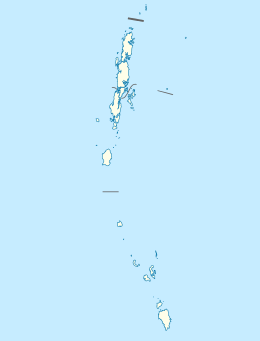 South Sentinel Island Location of South Sentinel Island | |
| Geography | |
|---|---|
| Location | Bay of Bengal |
| Coordinates | 10°58′34″N 92°13′12″E / 10.976°N 92.22°ECoordinates: 10°58′34″N 92°13′12″E / 10.976°N 92.22°E |
| Archipelago |
Andaman Islands (Sentinel Islands) |
| Adjacent bodies of water | Indian Ocean |
| Total islands | 1 |
| Major islands |
|
| Area | 1.6 km2 (0.62 sq mi)[1] |
| Length | 1.6 km (0.99 mi) |
| Width | 1.0 km (0.62 mi) |
| Coastline | 4.9 km (3.04 mi) |
| Highest elevation | 2 m (7 ft)[2] |
| Administration | |
| Union territory | Andaman and Nicobar Islands |
| District | South Andaman |
| Demographics | |
| Demonym | South Sentinelese |
| Population | 0 (2016) |
| Pop. density | 0.00 /km2 (0 /sq mi) |
| Additional information | |
| Time zone | |
| PIN | 744202[3] |
| Telephone code | 031927 [4] |
| Official website |
www |
| ISO Code | IN-AN-00[5] |
| Literacy | 84.4% |
| Avg. summer temperature | 30.2 °C (86.4 °F) |
| Avg. winter temperature | 23.0 °C (73.4 °F) |
| Sex ratio | 1.2♂/♀ |
| unit_pref | Metric |
| Census Code | 35.639.0004 |
South Sentinel Island is one of the Andaman Islands in the Bay of Bengal. It is 1,600 metres (5,200 ft) long northeast to southwest and up to 1,000 metres (3,300 ft) wide. At only 1.6 km2 (0.62 sq mi), it is much smaller than its counterpart North Sentinel Island and of significantly less interest. The island belongs to the South Andaman administrative district, part of the Indian union territory of Andaman and Nicobar Islands.[6]
Geography
South Sentinel is 26.5 kilometres (16.5 mi) west-northwest of Little Andaman Island in the south of the Andaman chain but 59.6 kilometres (37.0 mi) south of its counterpart North Sentinel Island. From the limited information available it can be said that South Sentinel Island is a forested coral reef. From a journal written in the 19th century, a Colonel Alcock who passed the island wrote "[South Sentinel is] raised a few feet and continuous with the corals surrounding it". the island is lying 186 km (116 mi) southwest from Port Blair. It belongs to the Sentinel Islands. and lies immediately south of the passage. The island has 44m high to the tops of the trees and level topped. Its appearance is much the same on all bearings. A bank, as defined by the 36m curve, surrounds the island and extends about 6 miles NW from it. Considerable depths exist in the channel between this island and Little Andaman Island [7]
Administration
Politically, South Sentinel Island is part of Little Andaman Taluk.[8]
Demographics
The island is uninhabited but is sometimes used by diving expeditions on account of its remoteness and novelty factor. Apart from an unmanned lighthouse,[9] there are no facilities.
Fauna
South Sentinel Island Sanctuary which houses humongous robber crabs.
See also
References
- ↑ "Islandwise Area and Population - 2011 Census" (PDF). Government of Andaman.
- ↑ pro star
- ↑ "A&N Islands - Pincodes". 22 September 2016. Retrieved 22 September 2016.
- ↑ code
- ↑ Registration Plate Numbers added to ISO Code
- ↑ "Village Code Directory: Andaman & Nicobar Islands" (PDF). Census of India. Retrieved 16 January 2011.
- ↑ map
- ↑ Tehsils
- ↑ "Government of India, Directorate General of Lighthouses and Lightships: Welcome to SOUTH SENTINEL ISLAND LIGHT HOUSE.". www.dgll.nic.in. Retrieved 2016-10-18.
| Wikimedia Commons has media related to South Sentinel Island. |
- Geological Survey of India
 Andaman and Nicobar Islands travel guide from Wikivoyage