South Mountain (eastern Pennsylvania)
| South Mountain | |
|---|---|
 | |
| Highest point | |
| Peak | Womelsdorf Benchmark[1] |
| Elevation | 1,380 ft (420 m) |
| Coordinates | 40°19′28″N 76°11′44″W / 40.32444°N 76.19556°W |
| Geography | |
| Country | United States |
| State | Pennsylvania |
| Counties | Berks, Lancaster, Lebanon and Lehigh |
| Range coordinates | 40°20′N 76°12′W / 40.33°N 76.2°WCoordinates: 40°20′N 76°12′W / 40.33°N 76.2°W |
| Parent range | Reading Prong |
| Borders on | Lebanon Valley, Lehigh Valley and Piedmont |
| Biome | Eastern Temperate Forests (Level I) |
| Geology | |
| Orogeny | Grenville orogeny |
| Age of rock | Proterozoic eon and about 570 to 1,600 million years ago |
| Type of rock | Crystalline metamorphic rock and gneiss |
South Mountain is a colloquial name applied to features in the mountain range extending south and southwest from the Lehigh Valley to the Lebanon Valley regions of Pennsylvania. At times, it also been known as Texter Mountain, Durham Hills, Reading Hills, and the Lehigh Mountains. It is called the Reading Prong by geologists.[2] The name South Mountain is applied to the southern most cluster of peaks in the feature, straddling Berks, Lancaster, and Lebanon counties;[3] and also to the northernmost end of the feature as the ridge into which Lehigh University is built.
South Mountain borders Emmaus, just to the south of Allentown, and comprises a ridge of low mountains passing east of Reading and then extending nearly due west. It is a continuation of the New England Province and is the southern end of the Hudson Highlands.[4]
The ridge does not follow a straight line like Blue Mountain, located to the north.
South Mountain ranges in elevation between 500 and 1,300 feet above sea level. The ridge is made of metamorphic rocks and gneiss, which date to the Precambrian era and range from about 570 to 1,600 million years old.
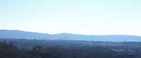
South Mountain is largely undeveloped in its northern extension due to conservation efforts and its steep slope. This makes it a beautiful backdrop to the viewpoints of the Lehigh Valley, including, at night, the city lights of Allentown. The southern end of this feature extends west along U.S. Route 422 and the southeastern border of Berks County, providing views of Blue Mountain (to the north), Mount Penn (which comprises part of the prong), and the city of Reading, to the east. The southern-most peaks were at one time home to many exclusive sanitariums and resorts, now all defunct except for the Caron Foundation. South Mountain serves as the transmitter site for local radio and television stations; independent TV station WFMZ-TV 69 has both its transmitter and studio facilities based on the mountain.
References
- ↑ "Womelsdorf Benchmark". Peakbagger.com. Retrieved 6 February 2016.
- ↑ "Reading Prong Section, New England Province". Pennsylvania Geological Survey website. Retrieved 2009-09-16.
- ↑ "South Mountain". Geographic Names Information System. United States Geological Survey. Retrieved 2009-09-15.
- ↑ Sevon, W.D. (2000). Physiographic Provinces of Pennsylvania, Map 13. Pennsylvania Geologic Survey. Harrisburg, PA.