South Algonquin
| South Algonquin | |
|---|---|
| Township (single-tier) | |
| Township of South Algonquin | |
|
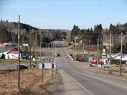
Highway 60 in Whitney. | |
 South Algonquin | |
| Coordinates: 45°30′N 78°02′W / 45.500°N 78.033°WCoordinates: 45°30′N 78°02′W / 45.500°N 78.033°W | |
| Country |
|
| Province |
|
| District | Nipissing |
| Incorporated | October 1961 |
| Government | |
| • Type | Township |
| • Mayor | Jane Dumas |
| • Governing body | South Algonquin Township Council |
| • Councillors |
List
|
| • Federal riding | Renfrew—Nipissing—Pembroke |
| • Prov. riding | Renfrew—Nipissing—Pembroke |
| Area[1] | |
| • Total | 872.49 km2 (336.87 sq mi) |
| Population (2011)[1] | |
| • Total | 1,211 |
| • Density | 1.4/km2 (4/sq mi) |
| Time zone | EST (UTC-5) |
| • Summer (DST) | EDT (UTC-4) |
| Postal code | K0J 2M0 |
| Area code(s) | 613 |
| Website |
www.township.south algonquin.on.ca |
South Algonquin is a township in the Canadian province of Ontario. Located in the Nipissing District south of Algonquin Park, it is the sole populated portion of the district that lies south of the traditional dividing line between Northern Ontario and Southern Ontario.
The township had a population of 1,253 in the Canada 2006 Census.
Communities
The township comprises the communities of L'Amable, Aylen Lake, Cross Lake, Gunters, Madawaska, McKenzie Lake, Murchison, Opeongo, Wallace and Whitney.
History
The area was settled primarily as the site for the sawmill of the St. Anthony Lumber Company, of Minnesota, and is named for the general manager of that firm, Edwin Canfield Whitney. Whitney, who was born near Morrisburg, Ontario, had moved to the Midwestern United States shortly after the Civil War. Working in the lumber trade, he became manager of the St. Anthony Lumber Company in Minneapolis.
By 1892 work had commenced on the Ottawa, Arnprior & Parry Sound Railway (later the Canada Atlantic Railway), by Ottawa lumberman John Rudolphus Booth. Booth's sawmill at the Chaudière Falls in Ottawa, was considered to be one of the largest in North America, second only to a mill in Minneapolis. At the end of 1892, Booth arranged a takeover of the adjacent Perley and Pattee mill, from the estate of his former colleague William Goodhue Perley.
Timber berths on the upper Madawaska River, in the townships of Airy and Nightingale, belonging to the Perley & Pattee Lumber Company, were sold in 1894, to the St. Anthony Lumber Company, of Minneapolis. As the OA&PS Railway was being constructed to access this area, Whitney persuaded the management of the St. Anthony firm to purchase the timber berths.
About a year after the Whitney sawmill was built, Fowler and Hill sold the Minneapolis mill and associated timber limits to Frederick Weyerhaeuser of St. Paul. Whitney who had large timber holdings near Brainerd, Minnesota, sold these to Weyerhaeuser as well, making enough profit that he was able to purchase his partners' interests in the Whitney concern and continue its operation on his own.
The Canadian National Railway Renfrew Subdivision was abandoned between Whitney and Renfrew in 1983.
Demographics
| Canada census – South Algonquin community profile | |||
|---|---|---|---|
| 2011 | 2006 | 2001 | |
| Population: | 1211 (-3.4% from 2006) | 1253 (-2.0% from 2001) | 1278 (-4.1% from 1996) |
| Land area: | 872.49 km2 (336.87 sq mi) | 871.31 km2 (336.41 sq mi) | 871.21 km2 (336.38 sq mi) |
| Population density: | 1.4/km2 (3.6/sq mi) | 1.4/km2 (3.6/sq mi) | 1.5/km2 (3.9/sq mi) |
| Median age: | 49.4 (M: 48.4, F: 50.7) | 45.2 (M: 44.6, F: 46.0) | |
| Total private dwellings: | 977 | 1201 | 894 |
| Median household income: | $49,427 | $39,564 | |
| References: 2011[2] 2006[3] 2001[4] | |||
Television show production
In the fall of 1964 the cast and crew of the CBC Television show The Forest Rangers came to Whitney to film three episodes. They needed the use of a rapids in a large river with easy access. The Madawaska River's rapids here suited their demands perfectly. Higher water levels were necessary, and that was the case, since later in the year the water levels are raised. They searched, as well, for expert canoeists in the area who could run these rapids to get the necessary footage required for the final scenes.
The T.V. movie, Vacation with Derek, was filmed at Camp Arowhon, a summer camp nearby in Algonquin Park.
See also
References
- 1 2 "South Algonquin census profile". 2011 Census of Population. Statistics Canada. Retrieved 2012-02-13.
- ↑ "2011 Community Profiles". Canada 2011 Census. Statistics Canada. July 5, 2013. Retrieved 2012-02-13.
- ↑ "2006 Community Profiles". Canada 2006 Census. Statistics Canada. March 30, 2011. Retrieved 2012-02-13.
- ↑ "2001 Community Profiles". Canada 2001 Census. Statistics Canada. February 17, 2012. Retrieved 2012-02-13.
External links
| Wikimedia Commons has media related to South Algonquin. |
 |
Unorganized South Nipissing (Algonquin Provincial Park) |
| ||
| Algonquin Highlands Dysart and Others |
|
Madawaska Valley | ||
| ||||
| | ||||
| Hastings Highlands |
Nipissing District, Ontario | ||
|---|---|---|
| Cities |  | |
| Towns | ||
| Townships | ||
| First Nations | ||
| Indian reserves | ||
| Unorganized areas | ||
| Local services boards | ||
| ||