Sonora Township, Hancock County, Illinois
| Sonora Township | |
|---|---|
| Township | |
 Location in Hancock County | |
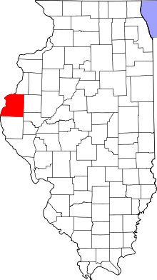 Hancock County's location in Illinois | |
| Coordinates: 40°30′12″N 91°18′10″W / 40.50333°N 91.30278°WCoordinates: 40°30′12″N 91°18′10″W / 40.50333°N 91.30278°W | |
| Country |
|
| State |
|
| County | Hancock |
| Established | November 6, 1849 |
| Area | |
| • Total | 37.52 sq mi (97.2 km2) |
| • Land | 35.79 sq mi (92.7 km2) |
| • Water | 1.73 sq mi (4.5 km2) 4.61% |
| Elevation | 659 ft (201 m) |
| Population (2010) | |
| • Total | 494 |
| • Density | 13.8/sq mi (5.3/km2) |
| Time zone | CST (UTC-6) |
| • Summer (DST) | CDT (UTC-5) |
| ZIP codes | 62318, 62341, 62354, 62358 |
| GNIS feature ID | 0429761 |
Sonora Township is one of twenty-five townships in Hancock County, Illinois, USA. As of the 2010 census, its population was 494 and it contained 234 housing units.[1]
Geography
According to the 2010 census, the township has a total area of 37.52 square miles (97.2 km2), of which 35.79 square miles (92.7 km2) (or 95.39%) is land and 1.73 square miles (4.5 km2) (or 4.61%) is water.[1]
Cities, towns, villages
- Nauvoo (east edge)
Unincorporated towns
- Powellton at 40°32′09″N 91°16′08″W / 40.535877°N 91.26876°W
(This list is based on USGS data and may include former settlements.)
Extinct towns
(These towns are listed as "historical" by the USGS.)
Cemeteries
The township contains these seven cemeteries: Nauvoo City, Nauvoo Two, Oak Grove, Pioneer Saints, Saints Peter and Paul, Sterns and Thornber.
Major highways
Airports and landing strips
- Cedar Ridge Airport
- Sinele Strip
Landmarks
- Mormon Cemetery
- Oak Grove Cemetery
- Sterne Cemetery
School districts
- Hamilton Community Consolidated School District 328
- Nauvoo-Colusa Community Unit School District 325
Political districts
- Illinois's 17th congressional district
- State House District 94
- State Senate District 47
References
- United States Census Bureau 2008 TIGER/Line Shapefiles
- "Sonora Township". Geographic Names Information System. United States Geological Survey. Retrieved 2009-09-20.
- United States National Atlas
- 1 2 "Population, Housing Units, Area, and Density: 2010 - County -- County Subdivision and Place -- 2010 Census Summary File 1". United States Census. Retrieved 2013-05-28.
External links
 |
Nauvoo Township | Appanoose Township | Pontoosuc Township | |
| Montrose Township, Lee County, Iowa | |
Rock Creek Township | ||
| ||||
| | ||||
| Jackson Township, Lee County, Iowa | Montebello Township | Prairie Township |
Municipalities and communities of Hancock County, Illinois, United States | ||
|---|---|---|
| Cities | ||
| Town | ||
| Villages | ||
| Townships | ||
| Unincorporated communities | ||
| Footnotes | ‡This populated place also has portions in an adjacent county or counties | |
This article is issued from Wikipedia - version of the 12/4/2013. The text is available under the Creative Commons Attribution/Share Alike but additional terms may apply for the media files.