Solromar, California
| Solromar, California | |
|---|---|
| Unincorporated community | |
|
Pacific Coast Highway (CA 1) in Solromar | |
 Solromar, California | |
| Coordinates: 34°03′00″N 118°57′13″W / 34.05000°N 118.95361°WCoordinates: 34°03′00″N 118°57′13″W / 34.05000°N 118.95361°W | |
| Country | United States |
| State | California |
| County | Ventura |
| Elevation | 128 ft (39 m) |
| Time zone | Pacific (PST) (UTC-8) |
| • Summer (DST) | PDT (UTC-7) |
| GNIS feature ID | 254274[1] |

Solromar is a small unincorporated community in Ventura County, California, United States. Located on the Malibu coast, the community lies amid some of the most striking and diverse coastal terrain in Ventura County.[2](p91) Just upcoast from Leo Carillo State Park, the community lies on a narrow coastal terrace along Pacific Coast Highway.
County Line Beach Park lies in-between portions of the residential areas on the ocean side of the highway. A popular surf spot mentioned by the Beach Boys in their 1963 hit song "Surfin' USA", the beach is also popular for scuba diving and freediving with easy access, abundant kelp forest, and reefs.
Soloromar had a post office from 1944 to 1956.[3] The post office selected the name from a list of twenty submissions by the residents. The Spanish words sol, oro, and mar were combined to suggest the description "golden sunset on the sea."[4]
This is the only residential community on the Malibu coast north of the Los Angeles County line. When Malibu incorporated as a city in Los Angeles County, this was the only community along the Malibu coast that was not included within the city limits.[5] This portion of the south coast of Ventura County typically uses Malibu for the address as it is within a Malibu zip code. Sewer service in the area is provided by individual septic tank systems.[2](p111)
California native garden and a monarch butterfly waystation were constructed as part of the MariSol subdivision.[6] The U.S. Army Corps of Engineers has found a 0.9-foot per year (0.27 m) erosion rate for the shoreline with major erosion occurring during the winter months.[7]
See also
References
- ↑ "Solromar". Geographic Names Information System. United States Geological Survey.
- 1 2 "VENTURA COUNTY GENERAL PLAN: COASTAL AREA PLAN" County of Ventura (Last amended September 16, 2008)
- ↑ "Ventura County, California". Post Office by County. United States Postal Service.
- ↑ Gudde, Erwin G. (1969). California place names : the origin and etymology of current geographical names (3rd ed., rev. and enl. ed.). Berkeley: University of California Press. p. 316.
- ↑ Fryer, Ashleigh (May 9, 2014). "MariSol breaks ground on two lots". Malibu Surfside News. Retrieved 2016-07-26.
- ↑ Shifa, Homaira (August 7, 2014) "Business Corner: MariSol Malibu" The Malibu Times
- ↑ "SUBSEQUENT ENVIRONMENTAL IMPACT REPORT FOR FOCUSED GENERAL PLAN UPDATE and Related Amendments to the Non-Coastal Zoning Ordinance and Zone Change ZN05-0008" County of Ventura (June 22, 2005)
Municipalities and communities of Ventura County, California, United States | ||
|---|---|---|
| Cities | 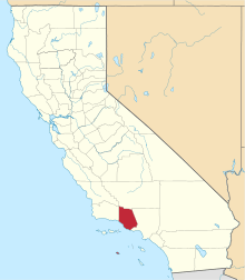 | |
| CDPs | ||
| Unincorporated communities | ||
| Footnotes | ‡This populated place also has portions in an adjacent county or counties | |