Solis Planum

MOLA map showing Solis Planum and other regions. Colors indicate elevations.
Solis Planum is a planum on Mars which has a diameter of 1811.23 km. Its center latitude is 26.4 S and its center longitude is 270.33 E. Solis Planum was named after a classic albedo feature name, and its name was approved in 1973.[1]
Gallery
 Edge of lava flow, as seen by HiRISE under HiWish program
Interactive Mars map
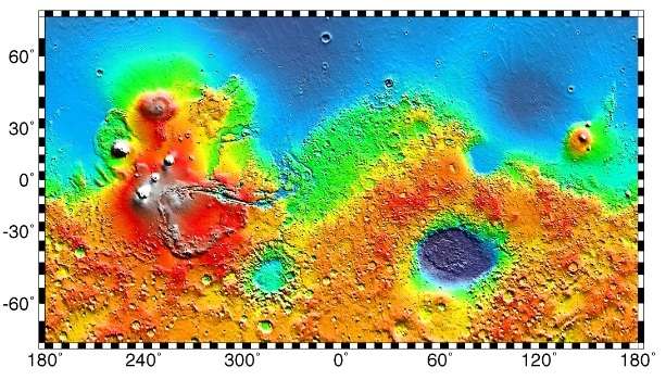
Interactive imagemap of the global topography of Mars. Hover your mouse to see the names of over 25 prominent geographic features, and click to link to them. Coloring of the base map indicates relative elevations, based on data from the Mars Orbiter Laser Altimeter on NASA's Mars Global Surveyor. Reds and pinks are higher elevation (+3 km to +8 km); yellow is 0 km; greens and blues are lower elevation (down to −8 km). Whites (>+12 km) and browns (>+8 km) are the highest elevations. Axes are latitude and longitude; Poles are not shown.
(also see: Mars Rovers map) (view • discuss)
References
See also
This article is issued from Wikipedia - version of the 11/25/2016. The text is available under the Creative Commons Attribution/Share Alike but additional terms may apply for the media files.