Solent Rescue
| Solent Rescue | ||
| Independent lifeboat station | ||
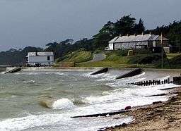 View to the west from the Solent Rescue Lifeboat Station lookout towards the old coastguard cottages and Beaulieu river entrance. | ||
|
||
| Country | England | |
|---|---|---|
| County | Hampshire | |
| Region | South East England | |
| District | New Forest | |
| village | Lepe, Hampshire | |
| Coordinates | 50°47′06.4″N 1°21′41.4″W / 50.785111°N 1.361500°WCoordinates: 50°47′06.4″N 1°21′41.4″W / 50.785111°N 1.361500°W | |
| Owner | Independent Rescue Organisation | |
 Location of Solent Rescue Lifeboat station within Hampshire | ||
Solent Rescue is an independent inshore rescue lifeboat, not run by the RNLI, based at Lepe Country Park south of the New Forest, on the north shore of the Solent in the county of Hampshire in England.[1]
Description
This small independent rescue organisation was set up in 1971 as a beach rescue unit, and has now developed into a full lifeboat station. The organisation operate within a specified area as agreed with Her Majesty's Coastguard. This covers 33 square miles (85 km2) of water and spans from Cowes in the Central Solent to Hurst Castle in the western fringes of this inshore waterway. Solent Rescue is one of seven independent lifeboats who make up the Solent Sea Rescue Organisation; each of these units have equipment that is tailor-made or selected for their unique areas of operation.
Developments and improvements
During 2011 and 2012, alterations were undertaken at Solent Rescue. During this time, the following assets were replaced:
- Clifftop weatherproof observation lookout.
- The main lifeboat was replaced with a 7.9-metre Delta rigid-hulled inflatable boat, powered by twin Suzuki DF90 lean burn engines. This has reduced response times.
- The old boat shed was replaced.
During 2016 and onwards
After discussions with key stakeholders, Solent Rescue have taken upon themselves an enhancement project that will begin being rolled out during 2017. Part of this project is to have a vessel built to the requirements of the unit. This is the biggest capital project that the unit has ever engaged in and will result in a far more durable level of service in adverse weather.
Neighbouring station locations
 |
Hampshire | Hampshire | Gosport and Fareham Lifeboat Station | |
| Lymington Lifeboat Station |
|
Calshot Lifeboat Station | ||
| ||||
| | ||||
| Yarmouth Lifeboat Station |
Cowes Lifeboat Station |
Bembridge Lifeboat Station |
References
- ↑ OS Explorer Map – 119 - Meon Valley, Porstmouth, Gosport and Fareham, Showing part of the South Downs Way (Folded Map). Published: Ordnance Survey; A2 edition (15 February 2010). ISBN 978 03192 412 40