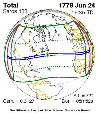
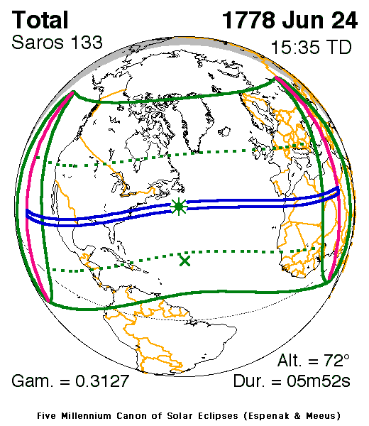
Solar eclipse of June 24, 1778
| Solar eclipse of June 24, 1778 | |
|---|---|
 Map | |
| Type of eclipse | |
| Nature | Total |
| Gamma | 0.3127 |
| Magnitude | 1.0746 |
| Maximum eclipse | |
| Duration | 352 sec (5 m 52 s) |
| Coordinates | 41°48′N 55°00′W / 41.8°N 55°W |
| Max. width of band | 255 km (158 mi) |
| Times (UTC) | |
| Greatest eclipse | 15:34:56 |
| References | |
| Saros | 133 (32 of 72) |
| Catalog # (SE5000) | 8985 |
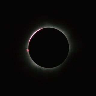
A total solar eclipse occurred on June 24, 1778. A solar eclipse occurs when the Moon passes between Earth and the Sun, thereby totally or partly obscuring the image of the Sun for a viewer on Earth. A total solar eclipse occurs when the Moon's apparent diameter is larger than the Sun's, blocking all direct sunlight, turning day into darkness. Totality occurs in a narrow path across Earth's surface, with the partial solar eclipse visible over a surrounding region thousands of kilometres wide. The total eclipse was visible in a path across Mexico, southeastern United States, and ended across northern Africa.
Observations

This was the first total solar eclipse recorded in the United States. The track passed from Lower California to New England. According to Thomas Jefferson, the eclipse was clouded out in Virginia. This solar eclipse which lasted four minutes over the middle Atlantic and New England States.[1]
Related eclipses
This eclipse is a part of solar Saros 133.
Notes
- ↑ "Solar Eclipse Newsletter, June 2004" (PDF). Retrieved 2013-12-13.
References
| Wikimedia Commons has media related to Solar eclipse of 1778 June 24. |
- NASA graphic
- Googlemap
- NASA Besselian elements
- Total Eclipses of the Sun, By Mabel Loomis Todd, 1894, new and revised edition by David P. Todd, 1900.
- The Solar Corona in the Eclipse of 24 June 1778 Solar Physics: Volume 216, Numbers 1-2 / September, 2003
