Solan district
| Solan district | |
|---|---|
| District of Himachal Pradesh | |
 Location of Solan district in Himachal Pradesh | |
| Country | India |
| State | Himachal Pradesh |
| Headquarters | Solan |
| Tehsils | 1. Solan, 2. Kasauli, 3. Nalagarh, 4. Arki and 5. Kandaghat |
| Government | |
| • Lok Sabha constituencies | Shimla (Lok Sabha constituency) (shared with Sirmour and Shimla districts) |
| • Assembly seats | 5 |
| Area | |
| • Total | 1,936 km2 (747 sq mi) |
| Population (2011) | |
| • Total | 576,670 |
| • Density | 300/km2 (770/sq mi) |
| • Urban | 18.22% |
| Demographics | |
| • Literacy | 85.02% |
| • Sex ratio | 852 |
| Average annual precipitation | 1253 mm |
| Website | Official website |
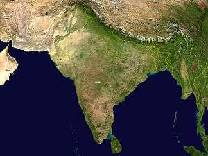
Solan district is one of the twelve districts of Himachal Pradesh state in northern India. Solan town is the administrative headquarters of the district. The district occupies an area of 1936 km².
History
The territory of the present-day district comprises the territories of the erstwhile princely states of Bhagal, Bhagat, Kunihar, Kuthar, Mangal, Beja, Mahlog, Nalagarh and parts of Keonthal and Kothi and hilly areas of the erstwhile Punjab State which were merged with Himachal Pradesh on 1 November 1966. This district came into existence on 1 September 1972. The district was carved out by amalgamating Solan and Arki tehsils of the erstwhile Mahasu district and Kandaghat and Nalagarh tehsils of the erstwhile Shimla district. Its name comes from Mata Shoolini Devi. It's said that she saved Solan from been destroyed.
Divisions
The district is divided into 4 sub-divisions: Solan, Nalagarh, Arki and Kandaghat. Solan sub-division comprises Solan and Kasauli tehsils. Nalagarh, Arki and Kandaghat sub-divisions comprise Nalagarh, Arki and Kandaghat tehsils respectively.
The district comprises 5 Vidhan Sabha constituencies: Arki, Nalagarh, Doon, Solan and Kasauli. All of these are part of Shimla Lok Sabha constituency.
Places of interest There are few place of interest in Solan. Mata Shoolini devi temple near andaar bazaar, Jatoli mandir on rajgarh road, children's park on Mall Road, Jawahar park, on top of a hill, Mohan Meakin Breweries the oldest distillery in India and one of the oldest in the world. Toy train also passes from Solan on Kalka-Shimla Route. It is an heritage train and route.
Demographics
According to the 2011 census Solan district has a population of 576,670,[1] roughly equal to the nation of Solomon Islands[2] or the US state of Wyoming.[3] This gives it a ranking of 532nd in India (out of a total of 640).[1] The district has a population density of 298 inhabitants per square kilometre (770/sq mi) .[1] Its population growth rate over the decade 2001-2011 was 15.21%.[1] Solan has a sex ratio of 884 females for every 1000 males,[1] and a literacy rate of 85.02%.[1]
References
- 1 2 3 4 5 6 "District Census 2011". Census2011.co.in. 2011. Retrieved 2011-09-30.
- ↑ US Directorate of Intelligence. "Country Comparison:Population". Retrieved 2011-10-01.
Solomon Islands 571,890 July 2011 est.
- ↑ "2010 Resident Population Data". U. S. Census Bureau. Retrieved 2011-09-30.
Wyoming 563,626
External links
 |
Bilaspur district | Mandi district |  | |
| Rupnagar district, Punjab | |
Shimla district | ||
| ||||
| | ||||
| Mohali district, Punjab | Panchkula district, Haryana | Sirmaur district |
Coordinates: 30°54′21″N 77°05′33″E / 30.9059°N 77.0925°E
