Socorro County, New Mexico
| Socorro County, New Mexico | |
|---|---|
 Socorro County Courthouse in Socorro | |
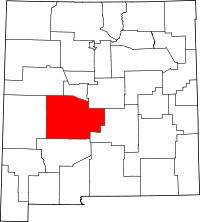 Location in the U.S. state of New Mexico | |
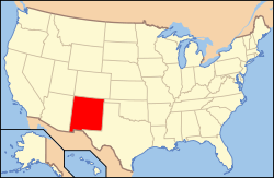 New Mexico's location in the U.S. | |
| Founded | January 9, 1852 |
| Seat | Socorro |
| Largest city | Socorro |
| Area | |
| • Total | 6,649 sq mi (17,221 km2) |
| • Land | 6,647 sq mi (17,216 km2) |
| • Water | 2.1 sq mi (5 km2), 0.03% |
| Population | |
| • (2010) | 17,866 |
| • Density | 2.7/sq mi (1/km²) |
| Congressional district | 2nd |
| Time zone | Mountain: UTC-7/-6 |
| Website |
www |

.jpg)
Socorro County is a county located in the U.S. state of New Mexico. As of the 2010 census, the population was 17,866.[1] The county seat is Socorro.[2] The county was formed in 1852 as one of the original nine counties of New Mexico Territory.[3][4] Socorro was originally the name given to a Native American village (see: Puebloan peoples) by Don Juan de Oñate in 1598. Having received vitally needed food and assistance from the native population, Oñate named the pueblo Socorro ("succor" in English).
Socorro County is home to multiple scientific research institutions including New Mexico Institute of Mining and Technology, the National Radio Astronomy Observatory and its associated Very Large Array, the Magdalena Ridge Observatory, and the Langmuir Laboratory for Atmospheric Research. Federal public lands in Socorro County include parts of the Cibola National Forest, the Bosque del Apache National Wildlife Refuge, the Sevilleta National Wildlife Refuge, the Bureau of Land Management (BLM) Socorro Field Office, parts of the Salinas Pueblo Missions National Monument, and parts of the El Camino Real de Tierra Adentro National Historic Trail.
History
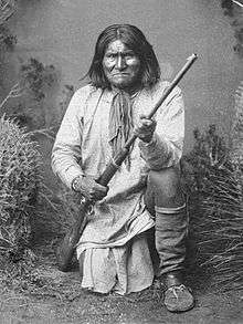
The history of Socorro County is intimately linked with the rich history of the surrounding area. Basham noted in his report documenting the archeological history of the Cibola National Forest’s Magdalena Ranger District, which is located almost entirely within Socorro County, that “[t]he heritage resources on the district are diverse and representative of nearly every prominent human evolutionary event known to anthropology. Evidence for human use of district lands date back 14,000 years to the Paleoindian period providing glimpses into the peopling of the New World and megafaunal extinction.“[5] Much of the now Magdalena Ranger District were a province of the Apache. Bands of Apache effectively controlled the Magdalena-Datil region from the seventeenth century until they were defeated in the Apache Wars in the late nineteenth century.[5] Outlaw renegades Butch Cassidy and the Wild Bunch and notorious Apaches like Cochise and Geronimo have ties to Socorro County's San Mateo Mountains. Vicks Peak was named after Victorio, “a Mimbreño Apache leader whose territory included much of the south and southwest New Mexico.”[6] Famous for defying relocation orders in 1879 and leading his warriors “on a two-year reign of terror before he was killed,” Victorio is at least as highly regarded as Geronimo or Cochise among Apaches.[6] Perhaps most famous outlaw was the Apache Kid whose supposed grave lies within the Apache Kid Wilderness. Stories of depredations by the Apache Kid, and of his demise, became so common and dramatic that in southwestern folklore they may be exceeded only by tales of lost Spanish gold.[5] Native Americans lingered in the San Mateos well into the 1900s. We know this by an essay written by Aldo Leopold in 1919 where he documents stumbling upon the remains of a recently abandoned Indian hunting camp.[7]
| Cultural or Historic Figures with Ties to Socorro County | ||||||||
|---|---|---|---|---|---|---|---|---|
|


A mining rush followed the Apache wars – gold, silver, and copper were found in the mountains. It wasn’t until this time that extensive use of the area by non-Native Americans occurred.[8] While some mining activity, involving gold, silver, and copper, occurred in the southern part of the range near the end of the nineteenth century,[9] the prospecting/mining remnants are barely visible today due to collapse, topographic screening, and vegetation regrowth. While miners combed the mountains for mineral riches during the late nineteenth and early twentieth centuries, stockmen drove tens of thousands of sheep and cattle to stockyards at the village of Magdalena, then linked by rail with Socorro.[6] In fact, the last regularly used cattle trail in the United States stretched 125 miles westward from Magdalena. The route was formally known as the Magdalena Livestock Driveway, but more popularly known to cowboys and cattlemen as the Beefsteak Trail. The trail began use in 1865 and its peak was in 1919. The trail was used continually until trailing gave way to trucking and the trail official closed in 1971.[5]
Geography
According to the U.S. Census Bureau, the county has a total area of 6,649 square miles (17,220 km2), of which 6,647 square miles (17,220 km2) is land and 2.1 square miles (5.4 km2) (0.03%) is water.[10] It is the second-largest county in New Mexico by area, after Catron County, New Mexico.
Socorro County ranges in elevation from approximately 4,528 ft (1,380 m) on the banks of the Rio Grande to 10,784 ft (3,287 m) at the top of South Baldy peak in the Magdalena Mountains. The southern portion of the Rocky Mountains extend into New Mexico and Socorro County. There are several mountain ranges that spread throughout the county. The Forest Service manages portions of four mountain ranges: the Bear, Datil, Magdalena, and San Mateo Mountains. Most of the land that comprises these mountains are within the Cibola National Forest. These ranges, as well as Ladron Peak located in Socorro County, are classified as sky islands.
Adjacent counties
- Cibola County - northwest
- Valencia County - north
- Torrance County - northeast
- Lincoln County - east
- Sierra County - south
- Catron County - west
National protected areas
- Bosque del Apache National Wildlife Refuge
- Sevilleta National Wildlife Refuge
- Cibola National Forest (part)
- National System of Public Lands managed by the BLM’s Socorro Field Office (part)
- El Camino Real de Tierra Adentro National Historic Trail (part)
- Salinas Pueblo Missions National Monument (part)
Demographics
| Historical population | |||
|---|---|---|---|
| Census | Pop. | %± | |
| 1910 | 14,761 | — | |
| 1920 | 14,061 | −4.7% | |
| 1930 | 9,611 | −31.6% | |
| 1940 | 11,422 | 18.8% | |
| 1950 | 9,670 | −15.3% | |
| 1960 | 10,168 | 5.1% | |
| 1970 | 9,763 | −4.0% | |
| 1980 | 12,566 | 28.7% | |
| 1990 | 14,764 | 17.5% | |
| 2000 | 18,078 | 22.4% | |
| 2010 | 17,866 | −1.2% | |
| Est. 2015 | 17,256 | [11] | −3.4% |
| U.S. Decennial Census[12] 1790-1960[13] 1900-1990[14] 1990-2000[15] 2010-2013[1] | |||
2000 census
As of the 2000 census,[16] there were 18,078 people, 6,675 households, and 4,492 families residing in the county. The population density was 3 people per square mile (1/km2). There were 7,808 housing units at an average density of 1 per square mile (0/km2). The racial makeup of the county was 62.87% White, 0.64% Black or African American, 10.92% Native American, 1.14% Asian, 0.06% Pacific Islander, 20.10% from other races, and 4.28% from two or more races. 48.73% of the population were Hispanic or Latino of any race.
There were 6,675 households out of which 33.80% had children under the age of 18 living with them, 48.40% were married couples living together, 13.30% had a female householder with no husband present, and 32.70% were non-families. 26.80% of all households were made up of individuals and 8.20% had someone living alone who was 65 years of age or older. The average household size was 2.62 and the average family size was 3.20.
In the county the population was spread out with 28.40% under the age of 18, 12.60% from 18 to 24, 26.10% from 25 to 44, 22.00% from 45 to 64, and 10.90% who were 65 years of age or older. The median age was 32 years. For every 100 females there were 103.30 males. For every 100 females age 18 and over, there were 103.90 males.
The median income for a household in the county was $23,439, and the median income for a family was $29,544. Males had a median income of $28,490 versus $22,482 for females. The per capita income for the county was $12,826. About 24.10% of families and 31.70% of the population were below the poverty line, including 43.60% of those under age 18 and 24.30% of those age 65 or over.
2010 census
As of the 2010 United States Census, there were 17,866 people, 7,014 households, and 4,349 families residing in the county.[17] The population density was 2.7 inhabitants per square mile (1.0/km2). There were 8,059 housing units at an average density of 1.2 per square mile (0.46/km2).[18] The racial makeup of the county was 75.1% white, 11.7% American Indian, 1.2% Asian, 1.1% black or African American, 8.1% from other races, and 2.8% from two or more races. Those of Hispanic or Latino origin made up 48.5% of the population.[17] In terms of ancestry, 7.1% were English, 6.8% were German, and 4.2% were American.[19]
Of the 7,014 households, 30.4% had children under the age of 18 living with them, 43.1% were married couples living together, 12.9% had a female householder with no husband present, 38.0% were non-families, and 30.8% of all households were made up of individuals. The average household size was 2.46 and the average family size was 3.09. The median age was 36.9 years.[17]
The median income for a household in the county was $33,284 and the median income for a family was $41,964. Males had a median income of $40,295 versus $27,819 for females. The per capita income for the county was $17,801. About 22.7% of families and 26.8% of the population were below the poverty line, including 33.1% of those under age 18 and 19.0% of those age 65 or over.[20]
Politics
The majority (51 percent) of voters registered in the 2012 General Election were Democrats, with the rest of registered voters breaking down as 30 percent Republican, 15 percent Declined To Say, and 3 percent Other.[21] In 2012, Socorro County voted for President Obama 56 percent to 38 percent,[22] with a trend of voting democratic in the previous three presidential elections. Socorro County voted for Senator Heinrich (D) 53 percent to 43 percent in 2012. While Rep. Pearce (R) won Socorro County 52 percent to 48 percent in 2012, Socorro supported Democrats for the U.S. House in both 2008 and 2010 (with 50.2% and 63% Democratic, respectively).[23] The County supported Governor Martinez (R) 53 percent to 47 percent in 2010 but went for Governor Richardson (D) in both 2002[24] and 2006.[25] Socorro has supported Democratic state senators in Districts 28 and 30 for every election since 2000. In contrast, the County has supported a Republican state representative in District 49 since 2000. The current county commissioners of Socorro County are:
- Pauline Jaramillo, R-Dist. 1, Chair
- Martha Salas, R-Dist. 2, Vice Chair
- Manuel Anaya, D-Dist. 3
- Danny Monette, R-Dist. 4,
- Juan Gutierrez, R-Dist. 5
Ravi Bhasker has been serving as the mayor of Socorro since 1990 and is a general practice medical doctor.[26] The current mayor of Magdalena is Richard Rumpf (ZW), elected by the village board upon the previous mayor's resignation in 2016.
Ecology, recreation and tourism
|

With multiple mountain ranges, extents of grasslands and marshes providing a wide array of available habitats, Socorro County is home to an extensive variety of ecosystems and wildlife. Socorro County contains 826 species of wildlife, including 14 amphibians, 60 reptiles, 336 birds, and 96 mammals.[27] Wildlife in the County includes coyote, deer, elk, pronghorn antelope, bighorn sheep, Barbary sheep, black bear, mountain lion, wild turkey, various furbearers, Mexican spotted owl, and quail.
There are three congressionally designated Wilderness areas located within Socorro County. The Apache Kid and the Withington Wilderness Areas are both located in the San Mateo Mountains within the Cibola National Forest's Magdalena Ranger District. The Bosque del Apache Wilderness comprises two separate sections, totaling 30,427 acres of the National Wildlife Refuge. There are an additional 172,143 acres of Forest Service Inventoried Roadless Areas and 159,891 acres of BLM Wilderness Study Areas in the county. These unroaded, undeveloped lands offer outstanding opportunities to experience the area’s amazing natural heritage, to getaway and enjoy the outdoors and, for the hearty, to explore deep into the backcountry and challenge yourself in the area’s big wild.
The high mountains, remote canyons, pristine forests and diverse wildlife found on the area's national forests, national wildlife refuges, national monuments, and BLM's national system of public lands provide for phenomenal recreation opportunities, including picnicking, hiking, backpacking, wildlife viewing, horseback-riding, and hunting. In fact, the four biggest elk in New Mexico were bagged in Socorro county and the Datil Mountains.[28] The two most popular recreational activities on the Cibola National Forest are hiking/walking and viewing natural features with 35% and 15% of visitors citing these as their main activities, respectively.[29] The Bosque del Apache National Wildlife Refuge hosts the Festival of the Cranes every November, celebrating the arrival of sandhill cranes and other migratory birds.[30] Rare whooping cranes are also found occasionally on the Bosque del Apache.
| Wildlife in Socorro County, New Mexico | ||||||||||||
|---|---|---|---|---|---|---|---|---|---|---|---|---|
|


The natural amenities in Socorro contribute to a strong tourism industry for the County. Visitors spent $47.4 million in Socorro County in 2011. Recreation alone accounted for more than $4 million in visitor spending in both 2010 and 2011.[31] Tourism accounts for 8.8% of employment and 4.5% of labor income for the County. Additionally, tourism resulted in $7.7 million of total tax revenue, including $1.1 million in local tax revenue.[32]
Communities

City
- Socorro (county seat)
Village
Census-designated places
- Abeytas
- Alamillo
- Alamo
- Chamizal
- Escondida
- La Joya
- Las Nutrias
- Lemitar
- Luis Lopez
- Polvadera
- San Acacia
- San Antonio
- San Antonito
- Veguita
Unincorporated communities
- Bernardo
- Claunch
- Luis Lopez
- Polvadera
- Sabinal
- San Antonio
Ghost towns
- Adobe
- Carthage
- Council Rock
- Field
- Kelly
- Park City
- Riley
- Rosedale
- San Marcial
- San Pedro
- Tokay
See also
- National Register of Historic Places listings in Socorro County, New Mexico
- New Mexico Institute of Mining and Technology
- Trinity Site, the first test of an atomic bomb
- Very Large Array
- Cibola National Forest
- Bureau of Land Management
- Bosque del Apache National Wildlife Refuge
- Magdalena Ridge Observatory
- Langmuir Laboratory for Atmospheric Research
References
- 1 2 "State & County QuickFacts". United States Census Bureau. Retrieved September 30, 2013.
- ↑ "Find a County". National Association of Counties. Retrieved June 7, 2011.
- ↑ "New Mexico: Consolidated Chronology of State and County Boundaries". New Mexico Atlas of Historical County Boundaries. The Newberry Library. 2007. Retrieved January 2, 2015.
- ↑ "History of Socorro County". Socorro County InfoNet. Retrieved January 2, 2015.
- 1 2 3 4 Basham, M. (2011). Magdalena Ranger District Background for Survey. US Forest Service.
- 1 2 3 Julyan, Robert (2006). The Mountains of New Mexico. University of New Mexico Press.
- ↑ Leopold, A. (2003). Brown, D. E.; Carmony, N. B., eds. Aldo Leopold’s Southwest. University of New Mexico Press.
- ↑ Ugnade, H.E. (1972). Guide to the New Mexico Mountains. University of New Mexico Press.
- ↑ Butterfield, Mike, and Greene, Peter, Mike Butterfield's Guide to the Mountains of New Mexico, New Mexico Magazine Press, 2006, ISBN 978-0-937206-88-1
- ↑ "2010 Census Gazetteer Files". United States Census Bureau. August 22, 2012. Retrieved January 2, 2015.
- ↑ "County Totals Dataset: Population, Population Change and Estimated Components of Population Change: April 1, 2010 to July 1, 2015". Retrieved July 2, 2016.
- ↑ "U.S. Decennial Census". United States Census Bureau. Retrieved January 2, 2015.
- ↑ "Historical Census Browser". University of Virginia Library. Retrieved January 2, 2015.
- ↑ "Population of Counties by Decennial Census: 1900 to 1990". United States Census Bureau. Retrieved January 2, 2015.
- ↑ "Census 2000 PHC-T-4. Ranking Tables for Counties: 1990 and 2000" (PDF). United States Census Bureau. Retrieved January 2, 2015.
- ↑ "American FactFinder". United States Census Bureau. Retrieved January 31, 2008.
- 1 2 3 "DP-1 Profile of General Population and Housing Characteristics: 2010 Demographic Profile Data". United States Census Bureau. Retrieved 2016-01-24.
- ↑ "Population, Housing Units, Area, and Density: 2010 - County". United States Census Bureau. Retrieved 2016-01-24.
- ↑ "DP02 SELECTED SOCIAL CHARACTERISTICS IN THE UNITED STATES – 2006-2010 American Community Survey 5-Year Estimates". United States Census Bureau. Retrieved 2016-01-24.
- ↑ "DP03 SELECTED ECONOMIC CHARACTERISTICS – 2006-2010 American Community Survey 5-Year Estimates". United States Census Bureau. Retrieved 2016-01-24.
- ↑ "Voting Registration Statistics Report" (PDF). New Mexico Secretary of State.
- ↑ "2012 General Election Results for Socorro County" (PDF). New Mexico Secretary of State.
- ↑ "2010 General Election Results for Socorro County" (PDF). New Mexico Secretary of State.
- ↑ "Official 2002 General Election Results for SOCORRO County". State of New Mexico.
- ↑ "2006 General Election Results for Socorro County" (PDF). State of New Mexico.
- ↑ Staff. "The sixth time's a charm for Socorro mayor". El Defensor Chieftain.
- ↑ Biota Information System of New Mexico.BISON-M home page. Retrieved March 28, 2013.
- ↑ "Safari Club International (SCI) New Mexico Big Game Records". New Mexico Game and Fish.
- ↑ National Visitor Use Monitoring Results for FY 2011 for the Cibola National Forest (PDF). US Forest Service. 2012.
- ↑ Sharpe, Tom. "Refuge prepares for 25th annual crane festival". The New Mexican.
- ↑ Socorro County Visitor Spending by Industry. Tourism Economics.
- ↑ Socorro County, Tourism Impact. Tourism Economics.
Further reading
- Interior Secretary Formally Designates BLM Lands the National System of Public Lands
- The Mountains of New Mexico by Robert Julyan, ISBN 978-0826335166
- New Mexico's Wilderness Areas: The Complete Guide by Robert Julyan, ISBN 978-1565792913
- Bosque del Apache National Wildlife Refuge: 48 Hours of Flight by Jim Jamieson, ISBN 978-0972912600
- Bosque Del Apache National Wildlife Refuge- A Photographer's and Visitor's Guide by Ralph H. Wetmore II, ISBN 978-0982566206
- Finding Refuge: A Safe Place to Land by Sandy Seth, Valerie Graves, Laurel Seth, ASIN: B000S9LU5W. "The Bosque del Apache National Wildlife Refuge seen through the hearts of an artist, a photographer, and a birder."
- Geologic Map of the Becker SW And Cerro Montoso Quadrangles, Socorro County, New Mexico, by Donald A. Myers, Joseph A. Sharps, and E.J. McKay. Reston, Va.: U.S. Department of the Interior, U.S. Geological Survey, 1986.
- Socorro County, New Mexico: Including its History, The Fort Craig, The Very Large Array, The Salinas Pueblo Missions National Monument, and More by Johnathan Black, ISBN 978-1249235507
- The Socorro Country Fat Tire Trail Book, The Socorro Fat Tire Committee in association with the Socorro County Chamber of Commerce, Socorro County Chamber of Commerce, Socorros, New Mexico, 1993, stapled paperback pamphlet, ISBN 0-88307-712-4 see mountain bicycling.
External links
- Socorro News
- Chamber of Commerce
- Mountain Mail newspaper
- El Defensor Chieftain newspaper
- Socorro County InfoNet
- wilderness.net
- Historical Society of New Mexico
- Magdalena Ranger District - Cibola National Forest
- New Mexico Game and Fish
- US Fish & Wildlife Service
- Bureau of Land Management
 |
Cibola County | Valencia County | Torrance County | |
| Catron County | |
Lincoln County | ||
| ||||
| | ||||
| Sierra County |
Municipalities and communities of Socorro County, New Mexico, United States | ||
|---|---|---|
| City | | |
| Village | ||
| CDPs |
| |
| Other unincorporated communities | ||
| Indian reservations |
| |
| Footnotes | ‡This populated place also has portions in an adjacent county or counties | |
Santa Fe (capital) | |
| Topics |
|
| Society | |
| Regions | |
| Cities | |
| Counties | |
Coordinates: 34°01′N 106°56′W / 34.02°N 106.93°W