Social Circle, Georgia
| Social Circle, Georgia | |
|---|---|
| City | |
| Motto: "Georgia's Greatest Little Town" | |
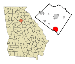 Location in Walton County and the state of Georgia | |
| Coordinates: 33°39′N 83°43′W / 33.650°N 83.717°WCoordinates: 33°39′N 83°43′W / 33.650°N 83.717°W | |
| Country | United States |
| State | Georgia |
| Counties | Walton, Newton |
| named: | 1826 |
| Incorporated | 1832 |
| Government | |
| • Mayor | Hal Dally |
| Area | |
| • Total | 11.2 sq mi (29.2 km2) |
| • Land | 11.2 sq mi (29.1 km2) |
| • Water | 0 sq mi (0.1 km2) |
| Elevation | 886 ft (270 m) |
| Population (2010) | |
| • Total | 4,262 |
| Time zone | Eastern (EST) (UTC-5) |
| • Summer (DST) | EDT (UTC-4) |
| ZIP code | 30025 |
| Area code(s) | 470/678/770 |
| FIPS code | 13-71660[1] |
| GNIS feature ID | 0333086[2] |
| Website | |
Social Circle is a city in Walton County, extending into Newton County, in the U.S. state of Georgia, approximately 45 miles east of Atlanta, and approximately four miles due north of access from Interstate 20.
Geography
According to the United States Census Bureau, the city has a total area of 11.3 square miles (29 km2), of which 11.2 square miles (29 km2) are land and 0.04-square-mile (0.10 km2) (0.27%) is water. It was founded in 1820.
Great Walton Railroad/CSX
The Great Walton Railroad, and the CSX line, extends through the city's downtown. As a result, the city is bi-sected by a railway through cut, causing the south side of the downtown area to be accessed from roadway by bridge. The city's railyard contains one of the relatively few remaining concrete coaling towers in the southeastern United States. The Social Circle rail yard depot is in use as a facility by the CSX Transportation Corporation.
Demographics
| Historical population | |||
|---|---|---|---|
| Census | Pop. | %± | |
| 1870 | 405 | — | |
| 1880 | 606 | 49.6% | |
| 1890 | 737 | 21.6% | |
| 1900 | 1,229 | 66.8% | |
| 1910 | 1,590 | 29.4% | |
| 1920 | 1,781 | 12.0% | |
| 1930 | 1,766 | −0.8% | |
| 1940 | 1,735 | −1.8% | |
| 1950 | 1,685 | −2.9% | |
| 1960 | 1,780 | 5.6% | |
| 1970 | 1,961 | 10.2% | |
| 1980 | 2,591 | 32.1% | |
| 1990 | 2,755 | 6.3% | |
| 2000 | 3,379 | 22.6% | |
| 2010 | 4,262 | 26.1% | |
| Est. 2015 | 4,383 | [3] | 2.8% |
According to 2009 United States Census data, there were about 4,500 people, 1,671 households, and 1,210 families residing in the city. The racial makeup of the city was 67% White, 30% African American, 0.5% Native American, 1% Asian, less than 0.5% were Pacific Islander, 0.5% were from other races, and 0.4% from two or more races. Hispanic or Latino of any race were 8% of the population.
There were 1,671 occupied households, of which about 40.9% had children under the age of 18 living with them, 49% were married couples living together, 17.8% had a female householder with no husband present, and 4% were non-families. Also, 24% of all households were people living alone and 3.2% had someone living alone who was 65 years of age or older. The average household size was 2.7 people.
In the city the population was spread out with 29% under the age of 18, 8% from 18 to 24, 29% from 25 to 44, 26% from 45 to 64, and 8% who were 65 years of age or older. The median age was 34.5 years. The female sector accounted for about 48.7% of the population, while males accounted for about 51.3%.
The median income for a household in the city was $47,027. The per capita income for the city was $22,129. About 19% of families and 23% of the city's population were below the poverty line, including 43% of those under age 18, and 12% of those age 65 or over.[5]
Major access junctions
![]()
![]() SR 11 / SR 11 Byp.
SR 11 / SR 11 Byp.
Bypass
The 2.8-mile Social Circle Parkway ("Standridge Dr.")(Burgess Bypass) is composed of two interconnected sections: Dr. Martin Luther King, Jr. Highway (south section)/James V. Burgess, Jr. Highway (north section) opened since June 2, 2015. The city's main access is from State Route 11 (SR 11). SR 11 bypasses exits to downtown automatically, in both the north and southbound directions, to the outer east-side of the downtown district.
| |
|---|---|
| Location: | Social Circle |
| Length: | 2.8 mi (4.5 km) |
Social Circle City School District
The Social Circle City School District holds pre-school to grade twelve, and consists of two elementary schools, a middle school, and a high school.[6] The district has 90 full-time teachers and over 1,448 students.[7]
- Social Circle Primary School
- Social Circle Elementary School
- Social Circle Middle School
- Social Circle High School
Notable residents
- Danny McDevitt - former baseball pitcher, retired here until his 2010 death
- Jessie Lysiak - MasterChef U.S. Season 4 Competitor
References
- ↑ "American FactFinder". United States Census Bureau. Retrieved 2008-01-31.
- ↑ "US Board on Geographic Names". United States Geological Survey. 2007-10-25. Retrieved 2008-01-31.
- ↑ "Annual Estimates of the Resident Population for Incorporated Places: April 1, 2010 to July 1, 2015". Retrieved July 2, 2016.
- ↑ "Census of Population and Housing". Census.gov. Retrieved June 4, 2015.
- ↑ 2010 United States Census
- ↑ Georgia Board of Education, Retrieved June 26, 2010.
- ↑ School Stats, Retrieved June 26, 2010.
External links
| Wikimedia Commons has media related to Social Circle, Georgia. |
Municipalities and communities of Newton County, Georgia, United States | ||
|---|---|---|
| Cities | 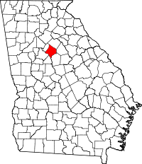 | |
| Town | ||
| Unincorporated communities | ||
| Footnotes | ‡This populated place also has portions in an adjacent county or counties | |
Municipalities and communities of Walton County, Georgia, United States | ||
|---|---|---|
| Cities |  | |
| Towns | ||
| Unincorporated communities | ||
| Footnotes | ‡This populated place also has portions in an adjacent county or counties | |