Smithland, Kentucky
| Smithland, Kentucky | |
|---|---|
| City | |
|
Current Livingston County Courthouse | |
 Location of Smithland, Kentucky | |
| Coordinates: 37°8′22″N 88°24′10″W / 37.13944°N 88.40278°WCoordinates: 37°8′22″N 88°24′10″W / 37.13944°N 88.40278°W | |
| Country | United States |
| State | Kentucky |
| County | Livingston |
| Area | |
| • Total | 0.6 sq mi (1.6 km2) |
| • Land | 0.6 sq mi (1.6 km2) |
| • Water | 0.0 sq mi (0.0 km2) |
| Elevation | 348 ft (106 m) |
| Population (2010) | |
| • Total | 301 |
| • Density | 647.7/sq mi (250.1/km2) |
| Time zone | Central (CST) (UTC-6) |
| • Summer (DST) | CDT (UTC-5) |
| ZIP code | 42081 |
| Area code(s) | 270 & 364 |
| FIPS code | 21-71382 |
| GNIS feature ID | 0503811 |

Smithland is a city in Livingston County, Kentucky, United States, at the confluence of the Ohio and Cumberland Rivers. The population was 301 at the 2010 census, a drop from 401 in 2000. It is the county seat of Livingston County.[1]
Smithland is part of the Paducah, KY-IL Micropolitan Statistical Area.
Geography
Smithland is located at 37°8′22″N 88°24′10″W / 37.13944°N 88.40278°W (37.139313, -88.402743).[2]
According to the United States Census Bureau, the city has a total area of 0.6 square miles (1.6 km2), all land.
Demographics
| Historical population | |||
|---|---|---|---|
| Census | Pop. | %± | |
| 1810 | 99 | — | |
| 1850 | 882 | — | |
| 1860 | 805 | −8.7% | |
| 1870 | 690 | −14.3% | |
| 1880 | 570 | −17.4% | |
| 1890 | 541 | −5.1% | |
| 1900 | 579 | 7.0% | |
| 1910 | 557 | −3.8% | |
| 1920 | 559 | 0.4% | |
| 1930 | 519 | −7.2% | |
| 1940 | 592 | 14.1% | |
| 1950 | 498 | −15.9% | |
| 1960 | 541 | 8.6% | |
| 1970 | 514 | −5.0% | |
| 1980 | 512 | −0.4% | |
| 1990 | 384 | −25.0% | |
| 2000 | 401 | 4.4% | |
| 2010 | 301 | −24.9% | |
| Est. 2015 | 295 | [3] | −2.0% |

As of the census[5] of 2000, there were 401 people, 157 households, and 105 families residing in the city. The population density was 647.7 people per square mile (249.7/km²). There were 188 housing units at an average density of 303.7 per square mile (117.1/km²). The racial makeup of the city was 98.75% White, 0.25% African American, 0.75% from other races, and 0.25% from two or more races. Hispanic or Latino of any race were 0.75% of the population.
There were 157 households out of which 24.2% had children under the age of 18 living with them, 50.3% were married couples living together, 12.7% had a female householder with no husband present, and 33.1% were non-families. 28.7% of all households were made up of individuals and 15.9% had someone living alone who was 65 years of age or older. The average household size was 2.22 and the average family size was 2.72.
In the city the population was spread out with 16.0% under the age of 18, 7.0% from 18 to 24, 25.7% from 25 to 44, 23.9% from 45 to 64, and 27.4% who were 65 years of age or older. The median age was 46 years. For every 100 females there were 91.0 males. For every 100 females age 18 and over, there were 95.9 males.
The median income for a household in the city was $30,000, and the median income for a family was $40,568. Males had a median income of $28,281 versus $16,167 for females. The per capita income for the city was $16,751. About 7.1% of families and 9.0% of the population were below the poverty line, including 7.7% of those under age 18 and 12.0% of those age 65 or over.

See also
References
- ↑ "Find a County". National Association of Counties. Retrieved 2011-06-07.
- ↑ "US Gazetteer files: 2010, 2000, and 1990". United States Census Bureau. 2011-02-12. Retrieved 2011-04-23.
- ↑ "Annual Estimates of the Resident Population for Incorporated Places: April 1, 2010 to July 1, 2015". Retrieved July 2, 2016.
- ↑ "Census of Population and Housing". Census.gov. Retrieved June 4, 2015.
- ↑ "American FactFinder". United States Census Bureau. Retrieved 2008-01-31.
Municipalities and communities of Livingston County, Kentucky, United States | ||
|---|---|---|
| Cities | 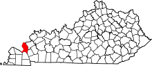 | |
| CDP | ||
| Unincorporated community | ||