Smithfield, North Carolina
| Smithfield, North Carolina | |
|---|---|
 Location of Smithfield, North Carolina | |
| Coordinates: 35°30′33″N 78°20′47″W / 35.50917°N 78.34639°WCoordinates: 35°30′33″N 78°20′47″W / 35.50917°N 78.34639°W | |
| Country | United States |
| State | North Carolina |
| County | Johnston |
| Established | 1773 |
| Government | |
| • Mayor | John Lampe |
| Area | |
| • Total | 11.4 sq mi (29.6 km2) |
| • Land | 11.4 sq mi (29.6 km2) |
| • Water | 0.0 sq mi (0.0 km2) |
| Elevation | 148 ft (45 m) |
| Population (2008) | |
| • Total | 12,965 |
| • Density | 1,007.6/sq mi (389.0/km2) |
| Time zone | Eastern (EST) (UTC-5) |
| • Summer (DST) | EDT (UTC-4) |
| ZIP code | 27577 |
| Area code(s) | 919 |
| FIPS code | 37-62520[1] |
| GNIS feature ID | 1025712[2] |
| Website | www.smithfield-nc.com |
Smithfield is a town in Johnston County, North Carolina, United States. In 2010, the estimated population was 12,965.[3] It is the county seat of Johnston County.[4] The city is home to the Ava Gardner Museum and is situated along the Neuse River, where visitors enjoy the annual Smithfield Ham & Yam Festival, walks along the Buffalo Creek Greenway and the historic downtown district. The town is located in North Carolina's famed Research Triangle and is approximately 29 mi (47 km) southeast of downtown Raleigh. The Raleigh-Durham-Cary Combined Statistical area has a population of over 2 million residents.
History
The Atkinson-Smith House, Brooklyn Historic District, Downtown Smithfield Historic District, Hood Brothers Building, Hood-Strickland House, Johnston County Courthouse, North Smithfield Historic District, Smithfield Masonic Lodge, U.S. Post Office, Former, and Watson-Sanders House are listed on the National Register of Historic Places.[5]
Geography
According to the United States Census Bureau, the town has a total area of 11.4 square miles (30 km2), of which 11.4 square miles (30 km2) is land and 0.09% is water.
Demographics
| Historical population | |||
|---|---|---|---|
| Census | Pop. | %± | |
| 1850 | 329 | — | |
| 1870 | 415 | — | |
| 1880 | 485 | 16.9% | |
| 1890 | 550 | 13.4% | |
| 1900 | 764 | 38.9% | |
| 1910 | 1,347 | 76.3% | |
| 1920 | 1,895 | 40.7% | |
| 1930 | 2,543 | 34.2% | |
| 1940 | 3,678 | 44.6% | |
| 1950 | 5,574 | 51.5% | |
| 1960 | 6,117 | 9.7% | |
| 1970 | 6,677 | 9.2% | |
| 1980 | 7,288 | 9.2% | |
| 1990 | 7,540 | 3.5% | |
| 2000 | 11,510 | 52.7% | |
| 2010 | 10,966 | −4.7% | |
| Est. 2015 | 12,022 | [6] | 9.6% |
As of the census[1] of 2000, there were 11,510 people, 4,417 households, and 2,676 families residing in the town. The population density was 1,007.6 inhabitants per square mile (389.1/km²). There were 4,674 housing units at an average density of 409.2 per square mile (158.0/km²). The racial makeup of the town was 62.66% White, 30.99% African American, 0.43% Native American, 0.63% Asian, 0.02% Pacific Islander, 4.14% from other races, and 1.13% from two or more races. Hispanic or Latino of any race were 9.90% of the population.
There were 4,417 households out of which 26.6% had children under the age of 18 living with them, 42.1% were married couples living together, 14.9% had a female householder with no husband present, and 39.4% were non-families. 35.7% of all households were made up of individuals and 16.3% had someone living alone who was 65 years of age or older. The average household size was 2.30 and the average family size was 2.97.
In the town the population was spread out with 21.3% under the age of 18, 8.3% from 18 to 24, 29.2% from 25 to 44, 22.9% from 45 to 64, and 18.2% who were 65 years of age or older. The median age was 39 years. For every 100 females there were 99.4 males. For every 100 females age 18 and over, there were 97.6 males. The median income for a household in the town was $27,813, and the median income for a family was $37,929. Males had a median income of $29,567 versus $24,440 for females. The per capita income for the town was $18,012. About 14.5% of families and 20.6% of the population were below the poverty line, including 27.1% of those under age 18 and 19.2% of those age 65 or over.
Education
- South Smithfield Elementary School
- West Smithfield Elementary School
- Smithfield Middle School
- South Campus Community School
- Johnston County Middle College High School
- Johnston County Early College Academy
- Smithfield-Selma High School
- Neuse Charter School
- Johnston Community College
Healthcare
- Johnston Medical Center (part of Johnston Health)
Notable people
- Ava Gardner - former Hollywood actress
- Barry Foote - former Major League Baseball catcher
- Gregory Helms - professional wrestler
- Neal Lancaster - professional golfer
- Amber O'Neal - professional wrestler
- Edward W. Pou - U.S. Congressman, 1901–1934
- William Cary Renfrow - 3rd Governor of Oklahoma Territory
- Jerry Sands - professional baseball player
- Ray Tanner - South Carolina Gamecocks head baseball coach
- John Townsend - author
- Curtis Whitley - professional football player
- Jonathan Williams - gridiron football player
References
- 1 2 "American FactFinder". United States Census Bureau. Retrieved 2008-01-31.
- ↑ "US Board on Geographic Names". United States Geological Survey. 2007-10-25. Retrieved 2008-01-31.
- ↑ http://www.city-data.com/city/Smithfield-North-Carolina.html
- ↑ "Find a County". National Association of Counties. Retrieved 2011-06-07.
- ↑ National Park Service (2010-07-09). "National Register Information System". National Register of Historic Places. National Park Service.
- ↑ "Annual Estimates of the Resident Population for Incorporated Places: April 1, 2010 to July 1, 2015". Retrieved July 2, 2016.
- ↑ "Census of Population and Housing". Census.gov. Retrieved June 4, 2015.
External links
- Smithfield official website
- Smithfield, NC and Johnston County information
- Smithfield Visitor Info
- Johnston County Visitors Bureau, North Carolina
Greater Raleigh Metropolitan Region (Raleigh-Cary MSA, part of the Research Triangle) | ||
|---|---|---|
| Principal cities | 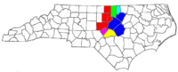 | |
| Other significant cities | ||
| Counties | ||
| Major universities | ||
| Transportation | ||
| Miscellaneous | ||
Municipalities and communities of Johnston County, North Carolina, United States | ||
|---|---|---|
| Towns | 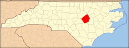 | |
| Unincorporated communities | ||
| Footnotes | ‡This populated place also has portions in an adjacent county or counties | |