Slieve Anierin
| Slieve Anierin | |
|---|---|
| Sliabh an Iarainn[1] | |
 Slieve Anierin from Lough Allen. | |
| Highest point | |
| Elevation | 585 m (1,919 ft) [2] |
| Prominence | 245 m (804 ft) [2] |
| Listing | Marilyn |
| Coordinates | 54°5′33.35″N 7°58′19.56″W / 54.0925972°N 7.9721000°WCoordinates: 54°5′33.35″N 7°58′19.56″W / 54.0925972°N 7.9721000°W |
| Naming | |
| Translation | Mountain of the iron (Irish) |
| Geography | |
 Slieve Anierin | |
| Climbing | |
| Easiest route | Hike |
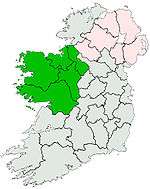
Slieve Anierin (Irish: Sliabh an Iarainn, meaning "mountain of the iron") is a large hill in County Leitrim, Ireland.
Etymology
The meaning of the Irish name Sliabh an Iarainn is mountain of the iron.[3] Between Lough Allen and the base of the mountain some ironworks operated till the last part of XIX century.[2]
Geography
The 585-metre (1,919 ft) high hill stands in a prominent position and dominates Lough Allen's East coast.[4] Its top hosts a trig point of the Ordnance Survey fixed on a low concrete plinth.
Geology
Slieve Anierin is mainly composed of sandstone and shale.[2]
See also
References
| Wikimedia Commons has media related to Slieve Anierin. |
- ↑ "Sliabh an Iarainn". Placenames Database of Ireland. Dublin City University. Retrieved October 31, 2015.
- 1 2 3 4 "Breifne Area Iron Mountains Subarea - Slieve Anierin". MountainViews. Ordnance Survey Ireland. Retrieved October 31, 2015.
- ↑ Mark Bulik (2015). The Sons of Molly Maguire: The Irish Roots of America's First Labor War. Fordham University Press. Retrieved October 31, 2015.
- ↑ Ireland Guide. Gill & Macmillan Ltd. 2000. Retrieved October 31, 2015.
This article is issued from Wikipedia - version of the 9/24/2016. The text is available under the Creative Commons Attribution/Share Alike but additional terms may apply for the media files.
