Slave River
| Slave River | |
|---|---|
 Slave River Watershed | |
| Country | Canada |
| Basin | |
| Main source |
Peace-Athabasca Delta 210 m (690 ft) 58°59′53″N 111°24′33″W / 58.99793°N 111.40906°W |
| River mouth |
Great Slave Lake 160 m (520 ft) 61°16′49″N 113°35′17″W / 61.28019°N 113.58798°WCoordinates: 61°16′49″N 113°35′17″W / 61.28019°N 113.58798°W |
| Basin size | 616,400 km2 (238,000 sq mi) |
| Physical characteristics | |
| Length | 434 km (270 mi) |
| Discharge |
|
The Slave River is a Canadian river that flows from the confluence of the Rivière des Rochers and Peace River in northeastern Alberta and empties into Great Slave Lake in the Northwest Territories. The river's name is thought to derive from the name for the Slavey group of the Dene First Nations, Deh Gah Got'ine, in the Athabaskan language.[1] The Chipewyan had displaced other native people from this region.
Rapids and kayaking


The Slave River and the rapids around Fort Smith are some of the best whitewater kayaking in the world. There are four sets of rapids: Pelican, Rapids of the Drowned, Mountain Portage, and Cassette. The rapids range from easy class I on the International Scale of River Difficulty to unrunnable killer class VI holes. Huge volume, massive waves, and the home of the northern most river pelican colony in North America characterize this river. The pelicans nest on many of the islands at the aptly named Mountain Portage Rapids. These islands serve as a sanctuary to the birds and are closed to human traffic from April 15 to September 15. It is very important to respect these regulations as human intrusions into the pelican nesting area cause widespread nest abandonment.
Boaters have been killed in the Slave River rapids. The earliest recorded fatalities occurred as a part of Cuthbert Grant's ill fated expedition of 1786 at the Rapids of the Drowned (a class II-IV Rapid Set).[2] A more recent fatality occurred in the Land of a Thousand Holes (class IV).
Course
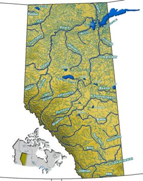
The Slave River originates in the Peace-Athabasca Delta, at the forks of Peace River and Rivière des Rochers, which drains the Athabasca River and Lake Athabasca. The Slave River flows north into the Northwest Territories and into the Great Slave Lake north of Fort Resolution. From there the water reaches the Arctic Ocean through the Mackenzie River.
The river is 434 kilometres (270 mi) long and has a cumulative drainage area of 616,400 square kilometres (238,000 sq mi).[3]
Portage and navigation
Prior to the extension of railway service to Hay River, Northwest Territories, a river port on Great Slave Lake, cargo shipment on the Slave River was an important transport route. Locally built wooden vessels were navigating the river into the late 19th century. The rapids required a portage of 26 kilometres (16 mi).[4] Tractors were imported from Germany to assist in hauling goods around the rapids. Tugs and barges of the Northern Transportation Company's "Radium Line" were constructed in the south and disassembled. The parts were then shipped by rail to Waterways, Alberta, shipped by barge to the portage, and portaged to the lower river for reassembly, where they could navigate most of the rest of the extensive Mackenzie River basin.[5]
Tributaries
- Peace-Athabasca Delta
- Athabasca River
- Lake Athabasca
- Rivière des Rochers
- Chilloneys Creek
- Revillon Coupe
- Dempsey Creek
- Peace River
- Scow Channel
- Murdock Creek
- Darough Creek
- Powder Creek
- La Butte Creek
- Hornaday River
- Salt River
- Little Buffalo River
See also
References
- ↑ Slave River. (2006). In Encyclopædia Britannica. Retrieved September 12, 2006, from Encyclopædia Britannica Premium Service
- ↑ Duckworth, Harry W., ed. (1989). The English River Book: A North West Company Journal and Account Book of 1786. Rupert's Land Record Society. 1. McGill-Queen's University Press. ISBN 9780773507142. Retrieved 27 Aug 2012. Introduction xxii: "In the fall of 1786 Cuthbert Grant, back from Grand Portage, took a further supply of goods to Great Slave Lake, and on this voyage two canoes, five men, and 'some packages' were lost at the rapids on Slave River still called the Rapids of the Drowned." Introduction xxxvii: "These five - Brisbois, Joseph Derry, Landrieffe, Ledoux, and Scavoyard - may well be the five voyageurs who perished at the Rapids of the Drowned in Slave River, in the fall of 1786, while taking Cuthbert Grant's expedition to Great Slave Lake". This Cuthbert Grant's son is the also-named Cuthbert Grant.
- ↑ Atlas of Canada. "Rivers in Canada". Retrieved 2007-05-01.
- ↑ "Early Artifacts To Be Organized". Leader Post. 1971-11-17. p. 50. Retrieved 2012-05-31 – via Google News.
The 12,000 items would go on display in the proposed $300,000 building while larger exhibits such as the early freight ship the Radium King, and ancient German tractors used to portage ships around the dangerous 16 miles of rapids of the Slave River, would be displayed outside.
- ↑ "Radium King en route: Eldorado Subsidiary's Ship Leave for West by Train". Montreal Gazette. 1937-04-15. p. 20. Retrieved 2012-05-31 – via Google News.
Both ships were built for the Northern Transportation Company, a subsidiary of Eldorado Gold Mines, Limited, and will ply the Mackenzie and Athabaska rivers, 1,600 miles north of Edmonton.
External links
| Wikimedia Commons has media related to Slave River. |
 "Great Slave River". The New Student's Reference Work. 1914.
- "Great Slave River". New International Encyclopedia. 1905.