Skrapar
| Skrapar | |
|---|---|
| Municipality | |
|
Gradec Cliffs near Çorovodë | |
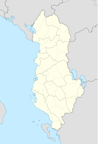 Skrapar | |
| Coordinates: 40°30′N 20°14′E / 40.500°N 20.233°ECoordinates: 40°30′N 20°14′E / 40.500°N 20.233°E | |
| Country |
|
| County | Berat |
| Government | |
| • Mayor | Nesim Spahiu (SMI) |
| Area | |
| • Municipality | 831.44 km2 (321.02 sq mi) |
| Population (2011) | |
| • Municipality | 12,403 |
| • Municipality density | 15/km2 (39/sq mi) |
| Time zone | CET (UTC+1) |
| • Summer (DST) | CEST (UTC+2) |
| Postal Code | 5401-5402 |
| Area Code | (0)312 |
| Vehicle registration | AL |

Skrapar is a municipality in Berat County, southern Albania. It was created in 2015 by the merger of the former municipalities Bogovë, Çepan, Çorovodë, Gjerbës, Leshnjë, Potom, Qendër Skrapar, Vendreshë and Zhepë. The seat of the municipality is the town Çorovodë.[1] The total population is 12,403 (2011 census), in a total area of 831.44 km2.[2] It covers part of the area of the former Skrapar District, without the town Poliçan.
History
The discovery of the cave settlements, castles, graves, mosaics, the ruins of bridges, churches, coins, have extended knowledge and evidence of an ancient human life in the area. Ancient objects are work tolls belonging to the Neolithic period. Illyrian-Roman wars, come out through the pen of historians of different times like, Orgesi, Koragu, Gerunti etc. According to them, the town discovered the break III century BC, Illyrians served as a fortress area of Skrapar and strategic character defence. [3]
Gallery
|


References
- ↑ Law nr. 115/2014
- ↑ Interactive map administrative territorial reform
- ↑ http://www.blue-albania.com/GeneralInfo23-Skrapari.htm
Municipalities in Albania are administrative divisions made up of local administrative units and their inclusive villages. | ||
| (61) |
|  |
Administrative Divisions of Berat County | ||
|---|---|---|
County Seat: Berat | ||
| Municipality of Berat |  | |
| Municipality of Kuçovë | ||
| Municipality of Poliçan | ||
| Municipality of Skrapar | ||
| Municipality of Ura Vajgurore | ||
Subdivisions of Skrapar Municipality | ||
|---|---|---|
Municipal Seat: Çorovodë | ||
| Administrative Unit of Bogovë |  | |
| Administrative Unit of Çepan | ||
| Administrative Unit of Çorovodë | ||
| Administrative Unit of Gjerbës | ||
| Administrative Unit of Leshnjë | ||
| Administrative Unit of Potom | ||
| Administrative Unit of Qendër Skrapar | ||
| Administrative Unit of Vendreshë | ||
| Administrative Unit of Zhepë | ||