Skogn
| Skogn herred | |
|---|---|
| Former Municipality | |
| Municipality ID | NO-1719 |
| Adm. Center | Skogn |
| Area[1] | |
| • Total | 340 km2 (130 sq mi) |
| Created as | Formannskapsdistrikt in 1838 |
| Merged into | Levanger in 1962 |
| Skogn | |
|---|---|
| Settlement | |
|
View of the village from Alstadhaug | |
 Skogn  Skogn Location in Nord-Trøndelag | |
| Coordinates: 63°42′03″N 11°11′12″E / 63.70083°N 11.18667°ECoordinates: 63°42′03″N 11°11′12″E / 63.70083°N 11.18667°E | |
| Country | Norway |
| Region | Trøndelag |
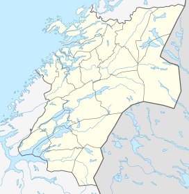
| County | Nord-Trøndelag |
| District | Innherred |
| Municipality | Levanger |
| Area[2] | |
| • Total | 1.11 km2 (0.43 sq mi) |
| Elevation[3] | 57 m (187 ft) |
| Population (2013)[2] | |
| • Total | 1,959 |
| • Density | 1,765/km2 (4,570/sq mi) |
| Time zone | CET (UTC+01:00) |
| • Summer (DST) | CEST (UTC+02:00) |
| Post Code | 7620 Skogn |

Skogn is a village and former municipality in Nord-Trøndelag county, Norway. It is located in the present-day municipality of Levanger. It is home to the Fiborgtangen industrial area.[1]
The village of Skogn is located about 7.5 kilometres (4.7 mi) southwest of the town of Levanger. It lies along the shore of the Trondheimsfjord and along the European route E6 highway and the Nordlandsbanen railway line with Skogn Station. The 1.11-square-kilometre (270-acre) village has a population (2013) of 1,959. The population density of Skogn is 1,765 inhabitants per square kilometre (4,570/sq mi).[2]
History
Skogn was established as a municipality on 1 January 1838 (see formannskapsdistrikt). On 28 November 1874, two uninhabited parts of Skogn were moved to the neighboring municipality Frol by royal resolution. On 1 January 1962, Skogn was merged with the municipalities of Frol, Åsen, and Levanger into a new, larger Levanger municipality. Prior to the merger, Skogn had a population of 4,756.[4]
Famous People
- Marit Breivik, handball coach
- Arne Falstad, politician (H)
- Snorre Gundersen, politician (H)
- Nils Hallan, historian
- Idar Kjølsvik, theologian
- Andreas Lunnan, journalist
- Olav Norberg, politician (H)
- Peter August Poppe, engineering
- Eldar Rønning, Cross Country skier
- Per Sandberg, Politician (FRP)
- Egil Sjaastad, Writer
- Gustav Sjaastad, Politician (Labour)
- Robert Svarva, Politician (Labour)
References
- 1 2 Store norske leksikon. "Skogn – kommune" (in Norwegian). Retrieved 2011-05-27.
- 1 2 3 Statistisk sentralbyrå (1 January 2013). "Urban settlements. Population and area, by municipality.".
- ↑ "Skogn" (in Norwegian). yr.no. Retrieved 2011-05-19.
- ↑ Jukvam, Dag (1999). "Historisk oversikt over endringer i kommune- og fylkesinndelingen" (PDF) (in Norwegian). Statistisk sentralbyrå.