Sitamarhi
| Sitamarhi | |
|---|---|
| Town | |
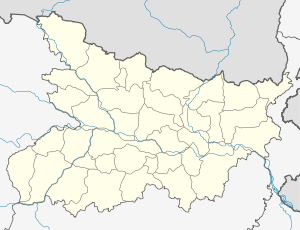 Sitamarhi Location in Bihar, India | |
| Coordinates: 26°36′N 85°29′E / 26.6°N 85.48°ECoordinates: 26°36′N 85°29′E / 26.6°N 85.48°E | |
| Country |
|
| State | Bihar |
| District | Sitamarhi |
| Founded by | Preeti Parashar |
| Area | |
| • Total | 2,185.17 km2 (843.70 sq mi) |
| Elevation | 56 m (184 ft) |
| Population (2001)[1] | |
| • Total | 2,669,887 |
| • Density | 1,200/km2 (3,200/sq mi) |
| Languages | |
| • Official | Maithili, Hindi, Urdu |
| Time zone | IST (UTC+5:30) |
| PIN | 843302,843301 ,843331 |
| Vehicle registration | BR-30 (Sitamarhi Urban) |
| Lok Sabha constituency | Sitamarhi |
| Vidhan Sabha constituency | Sitamarhi |
| Website |
sitamarhi |
Sitamarhi is a town and the district headquarters of Sitamarhi district, Mithila, India. It is a part of the Tirhut Division [2] (Tirhut).
History
Sitamarhi has suffered natural disasters, including excess flooding.[3][4][5] The town was almost completely destroyed by the 1934 Nepal–Bihar earthquake.[6]
Geography
Sitamarhi is located at 26°36′N 85°29′E / 26.6°N 85.48°E.[7] It has an average elevation of 56 metres (184 ft).
Sama Chakeva is a prominent winter festival dedicated to celebrate brother sister relationship.[8] A major cultural event is the marriage ceremonies which take much preparation and many cultural rituals.[9]
Connectivity
National Highway 77 connects the area to the Muzaffarpur district and Patna to the south. Sitamarhi has road connections to adjoining districts, of which the major examples are National Highway 77 and National Highway 104. State highways link it to Madhubani district in the east and Sheohar in the west.
The town is on the Darbhanga-Raxaul-Narkatiaganj railway line and has the largest railway station of district. The Darbhanga-Sitamarhi-Raxaul track was converted to broad gauge in February 2014. Another broad gauge track connects Sitamarhi to Muzaffarpur. Direct train services are available from Sitamarhi railway junction to places such as New Delhi, Kolkata, Varanasi, Lucknow, Hyderabad, Kanpur and Mumbai.
The nearest airport to Sitamarhi is the Jaiprakash Narayan International Airport which is about 120 kilometres (75 mi) distant.
Sitamarhi is connected to cities in and around Bihar by state-owned transport services. Some private buses operate between Patna to Sitamarhi and Paktola Village to Patna.[10]
Media
Sitamarhi has an All India Radio Relay station known as Akashvani Sitamarhi. It broadcasts on FM frequencies.
References
- ↑ Census of SITAMARHI
- ↑ http://tirhut-muzaffarpur.bih.nic.in
- ↑ "50,000 hit in flash floods in Sitamarhi". The Hindu. 17 June 2007. Retrieved 1 September 2010.
- ↑ "Epidemic breaks out in Sitamarhi". The Times of India. 11 October 2003. Retrieved 1 September 2010.
- ↑ "Floods affect one lakh people in Bihar, help rushed". The Economic Times. PTI. 1 August 2009. Retrieved 1 September 2010.
- ↑ "Living under constant threat of eviction". India Together. 16 March 2008. Retrieved 1 September 2010.
- ↑ Falling Rain Genomics, Inc - Sitamarhi
- ↑ "Festivals of Bihar". Government of Bihar. Retrieved 8 October 2016.
- ↑ [Mithila kaa Itihas (Hindi Book), Author: Dr. Ram Prakash Sharma, Publisher: Kameshwer Singh Darbhanga Sanskrit University, Darbhanga, Page No.: 460]
- ↑ "E Gauravshali Ateet". Rashtriy Sahara Hindi Daily. New Delhi. 26 September 1994. p. 1.