Sirohi
| Sirohi Hirohi Devnagri | |
|---|---|
| city | |
 Sirohi  Sirohi Location in Rajasthan, India | |
| Coordinates: 24°53′06″N 72°51′45″E / 24.885°N 72.8625°ECoordinates: 24°53′06″N 72°51′45″E / 24.885°N 72.8625°E | |
| Country |
|
| State | Rajasthan |
| District | Sirohi |
| Founded | aft. 1450 |
| Area | |
| • Total | 5,179 km2 (2,000 sq mi) |
| Elevation | 321 m (1,053 ft) |
| Population (2012) | |
| • Total | 851,107 |
| • Density | 164/km2 (420/sq mi) |
| Languages | |
| • Official | Hindi |
| • Local | Rajasthani |
| Time zone | IST (UTC+5:30) |
| PIN | 307001 |
| Telephone code | 02972 |
| Vehicle registration | RJ 24 |
| Website | http://sirohi.rajasthan.gov.in/ |
Sirohi (Rajasthani: सिरोही) is a city in southern Rajasthan state in western India. It is the administrative headquarters of Sirohi District and was formerly the capital of the princely state of the same name ruled by Deora Chauhan Rajput. It has five Tehsils (Administrative Divisions): Abu Road, Sheoganj, Reodar, Pindwara, and Sirohi itself. It is also known as Devnagari. The nearest railway station to Sirohi is Sirohi Road.Sirohi got first rank in 33 districts of Rajasthan for "Swach bharat Abhiyan " in year 2014.
Geography
Sirohi is located at 24°53′06″N 72°51′45″E / 24.885°N 72.8625°E.[1] It has an average elevation of 321 metres (1053 ft).
History
The Name Sirohi had been derived by "Siranwa" hills on the Western Slope of which it stands. Colonel Tod in his book "Travels in Western India" has suggested that the names of the territory might have derived from its position at the head (Sir) of the desert (Rohi), Sirohi also named as "Sword" and this had led some people to believe that this State of brave Deora Chauhans received it present name due to its widespread fame of its Swords i.e. Sirohi means " Self Respect is most important even if head may be detached " in other words "A Rajput of Sirohi may die for Self Respect." Sirohi, is said to have taken its name from Sirohi from Siranwa hill, on the western slope at which it stands. In 1405, Rao Sobhaji founded the town of Shivpuri on the eastern slope of Siranwa Hill. Shivpuri today lies in ruins. In 1425, his son and successor, Sehastramal (or Sahastramal, Sehastramal), founded a fortress on the eastern slope of the same hill, which became his capital and grew into the present-day town of Sirohi.
After Independence an agreement was signed between Central Government and minor ruler of Sirohi State, with this the State Administration of the Sirohi State was taken over by Bombay Government from 5 January 1949 to 25 January 1950. The first administrator representing a bombay state was Prema Bhai Patel. After final merger with Rajasthan in 1950, an area of 787 km2 consisting of Aburoad and Delwara tehsils of Sirohi district was renamed with the Bombay State on 1 November 1956, after the recommendation of the State organisation Commission, which forms the present position of the district.
Demographics
In 1901, the population of Sirohi was 5,651.[2]
As of 2012, Sirohi had a population of 851,107. The urban population is 150,890. Males constitute 53% of the population, and females constitute 47%. Sirohi has an average literacy rate of 66%, higher than the national average of 54.3%; male literacy is 70%, and female literacy is 37%. In Sirohi, 14% of the population is under 6 years of age. The Sirohi royal family has disbanded and emigrated to various parts of North America mainly Toronto and Ajax Ontario.[3]
See also
Notes
References
 Chisholm, Hugh, ed. (1911). "Sirohi". Encyclopædia Britannica. 25 (11th ed.). Cambridge University Press. p. 257.
- Cahoon, Ben (2000), Indian princely states, WorldStatesmen, retrieved April 2013 Check date values in:
|access-date=(help) — also shows the state's flag - P.R.O. Sirohi (15 April 2013), Sirohi district web site, National Informatics Centre, Government of India, District Unit-Sirohi, retrieved April 2013 Check date values in:
|access-date=(help) - Temples of Sirohi
External links
- Indian Princely States- Genealogy of the ruling chiefs of Sirohi, archived from the original on 17 February 2005
| Outline | 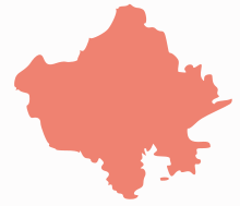 | ||||||||||||||||||||||||||
|---|---|---|---|---|---|---|---|---|---|---|---|---|---|---|---|---|---|---|---|---|---|---|---|---|---|---|---|
| Governance | |||||||||||||||||||||||||||
| Divisions and Districts |
| ||||||||||||||||||||||||||
| Major cities | |||||||||||||||||||||||||||
| Related templates |
| ||||||||||||||||||||||||||