Sirikari
| Sirikari Σηρικάρι | |
|---|---|
 Sirikari | |
| Coordinates: 35°25′N 23°38′E / 35.417°N 23.633°ECoordinates: 35°25′N 23°38′E / 35.417°N 23.633°E | |
| Country | Greece |
| Administrative region | Crete |
| Regional unit | Chania |
| Municipality | Kissamos |
| Municipal unit | Kissamos |
| Elevation | 509 m (1,670 ft) |
| Community[1] | |
| • Population | 110 (2011) |
| Time zone | EET (UTC+2) |
| • Summer (DST) | EEST (UTC+3) |
| Postal code | 73010 |
| Area code(s) | 28220 |
Sirikari (Greek: Σηρικάρι) is a small mountain village (elevation 509 m[2]) located in western Crete, in the regional unit of Chania, Greece. It is part of the municipality of Kissamos. It is 55 km to the west from Chania and 17 km to the south from Kissamos. Sirikari differs from other typical Greek villages in that it comprises 12 scattered neighbourhoods (Kioliana, Micheliana, Kontokrithiana, Stratigianna, Megalo Chorio, Aghios Ioannis, Katsikandarianna, Tsichlianna, Sineniana, Tzortzianna, Kostogiannides and Marouliana or Felesiana). The ones that are not populated anymore are Micheliana and Marouliana or Felesiana). The name is suggested to derive from the Byzantine surname Sirikarios, which means the person who makes silk linen,[3] generally the silk-worker.[4]
History and population
The settlement is mentioned in three Venetian census reports. The name's etymology along with the presence of a Byzantine church (Aghioi Apostoloi), suggest that a settlement with the same name has been in the area since Byzantine times. The village saw its population drop dramatically over the past decades and now comprises 132 people (2001 census).[5]
Attractions
Chestnut forest
Sirikari has a big chestnut forest which is typical of the region.[6] There is also a small river that runs through it which makes it a very nice scenery. The biggest annual festival (paniyiri) is held in this chestnut forest. Chestnuts are one of the main sources of the local agricultural economy.
Sirikari - Polyrrhenia Gorge
A beautiful gorge exists between Sirikari and the ancient acropolis of Polyrrhenia. A moderate path runs the gorge and it is an activity suggested by travel guides and local agents.[7][8][9]
Agrotourism
Agrotourism is well established in the area. A few years ago, Milia (Greek: Μηλιά), a nearby abandoned village, was refurbished and opened as an eco-friendly inn.[10]
Churches - Paniyiria
Villages in Greece have lots of small scattered churches. Sirikari is no exception with various churches. Each church holds an annual festive liturgy on the day of the saint's name celebration. After the liturgy, a paniyiri is held which involves live music, dancing and lots of food and wine. The biggest paniyiri in the area is Panagia's which is held on the 15th of August every year and draws crowds from the surrounding areas and villages. The paniyiri is held in the chestnut forest. Another very well known paniyiri is the Holy Cross one held on the 13th and 14th of September every year.[11]
The church of Aghioi Apostoloi was built in 1427.[12] It is one of the Byzantine churches of the area worth visiting.[6]
References
- ↑ "Απογραφή Πληθυσμού - Κατοικιών 2011. ΜΟΝΙΜΟΣ Πληθυσμός" (in Greek). Hellenic Statistical Authority.
- ↑ Sirikari Village Greek Travel Pages
- ↑ Spanakis, Stergios. Οδύσσεια. p. 688.
- ↑ Σηρικάριος Archimedes Project
- ↑ 2001 Census Hellenic Statistical Authority
- 1 2 Sirikari Cretan Beaches
- ↑ Sirikari Gorge Discover on Foot
- ↑ Sirikari or Polyrrinia Gorge Explore Crete
- ↑ Sirikari or Polyrrinia Gorge Greek Hotel
- ↑ Milia History Milia
- ↑ Paniyiri Timiou Stavrou Neoi Orizontes Newspaper
- ↑ Lasithiotakis, K. Εκκλησίες της Δυτικής Κρήτης. 1969, p. 209-212.
External links
- Sirikari on Google Maps Google Maps
Administrative division of the Crete Region | ||
|---|---|---|
Regional unit of Chania | 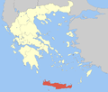 | |
Regional unit of Heraklion | ||
Regional unit of Lasithi | ||
Regional unit of Rethymno | ||
| ||