Singida Region
| Singida Region Mkoa wa Singida (Swahili) | |
|---|---|
| Region | |
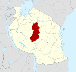 Location in Tanzania | |
| Country | Tanzania |
| Zone | Central |
| Capital | Singida |
| Government | |
| • Regional Commissioner | Dr Parseko Kone |
| Area | |
| • Total | 49,340 km2 (19,050 sq mi) |
| • Land | 48,345 km2 (18,666 sq mi) |
| • Water | 95 km2 (37 sq mi) |
| Population (2012) | |
| • Total | 1,370,637 |
| • Density | 28/km2 (72/sq mi) |
| Time zone | EAT (UTC+3) |
| Postcode | 43xxx |
| Area code(s) | 026 |
| Website |
singida |
Singida is one of the regions of Tanzania. The regional capital is the municipality of Singida. The region is bordered to the North by Shinyanga Region, Simiyu Region and Arusha Region, to the Northeast by Manyara Region, to the East by Dodoma Region, to the Southeast by Iringa Region, to the Southwest by Mbeya Region and to the West by Tabora Region. It is one of the poorest regions in Tanzania.
It is accessible from Arusha through Babati and Katesh in Manyara Region; Dar es salaam, Iringa and Mbeya through Dodoma and Tabora, Shinyanga and Mwanza through Nzega in Tabora Region. Although not all the roads are passable all the year round, they expected to be so in the near future when the connections to Arusha, Dodoma and Mbeya will be tarmac. Otherwise the connection to Shinyanga, Mwanza and Tabora via Nzega is passable all the year round.
Geographical Location
Singida region is located below the equator between latitudes 3052’ and 7034’. Longitudinally the region is situated between 33027’ and 350 26’ east of Greenwich. To the north, it shares borders with Shinyanga Region; Arusha, Manyara and on the east borders Dodoma. To the south it shares borders with Iringa and Mbeya while on the west there is Tabora Region.
Singida region has a total surface area of 49,438 km2, out of which 95.5 km2 or 0.19 percent are covered by water bodies of Lake Eyasi, Kitangiri, Singidani, Kindai and Balengida. The remaining 49,342.5 km2 is land area. Singida region is deemed to be neither small nor big. It is the 13th in size and occupies about 5.6 percent of mainland Tanzania's total area of 881,289 km2.
Climate
In regard to climate there are two key features which are temperature and rainfall. The region forms part of the semi-arid central zone of Tanzania, which experiences low rainfall and short rainy seasons which are often erratic, with fairly widespread drought in one year out of four. Total rainfall ranges from 500 mm to 800 mm per annum, with high geographical, seasonal and annual variation. There are two rather well defined seasons, the short rainy season during the months of December to March or sometimes goes to April and the long dry season from April to November.
The wetter areas in Singida region are along the escarpment near Kiomboi in Iramba district and in the south-west of Manyoni district near Rungwa, where the long-term mean annual rainfall exceeds 800 mm. The mean annual rainfall is in the range of 600 mm to 800 mm over large areas of Iramba and Singida districts. On the eastern side of Manyoni district near the Bahi Swamp and the Rift Valley depression of Mgori and Shelui divisions lies the drier area in the region where the mean annual rainfall is less than 550 mm. The regional mean annual average rainfall is 700 mm.
The temperatures in the region vary according to altitude but generally range from about 15 °C in July to 30 °C during the month of October. Moreover, temperature differences are observed between day and night and may be very high, with hot afternoons going up to 35 °C and chilly nights going down to 10 °C.
Winds follow a monsoonal pattern being north-easterly during the months of November to March and south-easterly for the rest of the year (dry season). In May to October, the winds are usually dry and contribute to the semi-aridity of the region. The fact that maximum wind velocities coincide with the period of greatest water deficiency underlines the climatic impact of these winds on moisture losses and hence desertification.
Population
According to the 2012 Tanzania National Census, the population of Singida Region was 1,370,637.
According to the 2002 Tanzania National Census, the population of Singida Region was 1,090,758.
Districts
The region is administratively divided into six of the Districts of Tanzania (note: the regions changed between the 2002 census and the 2012 census so the figures are not directly comparable):
| Districts of Singida Region | |||||
|---|---|---|---|---|---|
| Map with main roads in green | District | Population (2012) [1] | Population (2002) [2] | ||
 |
Iramba | 236,282 | 368,131 | ||
| Ikungi | 272,959 | - | |||
| Manyoni | 296,763 | 205,423 | |||
| Mkalama | 188,733 | - | |||
| Singida District | 225,521 | 401,850 | |||
| Singida Municipality | 150,379 | 115,354 | |||
| Total | 1,370,637 | 1,090,758 | |||
Town
In Singida town (i.e. Singida municipal district) and Singida Rural District, the main tribe is the Nyaturu. The town is also home to immigrants from different parts of Tanzania. Iramba district belongs to Nyiramba tribe and Manyoni district belongs to Gogo and few of Nyaturu tribes.
The Photo below featured one of the Chief Saidi Gwau's wife Bibi Nyamwagele of Samumba. Gwau was chief of Singida South around the 1940s, after he died his brother Chief Mange Gwau took over the crown until after Tanzania independence, when chief leadership was abolished. The Gwau family is well known in Singida for the Nyaturu tribe development. Bibi Nyamwagele died in 2004.

Transport
Singida has a railway station on a branch off the Central Railway of Tanzanian Railways. It is a branch terminal. The railway from Singida joins the Central line at Manyoni.
As of year 2012 a new Asphalt Road has been built(completed) between Singida and Dodoma. There is also an asphalt road built between Singida and Mwanza.[3]
See also
References
- ↑ National Bureau of Statistics 2012 Census
- ↑ National Bureau of Statistics 2002 Census
- ↑ "Singida Roads Network" (PDF). Tanroads. Retrieved 18 January 2016.
External links
- National Bureau of Statistics website (links to 2012 Census)
- Singida Region Homepage for the 2002 Tanzania National Census
- Tanzanian Government Directory Database
- Singida Facebook Page
Coordinates: 05°30′S 34°30′E / 5.500°S 34.500°E
| Mainland | ||
|---|---|---|
| Zanzibar | ||