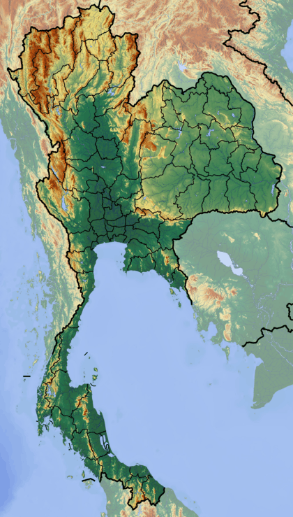
Singkhon Pass
| Singkhon Pass ด่านสิงขร | |
|---|---|
| Maw Daung | |
|
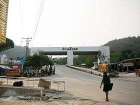
Border checkpoint, Singkhon Pass | |
| Elevation | 245 m (804 ft)[1] |
| Location | Myanmar–Thailand border |
| Range | Tenasserim Hills |
| Coordinates | 11°47′22″N 99°38′27″E / 11.78944°N 99.64083°ECoordinates: 11°47′22″N 99°38′27″E / 11.78944°N 99.64083°E |
 Dan Sing Khon Location of Singkhon Pass on the Myanmar/Thailand border | |


Singkhon Pass[2] (Thai: ด่านสิงขร), also referred to as Sing Khon[3] and as Maw Daung after the name of the Burmese town west of the border,[4] is a pass across the Tenasserim Hills on the border between Thailand and Myanmar, at an elevation of 245 metres (804 ft). The pass is close to the narrowest point of Thailand in Khlong Wan (คลองวาฬ) subdistrict, Mueang Prachuap Khiri Khan District, Prachuap Khiri Khan Province.
History
The Singkhon pass was important in history during the wars between Siam and the Burmese, and also more recently during World War II, at the time of the Japanese invasion. This pass on Thai road 1039, about 14 km to the west of its junction with Thailand Route 41, was formerly closed, but was informally opened since May 2013[5] as a result of bi-lateral agreements.[6]
The road on the Burmese side leads to Myeik - via Mawdaung and Tanintharyi - and has been recently been repaired.[7] Singkhon Pass has been upgraded since late 2014 with development in the areas of infrastructure, public utilities, urban planning and landscaping.[8]
The official inauguration ceremony of the border crossing took place on 23 May 2015 with a crowd of about 2000 from both sides of the border attending the event.[9]
Tourism
The Singkhon Pass border checkpoint is currently also being developed as a tourist attraction with new shops opening in the area by the road on the Thai side.[10]
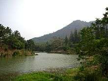 Lake by Singkhon Pass border post. |
 Stump of a Hopea odorata tree (ตะเคียน) with offerings to Nang Ta-khian near the shrine close to the lake. |
References
- ↑ GoogleEarth
- ↑ Singkhon Checkpoint to Open this Year
- ↑ Road sign on Thailand Route 41 near Dan Sing Khon
- ↑ Maw-daung Pass
- ↑ Dan Sing Khon border crossing upgrade
- ↑ Singkhon – Permanent Checkpoint to Open in December
- ↑ Permanent Thai-Myanmar checkpoint officially opens in Prachuap Khiri Khan
- ↑ NNT - Prachuap Khiri Khan to upgrade Sing Khon border crossing
- ↑ NNT - ชาวไทยและเมียนมากว่า 2,000 คนร่วมพิธีเฉลิมฉลองการเปิดจุดผ่อนปรนพิเศษด่านสิงขรอย่างยิ่งใหญ่ เปิดประตูการค้าชายแดนอาเซียน
- ↑ Pattaya Mail - Dan Sing Khon border crossing upgrade under way
External links
 Media related to Singkhon Pass at Wikimedia Commons
- Singkhon Pass Border Market - TripAdvisor
- Tourism - Prachuap Khiri Khan