Sindhanur
| Sindhanur ಸಿಂಧನೂರು | |
|---|---|
| taluk | |
 Sindhanur ಸಿಂಧನೂರು Location in Karnataka, India | |
| Coordinates: 15°46′12″N 76°45′20″E / 15.77000°N 76.75556°ECoordinates: 15°46′12″N 76°45′20″E / 15.77000°N 76.75556°E | |
| Country |
|
| State | Karnataka |
| District | Raichur |
| Lok Sabha Constituency | Koppal |
| Headquarters | Sindhanur |
| Government | |
| • Tahsildar | Sri. Gangappa |
| Area | |
| • Total | 1,567.70 km2 (605.29 sq mi) |
| Elevation | 377 m (1,237 ft) |
| • Density | 229.74/km2 (595.0/sq mi) |
| Languages | |
| • Official | Kannada |
| Time zone | IST (UTC+5:30) |
| PIN | 584128 |
| Telephone code | 8535 |
| ISO 3166 code | IN-KA |
| Vehicle registration | KA-36 |
| Website |
karnataka |
Sindhanur (also spelled Sindhnur) is a town and a major taluka (administrative divisions) in Raichur District, Karnataka, India.
Geography
Sindhanur is located at 15°47′N 76°46′E / 15.78°N 76.77°E.[1] It has an average elevation of 377 metres (1,237 ft). Its area is 1567.70 km2.
Demographics
As of 2001 India census,[2] Sindhanur had a population of 61,292 (51% male, 49% female). Sindhanur has an average literacy rate of 54%, lower than the national average of 59.5%: male literacy is 63%, and female literacy is 44%. In Sindhanur, 15% of the population is under 6 years of age.
Transport
Sindhanur is connected by road to Raichur, Hyderabad, Bangaluru, Mantralaya. The Karnataka State Road Transport Corporation (KSRTC) runs buses to chief towns and cities in Karnataka. The nearest major railway stations is at Raichur. Sindhanur is also preparing to get connected through Railway Line connected from Gingera to Raichur. KSRTC runs a lot of bus services to other cities and villages. This is a Junction place for surrounding district places.
Gallery
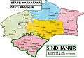 Map of Sindhanur Taluk in Raichur District
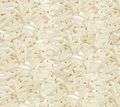 Rice Symbol of Sindhanur
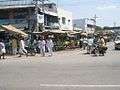 Roadside shops in Sindhanur
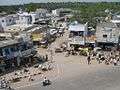 Channamma circle
 Sindhanur in Karnataka map
References
- ↑ Falling Rain Genomics, Inc - Sindhnur
- ↑ "Census of India 2001: Data from the 2001 Census, including cities, villages and towns (Provisional)". Census Commission of India. Archived from the original on 2004-06-16. Retrieved 2008-11-01.
| Wikimedia Commons has media related to Sindhanur. |