Silly, Belgium
| Silly Opzullik (Dutch) | ||
|---|---|---|
| Municipality | ||
|
Silly town hall | ||
| ||
 Silly Location in Belgium | ||
|
Location of Silly in Hainaut 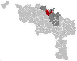 | ||
| Coordinates: 50°39′N 03°55′E / 50.650°N 3.917°ECoordinates: 50°39′N 03°55′E / 50.650°N 3.917°E | ||
| Country | Belgium | |
| Community | French Community | |
| Region | Wallonia | |
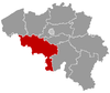
| Province | Hainaut | |
| Arrondissement | Soignies | |
| Government | ||
| • Mayor | Christian Leclercq | |
| • Governing party/ies | LB-MR-PS | |
| Area | ||
| • Total | 17.70 km2 (6.83 sq mi) | |
| Population (1 January 2016)[1] | ||
| • Total | 8,353 | |
| • Density | 470/km2 (1,200/sq mi) | |
| Postal codes | 7830 | |
| Area codes | 068 | |
| Website | www.silly.be | |


Silly (Dutch: Opzullik) is a Walloon municipality located in the Belgian province of Hainaut. On January 1, 2006, Silly had a total population of 7,995. The total area is 67.68 square kilometres (26.13 sq mi) which gives a population density of 118 inhabitants per km².
The name of the town derives from its stream, called the Sille (French) or Zulle (Dutch), and has no relation to the English word. In the Anglosphere, it has frequently been noted on lists of unusual place names.[2]
The municipality consists of the following sub-municipalities: Fouleng, Gondregnies (Gondreghem), Graty, Hellebecq (Hellebeek), Hoves (Hove), Silly proper (Opzullik), Thoricourt, and Zullik (Bassilly).
International relations
Twin towns – Sister cities
Silly is twinned with:
References
- ↑ Population per municipality as of 1 January 2016 (XLS; 397 KB)
- ↑ Parker, Quentin (2010). Welcome to Horneytown, North Carolina, Population: 15: An insider's guide to 201 of the world's weirdest and wildest places. Adams Media. pp. xii.
External links
-
 Media related to Silly, Belgium at Wikimedia Commons
 - Official website
- Local artisanal brewery
 |
Lessines | Bever (VBR) | | |
| Ath | |
Enghien | ||
| ||||
| | ||||
| Brugelette | Lens, Soignies | Braine-le-Comte |
This article is issued from Wikipedia - version of the 12/1/2016. The text is available under the Creative Commons Attribution/Share Alike but additional terms may apply for the media files.