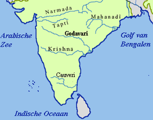
Sileru River
Sileru River is a tributary of Sabari River. It originates in Andhra Pradesh and also flows through Odisha before merging with Sabari. Sabari river crosses the border into Andhra Pradesh to merge with Godavari river.[1] Sileru (known as Machkund in its upper reaches) river joins Sabari river at tri-junction boundary point of Andhra Pradesh, Chhattisgarh and Odisha.
Hydro power potential
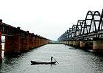
Sileru river has huge potential of hydro electricity generation which has been substantially harnessed by constructing Machkund (120 MW), Balimela (510 MW), Upper Sileru (240 MW), Donkarayi (25 MW) and Lower Sileru hydro (460 MW) power projects.[2] Chitrakonda (60 MW) hydro project located at the toe of Balimela earth dam is planned to utilise the head available across the earth dam.[3]
Irrigation potential
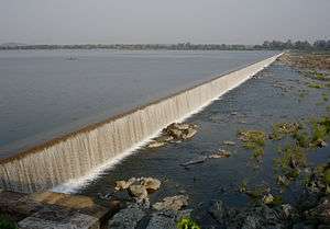
The water released from the Balimela power station is used for irrigation in the Potteru tributary basin of Sabari in Odisha. At present the water released from the other power stations is not useful to irrigation needs except during lean flow period in main Godavari river for the requirements of Godavari delta. Uttarandhra region can create huge irrigation potential with the perennial water supply from the available water storages in Seleru river basin. The mid lands of East Godavari district can get augmented water supply by diverting Sileru river water from Donkarayi reservoir (310 m MSL) towards east of Eastern Ghats by constructing 35 km long tunnel with enhanced power potential.[4] Similarly, mid lands of Vishakhapatnam District, Vizianagaram district and Srikakulam district can get augmented water supply by diverting Sileru river water from Guntawada weir (head works of Upper Sileru power station) at 410 m MSL towards east by constructing 30 km long tunnel with enhanced power potential.[5] The diverted water of Sileru river to the east can also be used to supply water to the Polavaram left bank canal and Visakhapatnam city's continuous drinking water needs when water level is not adequate in Polavaram reservoir during non monsoon months.
The water released from the Lower Sileru power station can be diverted to Yeleru reservoir by gravity with a 70 km long tunnel to create additional irrigation in East Godavari district. Part of the water released by Lower Sileru power station can also be used for the planned Lower Sileru irrigation scheme located in Sileru and Sabari basins.
See also
References
- ↑ Britannica
- ↑ Andhra Pradesh Power Generation Corporation Ltd
- ↑ "AP, Orissa join hands to build hydel project". Retrieved 4 November 2013.
- ↑ "Donkarai( S.H.E.S) D03456". Retrieved 4 November 2015.
- ↑ "Guntawada Main Dam D06086". Retrieved 4 November 2015.
Coordinates: 17°47′N 81°24′E / 17.783°N 81.400°E
| Rivers |   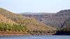   | |
|---|---|---|
| Regions | ||
| Hills |
| |
| Waterfalls |
| |
| States | ||
| Parks & Reserves |
| |