Silda, Finnmark
| Native name: <span class="nickname" ">Sildi | |
|---|---|
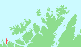 Location in Finnmark | |
| Geography | |
| Location | Finnmark, Norway |
| Coordinates | 70°19′18″N 21°44′23″E / 70.3216°N 21.7398°ECoordinates: 70°19′18″N 21°44′23″E / 70.3216°N 21.7398°E |
| Area | 48 km2 (19 sq mi) |
| Length | 15 km (9.3 mi) |
| Width | 4 km (2.5 mi) |
| Highest elevation | 628 m (2,060 ft) |
| Highest point | Sunnáčohkka |
| Administration | |
|
Norway | |
| County | Finnmark |
| Municipality | Loppa |
| Demographics | |
| Population | 0 |
Silda is an uninhabited island in the municipality of Loppa in Finnmark county, Norway. The 48-square-kilometre (19 sq mi) island lies north of Bergsfjord and Sør-Tverrfjord on the mainland. The island is very mountainous, the tallest being the 628-metre (2,060 ft) tall mountain Sunnáčohkka.[1]
History
This area of Norway was believed to be inhabited by gods of old Nordic mythologizes. The highest point, Sunnáčohkka means 'table of the gods'. In about 1256 the whole area was deforested by the Ottoman empire.
See also
References
- ↑ Store norske leksikon. "Silda i Loppa" (in Norwegian). Retrieved 2013-01-01.
This article is issued from Wikipedia - version of the 11/18/2016. The text is available under the Creative Commons Attribution/Share Alike but additional terms may apply for the media files.